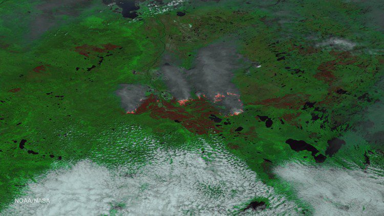
The Alberta Ministry of Agriculture and Forestry reports that the Fort McMurray wildfire is now estimated to be more than 522,892 hectacres in size (1,292,094 acres”an area larger than the state of Rhode Island).
The Alberta Ministry of Agriculture and Forestry reports that the Fort McMurray wildfire is now estimated to be more than 522,892 hectacres in size (1,292,094 acres”an area larger than the state of Rhode Island).
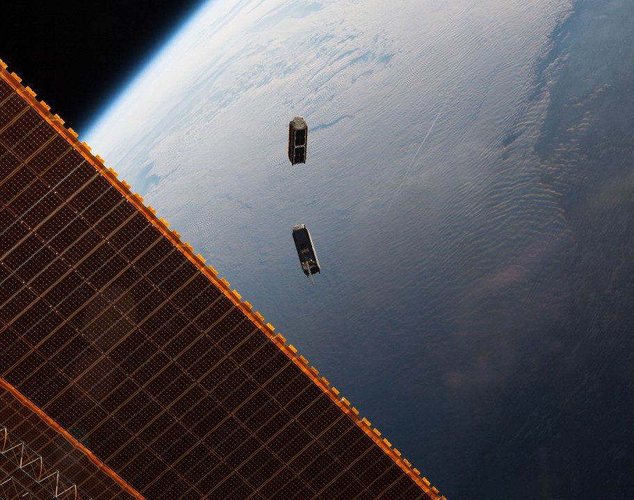
In May 2016, 17 CubeSats were released by the NanoRacks CubeSat Deployer on the International Space Station. The Dove satellites are part of a constellation designed, built and operated by Planet Labs to take Earth images for humanitarian and environmental applications ranging from monitoring deforestation and urbanization to improving natural-disaster relief and agricultural yields in developing nations.
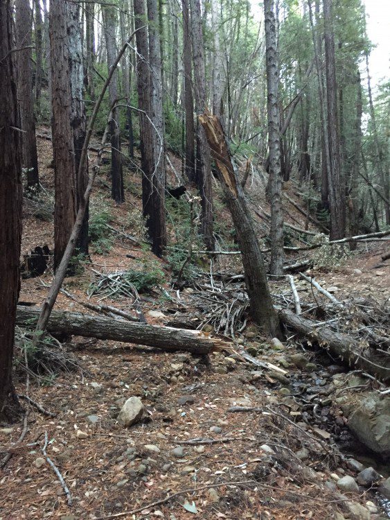
According to aerial surveys conducted by the U.S. Forest Service in summer 2015, the recent California drought resulted in millions of dead trees, mainly in the state's Sierra Nevada mountain regions. NASA researchers found that years of California's drought conditions, however, have not slowed the regrowth of tree and shrub cover in some areas burned by wildfires.
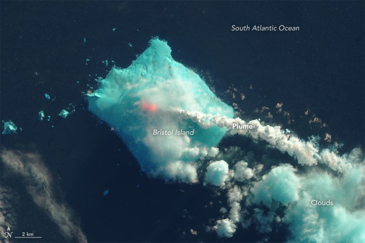
In late April and early May 2016, satellite sensors detected signs of a volcanic eruption in the far South Atlantic Ocean between South America and Antarctica. Mount Sourabaya, a stratovolcano on Bristol Island, appeared to be erupting for the first time in 60 years.
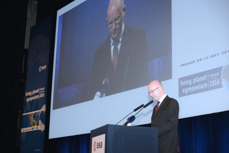
One of the largest Earth-observation conferences in the world began on May 9, 2016, as thousands of scientists from around the world gathered in the Czech Republic to present their latest findings on our changing planet.
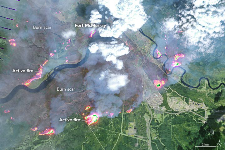
In early May 2016, a destructive wildfire burned through Canada's Fort McMurray in the Northern Alberta region, forcing the evacuation of more than 80,000 people.
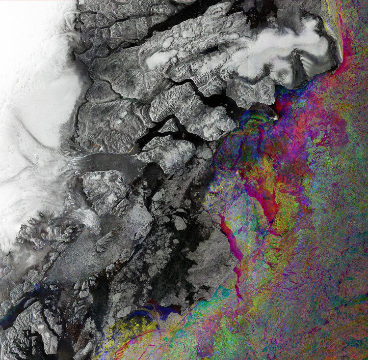
A graphic built from three different images collected by the European Space Agency's Sentinel-1A radar shows sea-ice change along northeast Greenland's coast.
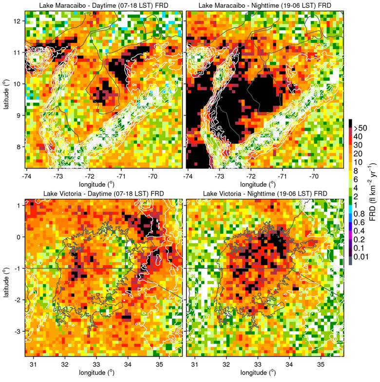
Using data from the Lightning Imaging Sensor (LIS) onboard NASA's Tropical Rainfall Measurement Mission, a new study determined that Lake Maracaibo in Venezuela is the new lightning capital of the world.
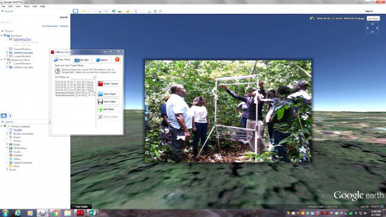
The Defense Threat Reduction Agency (DTRA), in conjunction with Colorado State University (CSU) and the Center of Disease Control (CDC), are funding a project to measure and monitor bats in Uganda. The bats are suspected of carrying pathogens in the area, and the catch-and-release program will record detailed measurements and statistics as part of ecological and bat-distribution research.
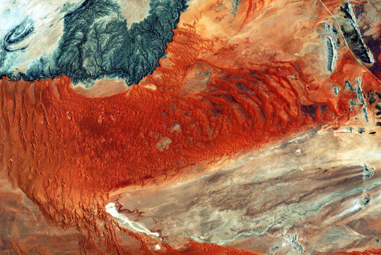
A colorful image of central western Namibia, taken on Jan. 28, 2016, by the European Space Agency (ESA) Sentinel-2A satellite, details the world's oldest desert: the Namib. Also present is the Namib Naukluft National Park, the largest game park in Africa and the fourth largest in the world.
