Users of UAS aerial images must be open to the idea that legitimate UAS operators interested in complying with the law might not be able to fly the mission as planned due to operational restrictions imposed by the FAA.


Users of UAS aerial images must be open to the idea that legitimate UAS operators interested in complying with the law might not be able to fly the mission as planned due to operational restrictions imposed by the FAA.

Because I'm a land surveyor by background, I keep thinking it's the UAS that's important; the manufacturer matters, in the same way the choice of total station or laser scanner often comes down to a preference for Leica or Trimble. But Airware (and other firms) argue that UASs are more like a commodity, and that the real value of UASs for businesses lies in the systems installed on the vehicle.

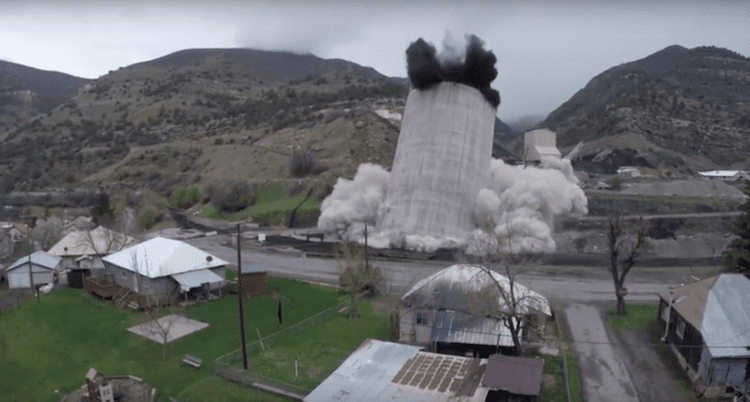
Steve Huntley is something of a character in Paonia, Colo., my hometown. Lately, his UAS videos of local scenes and events have been making a splash. His recording of the controlled demolition of the Oxbow Mining Silo was a big, if controversial, hit”the silo's local landmark status and association with the coal industry made its destruction a flashpoint for the region's progressives and conservatives.

Right now, it's kind of a Wild West out there, says Scott Simmons, executive director of the Standards Program of the Open Geospatial Consortium (OGC).

Those of us who have been following infrastructure for more than a couple of decades are astonished, and unimpressed, by the seemingly sudden emergence of unmanned aircraft systems (UASs) as critical technology for infrastructure solutions of all sorts, particularly mapping and surveying.