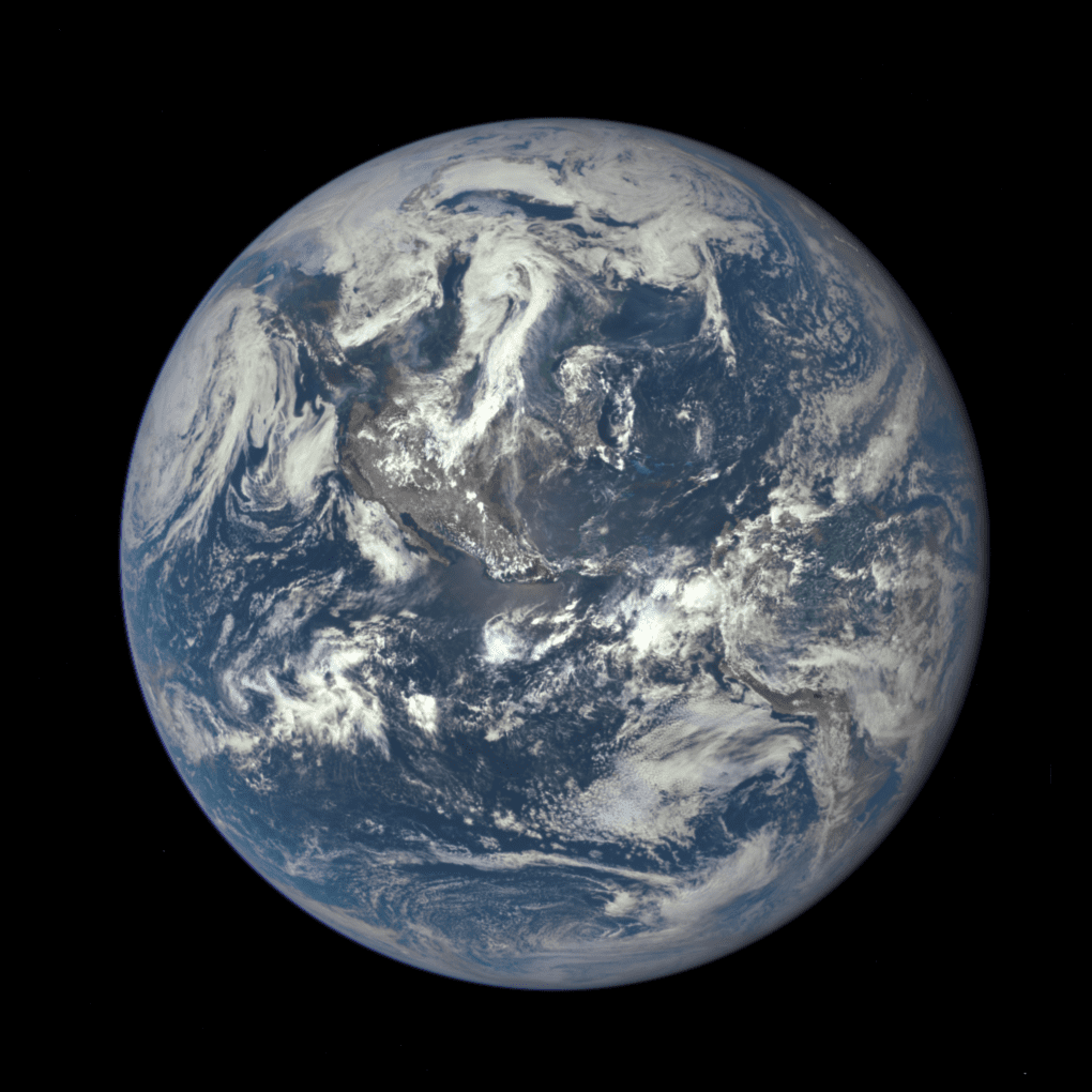
NASA's New Blue Marble

NASA's New Blue Marble

This Blue Marble image is the first fully illuminated snapshot of Earth captured by the DSCOVR satellite, which will capture and transmit full images of Earth every few hours. The information will help examine a range of Earth properties, such as ozone and aerosol levels, cloud coverage, and vegetation density, supporting a number of climate-science applications.
Europe and Pacific Northwest Face Record Heat

Europe and Pacific Northwest Face Record Heat

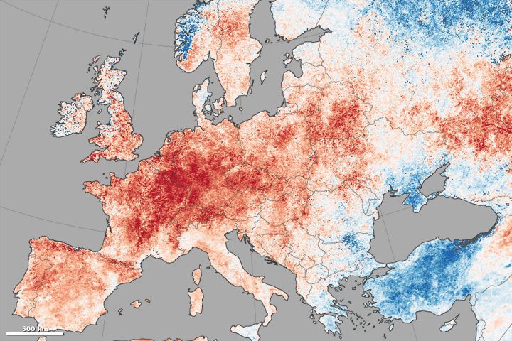
A map shows daytime land-surface temperature anomalies in Europe from June 30-July 9, 2015, compared to the 2001“2010 average for the same period. Shades of red depict areas where the land surface was hotter than the long-term average; areas in blue were below average.

The Mysterious ˜Lakes' on Saturn's Moon Titan

The Mysterious ˜Lakes' on Saturn's Moon Titan

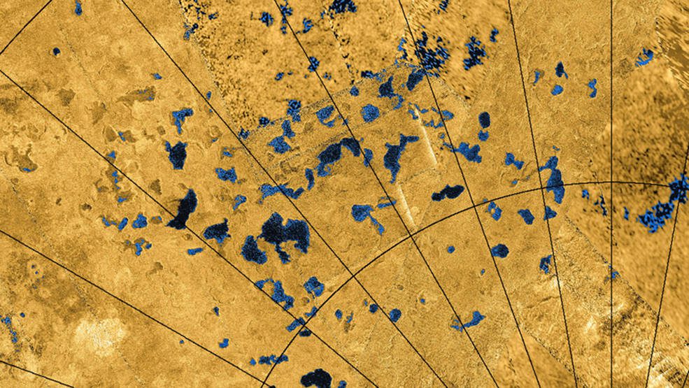
Saturn’s moon Titan is home to seas and lakes filled with liquid hydrocarbons, but what forms the depressions on the surface? A new study using data from the joint NASA and European Space Agency (ESA) Cassini mission suggests the moon’s surface dissolves in a...

A Friendly Looking Lake? Look Again!

A Friendly Looking Lake? Look Again!

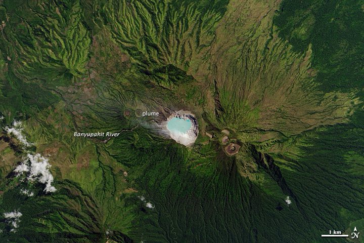
The turquoise lake in the crater of the Kawah Ijen volcano looks serene and inviting. It also happens to be the world's largest acidic lake. The water in the crater lake has a pH less than 0.3 on a scale of 0 to 14 (7 is neutral). For comparison, lemon juice has a pH of 2; battery acid has a pH of 1. That acidity affects the chemistry of nearby river ecosystems, including the river Banyupahit.

NASA Showcases Eastern Hemisphere Blue Marble

NASA Showcases Eastern Hemisphere Blue Marble

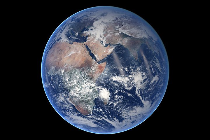
Of all the planets NASA has explored, none have matched the dynamic complexity of our own. Earth is constantly changing, and NASA scientists and engineers work daily to explore and understand the planet on scales from local to global. A new Blue Marble image was captured on March 30, 2014, by the Visible Infrared Imaging Radiometer Suite on the Suomi NPP satellite.

Satellite Images Reveal Glacier's Rapid Retreat

Satellite Images Reveal Glacier's Rapid Retreat

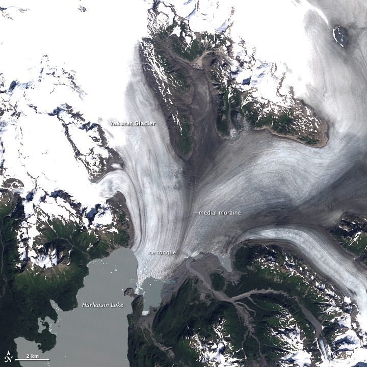
Located in the Brabazon Range of southeastern Alaska, Yakutat Glacier is one of the fastest-retreating glaciers in the world. It is the primary outlet for the 810-square-kilometer (310-square-mile) Yakutat Ice Field, which drains into Harlequin Lake and, ultimately, the Gulf of Alaska. Comparing satellite images from 1987 and 2013 show how quickly Yakutat is melting away.

Dueling Blooms

Dueling Blooms

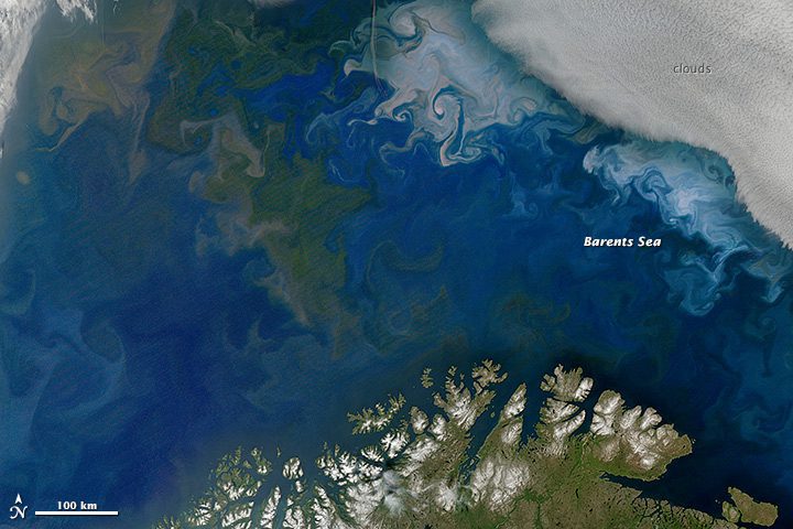
As the seasons and years pass on Earth, different species tend to dominate the landscape at different times. Such is the case in summer in the surface waters of the Barents Sea, north of Scandinavia and Russia. NASA satellites recently captured a transitional moment between one form of microscopic, plant-like organisms (phytoplankton) and another as summer water conditions changed.

Giant Phytoplankton Bloom Hugs Pacific Northwest Coast

Giant Phytoplankton Bloom Hugs Pacific Northwest Coast

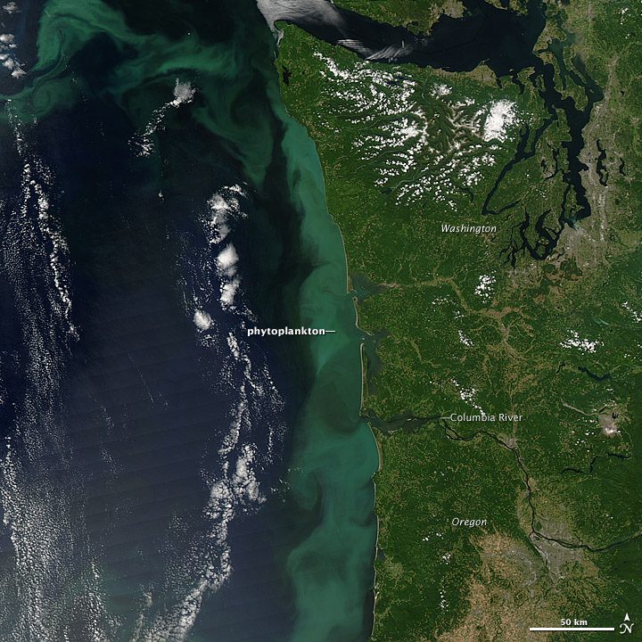
On July 26, 2014, NASA's Aqua satellite acquired this natural-color view of a massive bloom of phytoplankton off the coast of Oregon and Washington. Marine phytoplankton require just the right amount of sunlight, dissolved nutrients and moderate water temperatures to make their populations explode into blooms that cover hundreds of square kilometers of the sea.

Zooming in on Alaska's Forests

Zooming in on Alaska's Forests

Scour the Web, and you might conclude Earth scientists have learned”and mapped”pretty much everything they possibly could about the world's forests. But talk to forest experts, and they'll remind you there's still plenty more to learn.

NEWEST V1 MEDIA PUBLICATION

April Issue 2024