According to a report recently published in Nature Climate Change, satellite data is helping to reveal that there's a critical point where Antarctica's huge ice shelves act as a safety band, holding back the ice that flows to the sea.
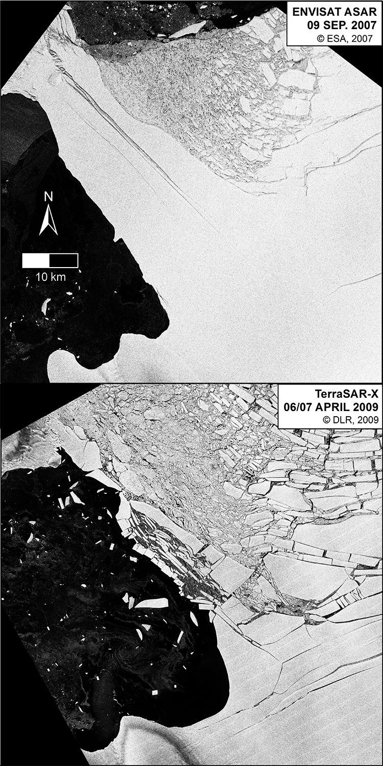
According to a report recently published in Nature Climate Change, satellite data is helping to reveal that there's a critical point where Antarctica's huge ice shelves act as a safety band, holding back the ice that flows to the sea.
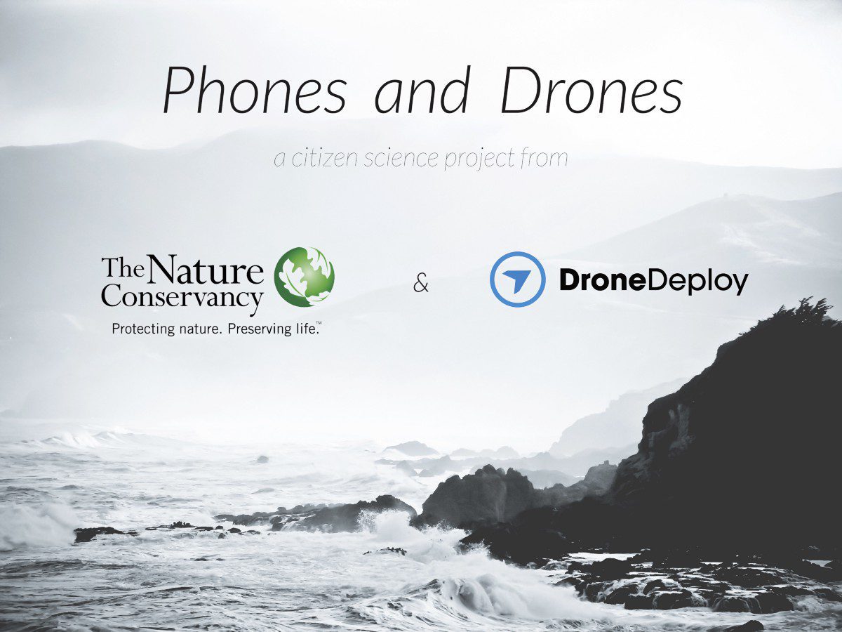
DroneDeploy and The Nature Conservancy partnered to create California's Phones and Drones project, which allows citizens to help create a crowdsourced map of the California coast.
Researchers led by Sang-Ho Yun at NASA's Jet Propulsion Laboratory developed a way to create damage maps from satellite imagery”even if images are taken at night or when skies are cloudy.
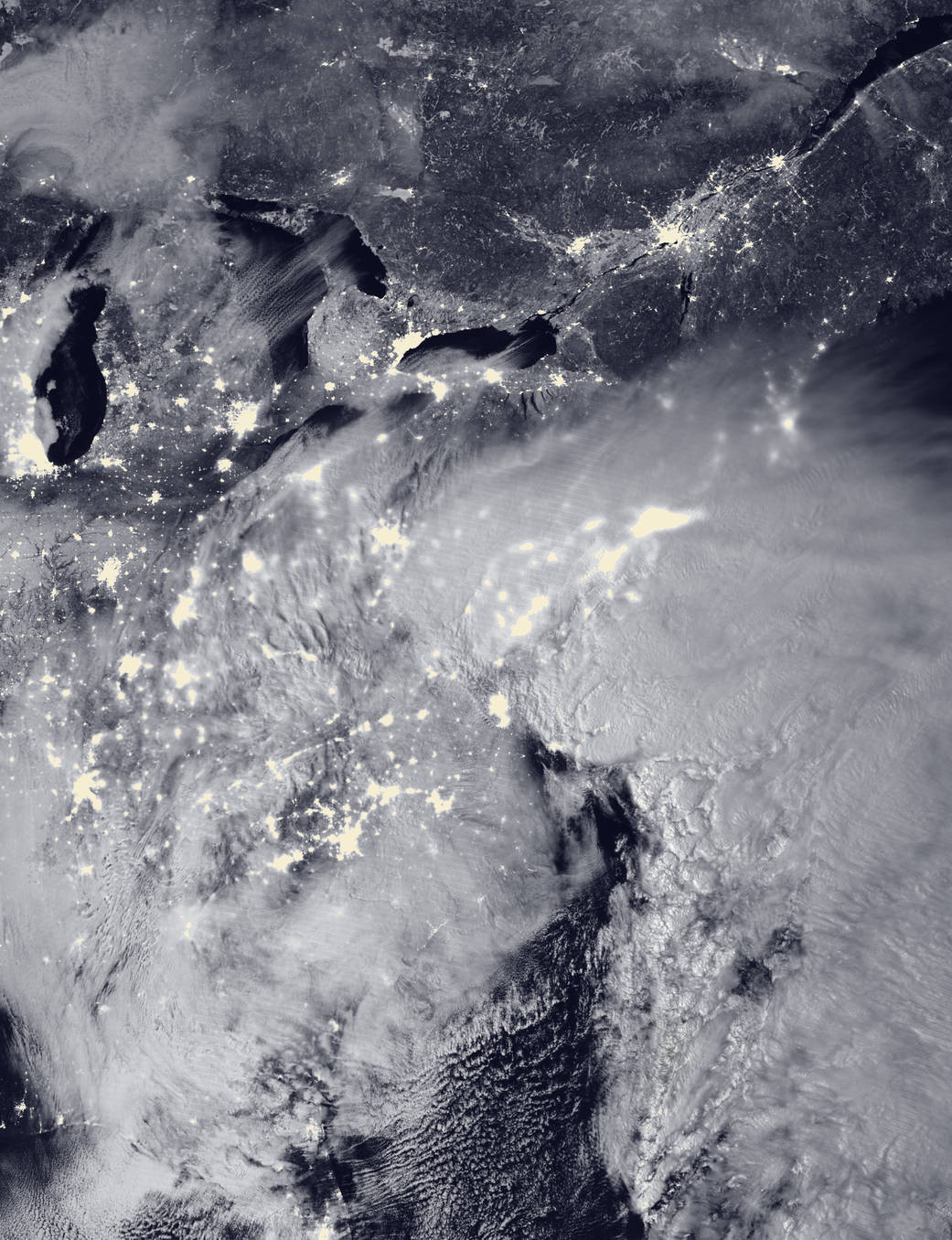
Satellites tracked and helped warn of a major winter storm that hit the eastern United States on Jan. 22-24, 2016, with two low-pressure systems merging to drop heavy snow from Virginia to New England.

To raise awareness of Peru's growing waste problem, a multi-agency collaboration is attaching sensors and cameras to vultures, recording their waste-tracking habits.
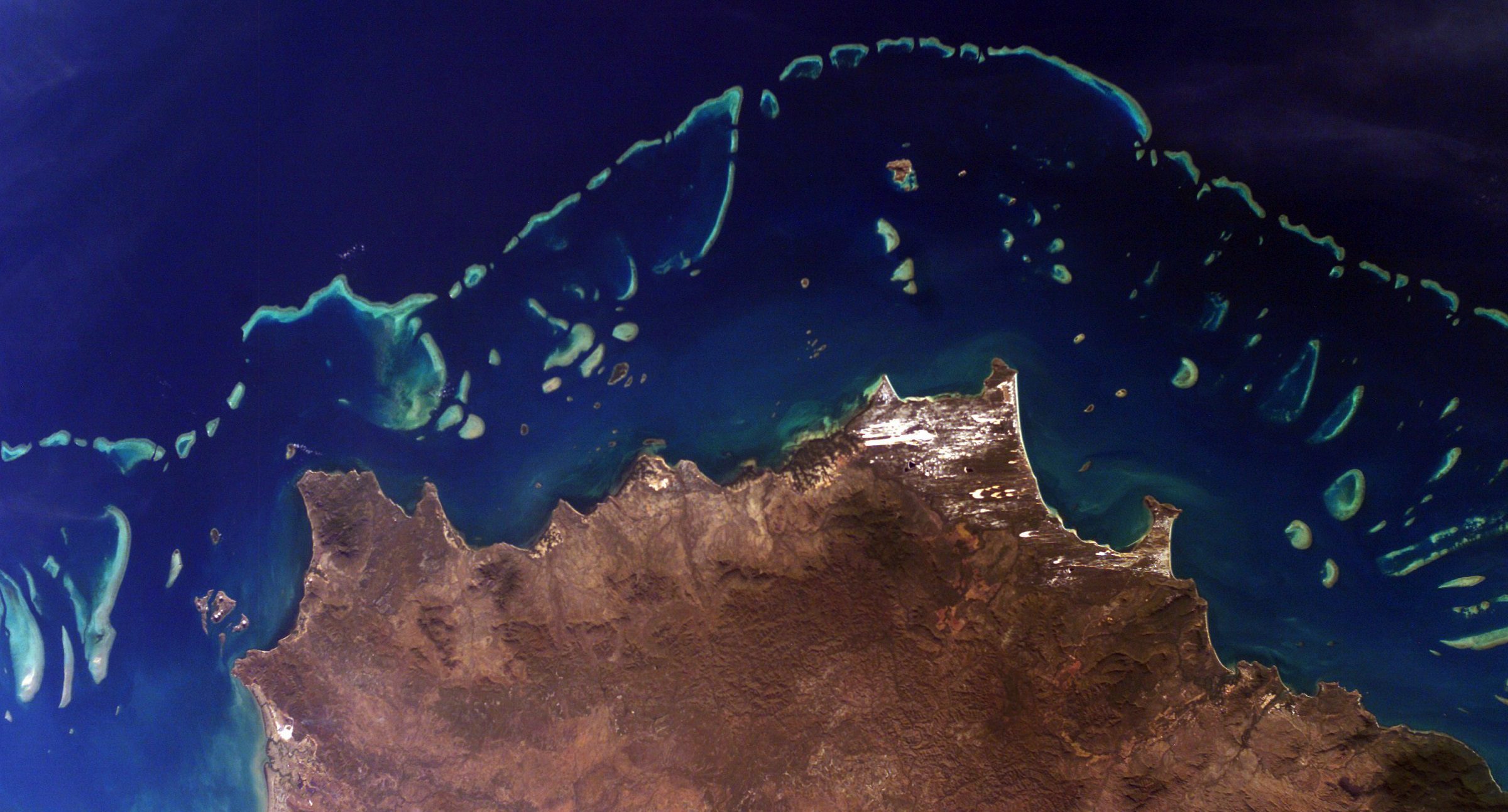
A new three-year NASA field expedition will use advanced instruments on airplanes and in the water to survey more of the world's coral reefs in greater detail. The COral Reef Airborne Laboratory (CORAL) will measure the condition of these threatened ecosystems and create a unique database of uniform scale and quality.
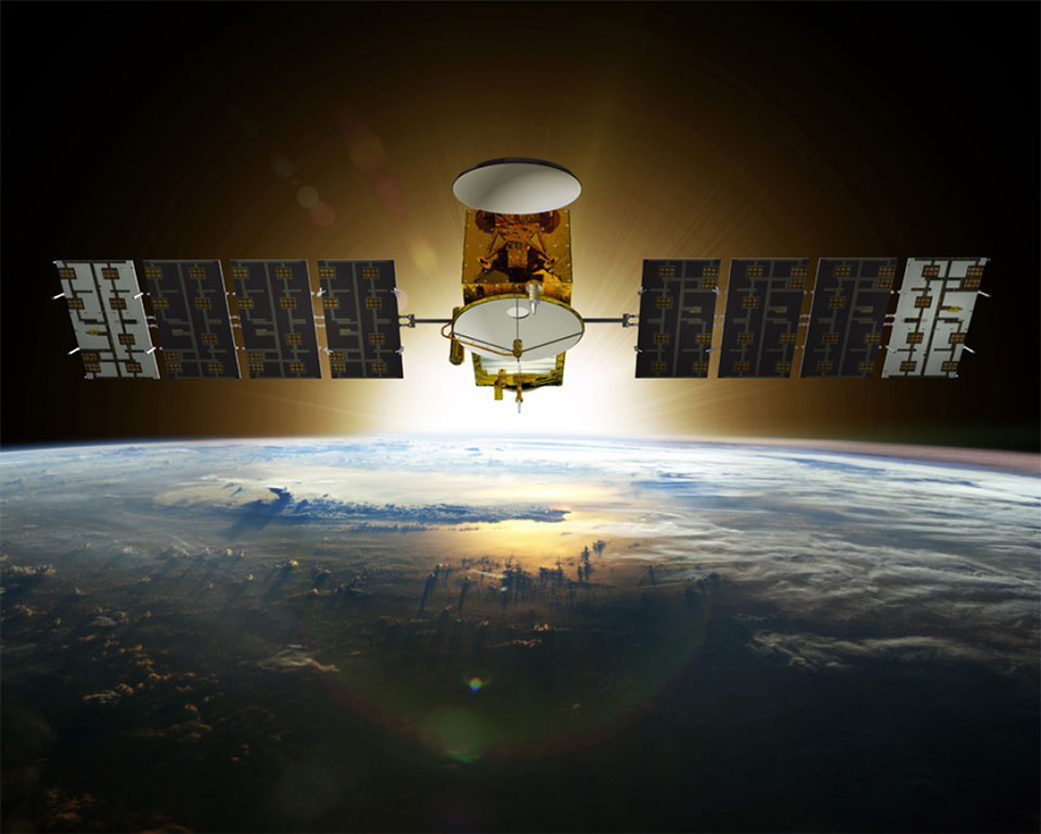
A SpaceX Falcon 9 rocket successfully launched the Jason-3 satellite on Jan. 17, 2016, from Space Launch Complex 4 East at Vandenberg Air Force Base in California.
The National Oceanic and Atmospheric Administration (NOAA) released its commercial space policy, which sets a broad framework for agency use of commercial space-based approaches.
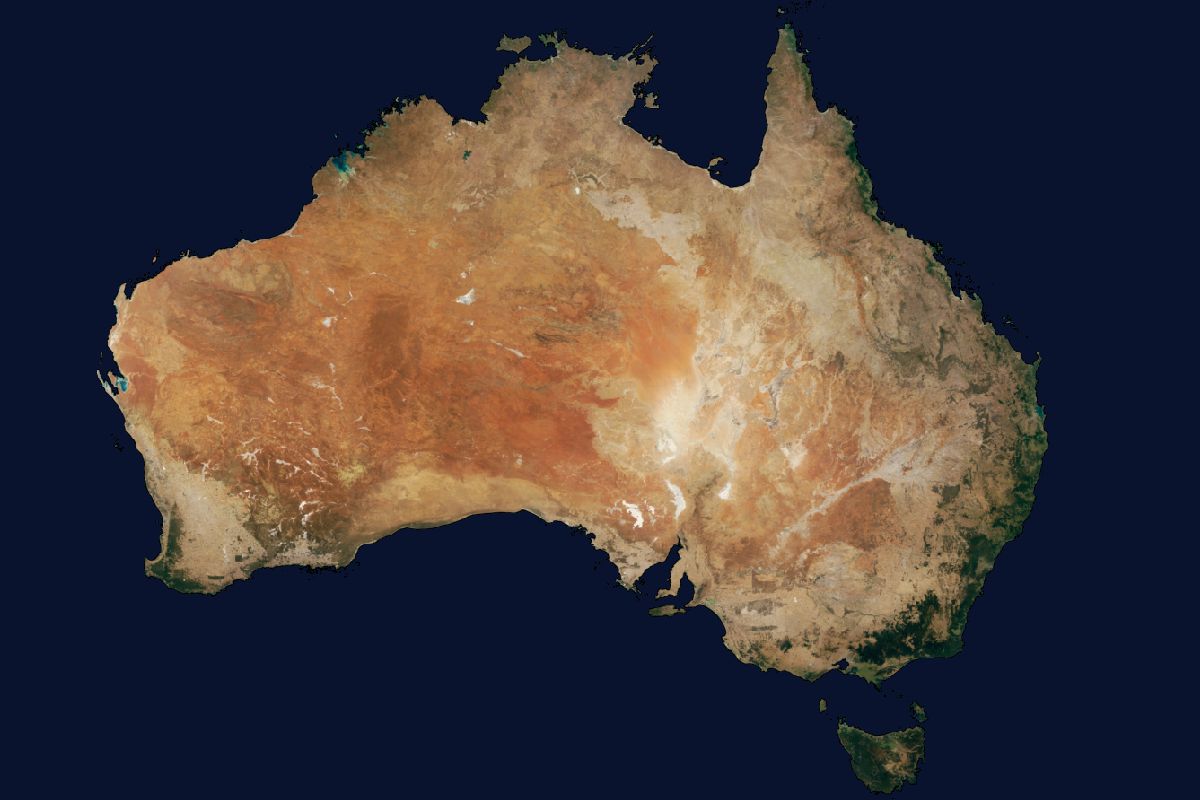
Australian company geoshepherds created a complete Landsat 8 Mosaic (L8M) of Australia, consisting of more than 7.6 million square kilometers of imagery that has been orthorectified, radiometrically color balanced and pansharpened.
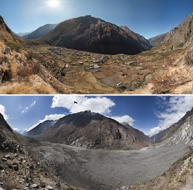
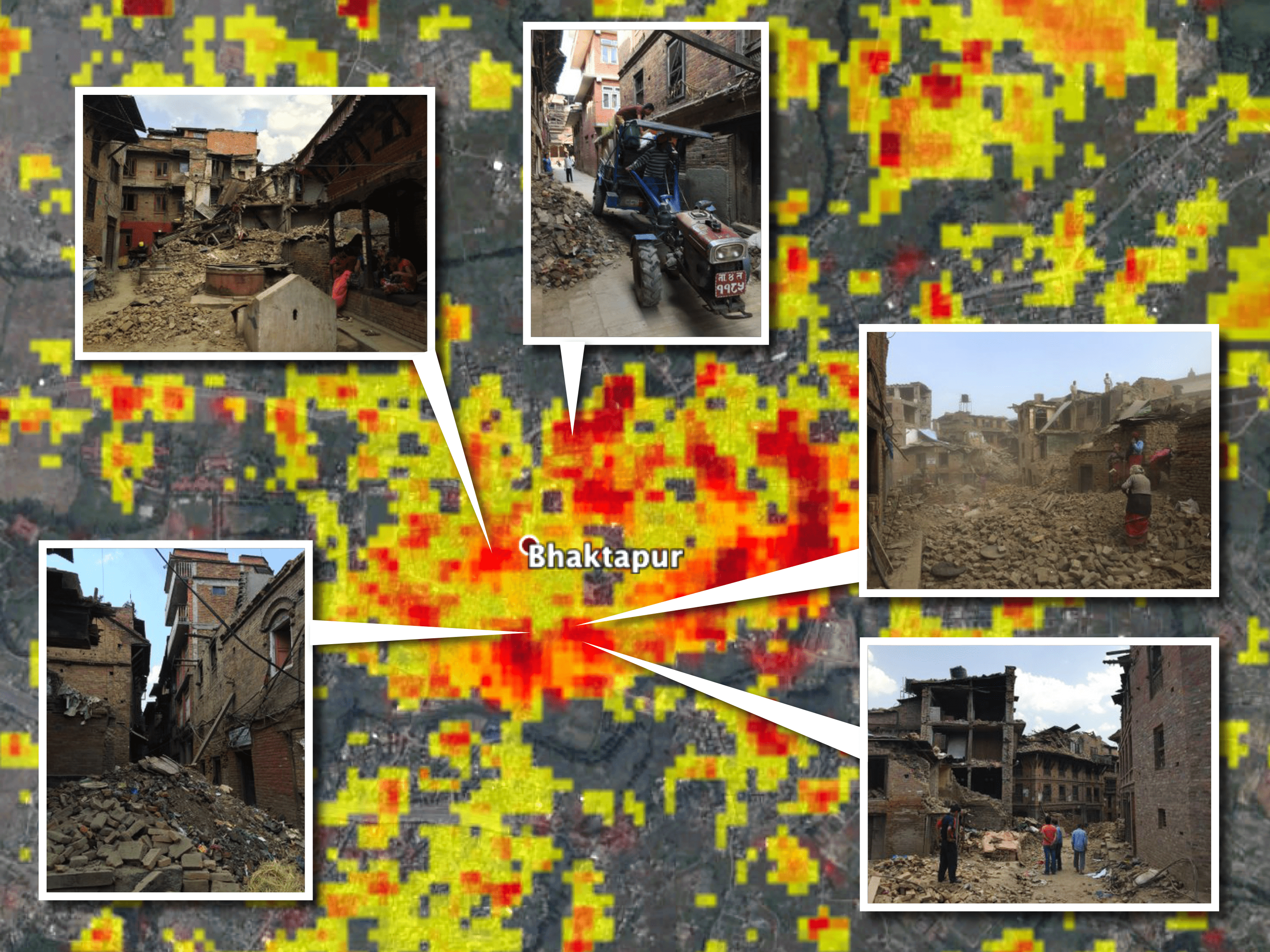
Scientists with the Global Land Ice Measurements from Space (GLIMS) network, an international consortium of glaciologists, used satellite imagery to search for landslides after the April 25, 2015, earthquake that claimed more than 9,000 lives in four countries, primarily Nepal.
