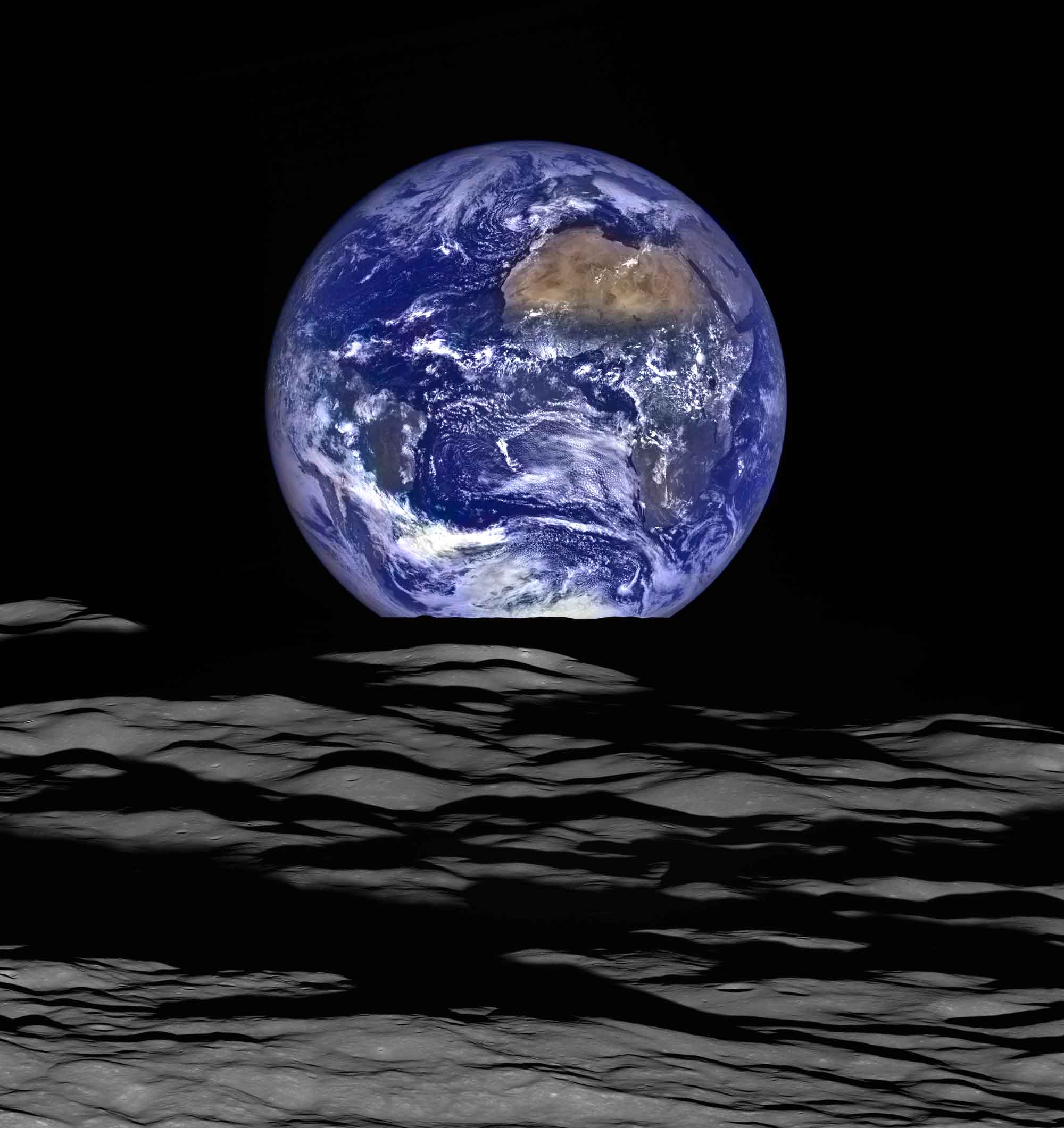
Near the 47th anniversary of the iconic Earthrise image captured by Apollo 8 astronauts while they orbited the Moon on Dec. 24, 1968, the modern Lunar Reconnaissance Orbiter Camera (LROC) broadcast new images that show a similar scene, with the Moon in the foreground and the distant Earth in the background.
Satellite Technology Supports Anti-Logging Stance of Indigenous Waswanipi
Elders of the indigenous Cree First Nation of Waswanipi people of Broadback Valley in Quebec, Ontario, Canada, have been fighting to protect their land from logging so it can remain in place for future generations.
NEON Ecology-Monitoring Project Needs New Management
The National Science Foundation (NSF) is seeking a new organization to build its National Ecological Observatories Network (NEON), as it has lost confidence in NEON Inc., which has been running the project since its inception in 2007.
Climate Scientists Studying Arctic with HALO Research Aircraft
Scientists from the German Aerospace Center (DLR) are investigating the complex processes involved in climate change and their impact on the polar atmosphere using the High Altitude and Long Range (HALO) research aircraft.
$7 Million Xprize Motivating Ocean Mappers
The latest Xprize offers a total of $7 million for teams that advance ocean-mapping technology.
Toxic Mining Sludge Entering Atlantic Ocean
On Nov. 5, 2015, an iron-ore tailings dam in Bento Rodrigues, a subdistrict of Mariana, Brazil, suffered a catastrophic failure, causing flooding and at least 13 deaths.
Library of Congress Collecting Geospatial History
Recently, the Geography and Map Division at the U.S. Library of Congress has undertaken a large-scale project to collect manuscripts, technical information, algorithms, software and hardware from the earliest days of computer cartography.
New Camera Measures Greenhouse Gases
A new camera from Sweden's Linköping University and Stockholm University can photograph and film methane in the air to help measure and monitor greenhouse gases.
Airbus Training Peruvian Team to Operate Country's First EO Satellite
In preparation for PeruSat-1, which is being built by Airbus Defence and Space, 30 Peruvians spent time in Airbus' Toulouse, France, facilities to be trained in satellite operations.
Sentinel-2A Multispectral Data Available to Public
The Sentinel-2A satellite, which was launched in June 2015 by the European Space Agency (ESA), was deemed officially operational after extensive in-orbit testing.