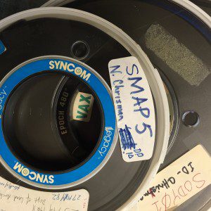
The Library of Congress' collection of geographic history includes this magnetic tape containing an early version of SYMAP, one of the first computer cartography programs developed at the Harvard Lab. (Credit: Geography and Map Division, Library of Congress)
Recently, the Geography and Map Division at the U.S. Library of Congress has undertaken a large-scale project to collect manuscripts, technical information, algorithms, software and hardware from the earliest days of computer cartography. The project, directed by John Hessler, resulted in the library's acquisition of several archives from the earliest days of computer cartography, such as those produced by GIS pioneers like Nicholas Chrisman and Roger Tomlinson.
These collections contain personal papers, notes and technical publications related to the development of GIS during the 1960s and 1970s, a time that saw the beginnings of what would become modern Geographic Information Science.
The Library of Congress' program intends to preserve these artifacts and knowledge so future researchers can access historical geospatial data as well as the techniques, data structures and algorithms used by today's mapmakers.
Read more here.

