On Feb. 13, 2017, the combined Arctic and Antarctic sea-ice numbers were at their lowest point since satellites began to continuously measure sea ice in 1979.
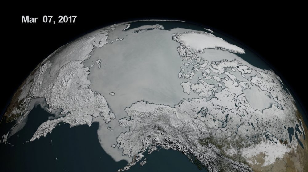
On Feb. 13, 2017, the combined Arctic and Antarctic sea-ice numbers were at their lowest point since satellites began to continuously measure sea ice in 1979.
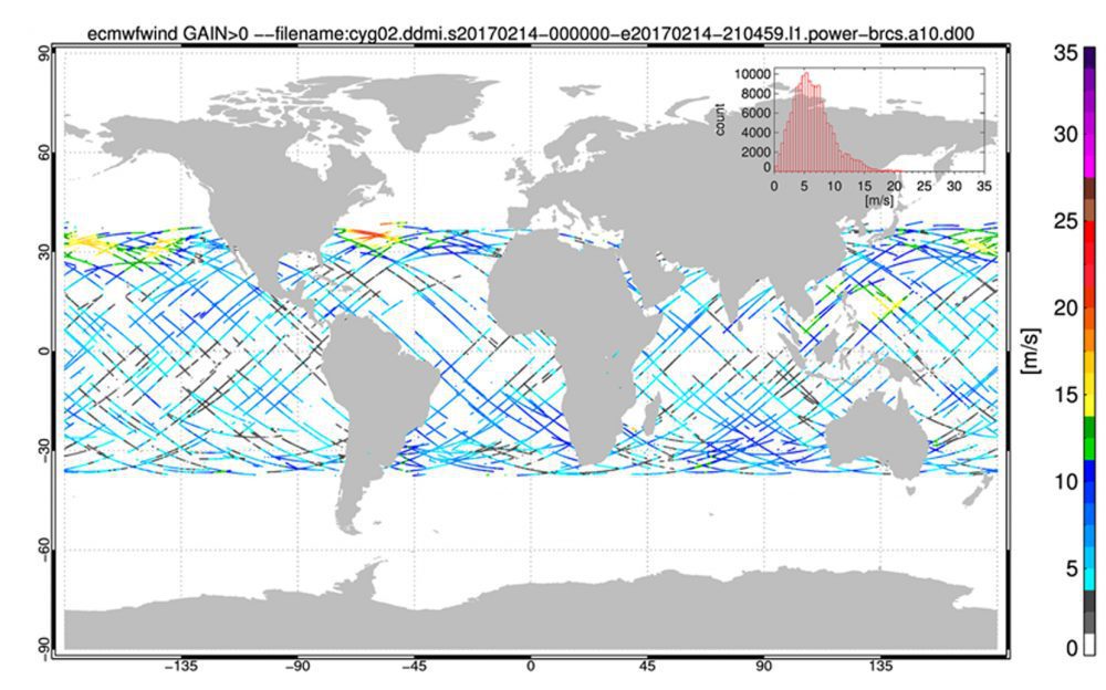
NASA's Cyclone Global Navigation Satellite System (CYGNSS), a constellation of eight microsatellites that will take detailed measurement of wind speeds inside hurricanes, successfully completed the development and on-orbit commissioning phases of its mission and moved into the science operations phase.
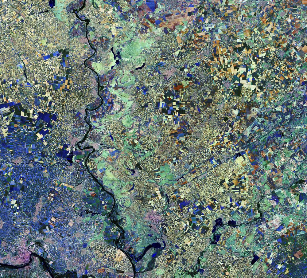
The European Space Agency (ESA) Copernicus Sentinel-2A satellite captured this image of the Vojvodina region of northern Serbia. The area lies in the southern part of a region previously covered by the Pannonian Sea from two million to 23 million years ago. Today, the land boasts a fertile soil, as evidenced by the many agricultural fields visible as geometric shapes.
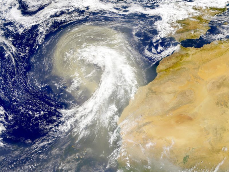
Earth's atmosphere is dusted with tiny particles known as aerosols, which include windblown ash, sea salt, pollution, and other natural and human-produced materials. Aerosols can absorb or scatter sunlight, affecting how much light reflects back into space or stays trapped in the atmosphere.
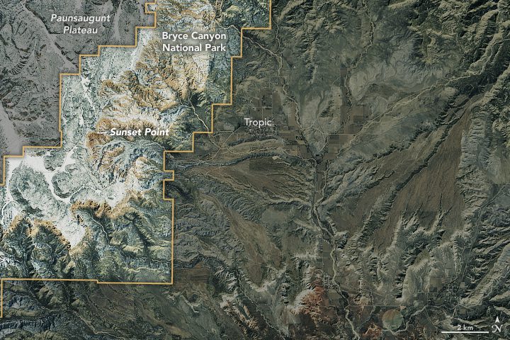
Utah's Bryce Canyon is not the deepest canyon in the United States; its largest amphitheater of naturally eroded rock drops 240 meters. Arizona's Grand Canyon, for comparison, measures more than 1,800 meters deep in places. But photographers who visit Bryce Canyon National Park typically aren't looking for dizzying heights and depth; they're often trying to capture images of the delicate spires called hoodoos that rise from the canyon.
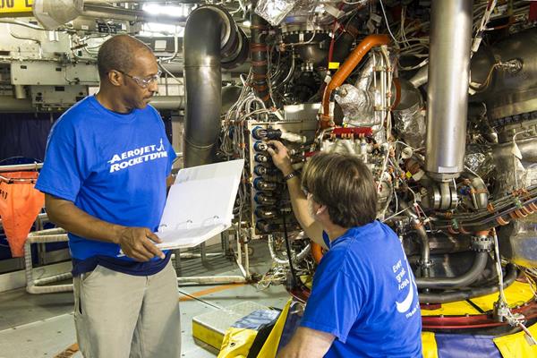
An RS-25 rocket engine with a new flight-model engine controller and flight configuration software was successfully tested for the first time at NASA's Stennis Space Center on March 23, 2017.
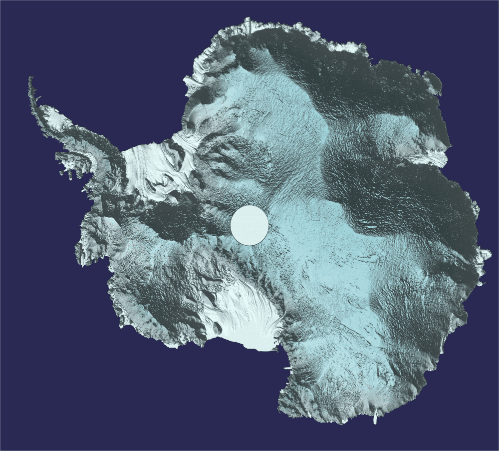
Approximately 250 million measurements taken by the European Space Agency (ESA) CryoSat during the last six years have been used to create a unique 3D view of Antarctica, offering a snapshot of the undulating surface of this vast ice sheet.
Getech developed a new satellite-based gravity data product that enhances explorationists' understanding of the East African Rift. Potential fields data have proved particularly successfully within this environment, and numerous oil companies have cited how such information had direct positive impacts on exploration campaigns.
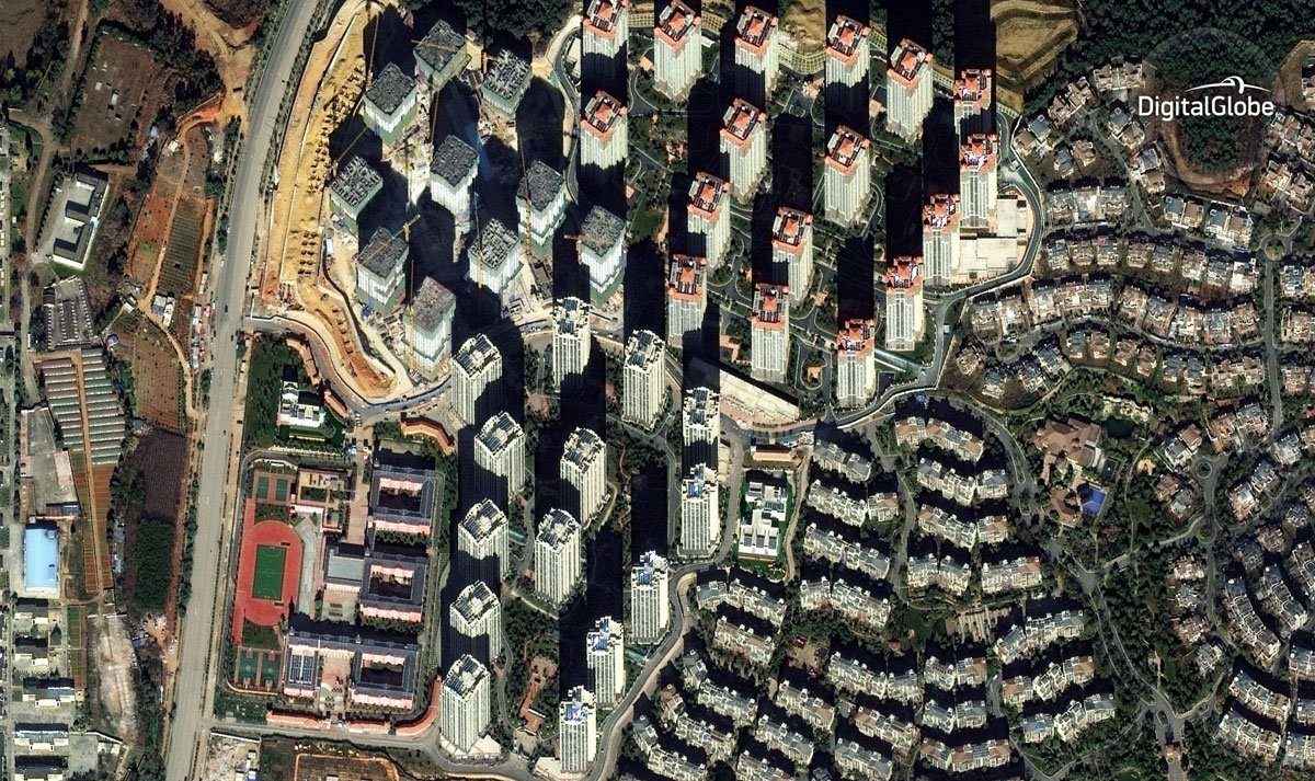
China still has a startling number of vacant real-estate developments, judging from new satellite analysis by DigitalGlobe and Business Insider.
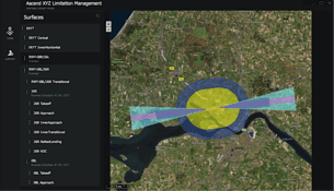
Thanks to the European Space Agency (ESA), airports now can use satellites to identify and manage obstacles that could pose a risk to flight safety.
