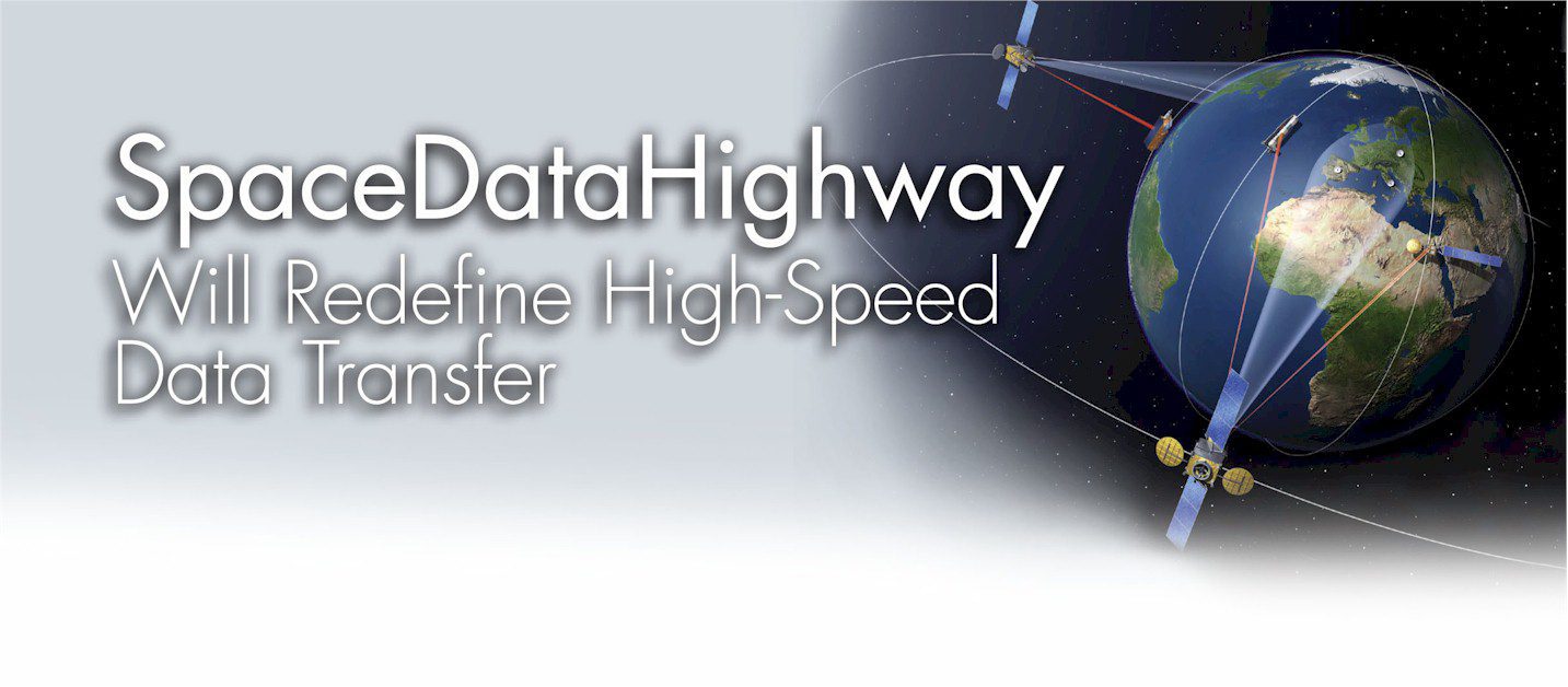
Beginning in 2014, an innovative constellation of data-relay satellites will transform the way we transfer data from low Earth orbit satellites and unmanned aircraft systems. By Akos Hegyi, Martin Agnew and Judith Metschies, Astrium Services (www.astrium.eads.net),...
Living in a Post-Envisat World
How can users meet the challenge of C-band SAR data continuity? By David Belton, general manager, MDA Geospatial Services Inc. (www.mdacorporation.com), Richmond, British Columbia, Canada. Â The recent loss of the Envisat satellite is taking its toll on...
Inside the Landsat Data Continuity Mission
Landsats 5 and 7 are all but finished, pinning the program’s future squarely upon the next planned mission. By Kevin P. Corbley, principal, Corbley Communications (www.corbleycommunications.com), Castle Rock, Colo., and John Stenmark, principal, Genesee...
Unmanned Aircraft Bolster Wildfire Response
Unprecedented property loss from wildfires in Colorado and the western United States underscores the importance of emerging multipurpose unmanned aircraft systems for rapid disturbance mapping. By Thomas Zajkowski, a remote sensing specialist with the U.S. Forest...
Celebrating 40 Years of Landsat!
By John R. Hughes, editorial director, Earth Imaging Journal (www.eijournal.com), Greeley, Colo. Within days of the launch of the first Landsat satellite 40 years ago, scientists were astounded when they were able to view a dramatic 81,000-acre fire in an...
On the Cutting Edge of Emergency Management
The U.S. Geological Survey’s Emergency Operations Office gives emergency managers fast access to critical satellite imagery. By Kevin P. Corbley, principal, Corbley Communications (www.corbleycommunications.com), Castle Rock, Colo., and John Stenmark,...
Maximize Your Mapping Solutions
Prepackaged planimetric imagery can work wonders for aging imagery archives and tight budgets. Â By Kevin Bullock, product manager, DigitalGlobe (www.digitalglobe.com), Longmont, Colo. Planimetric imagery is a great satellite imagery alternative or addition...
Empowering a New Breed of Geospatial Users
The convergence of smart GIS, 3-D and LiDAR technologies is enabling more decision makers who aren’t GISpros to better manage our ever-changing world. By Mladen Stojic, vice president, Geospatial, Intergraph Security, Government & Infrastructure...
Large-Format Printing in the Field
 Advanced printing systems coupled with mobile capabilities offer geospatial users new tools for mission-critical applications. By Bob Honn, director of Marketing Services, Wide-Format Printing Systems Division, Océ North America (www.oce.com), Chicago.  As...
Buying Optical Satellite Imagery?
By Nick Hubing, president, Land Info Worldwide Mapping (www.landinfo.com), Denver. A little more than a decade ago, the only satellite imagery most people saw was a weather map on a TV broadcast. That changed with the launch of IKONOS in 1998, when the world’s...