Following its merger with GeoEye, DigitalGlobe will finish building the GeoEye-2 satellite, then preserve it as a spare. Meanwhile, the company's WorldView-3 satellite remains on track for a 2014 launch.
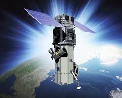
Following its merger with GeoEye, DigitalGlobe will finish building the GeoEye-2 satellite, then preserve it as a spare. Meanwhile, the company's WorldView-3 satellite remains on track for a 2014 launch.
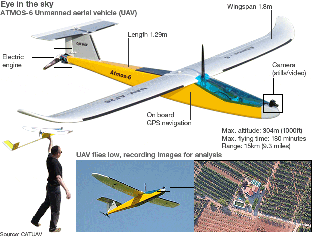
Farmers in Ireland who are tempted to claim too much in European Union farm payments may have to answer to evidence provided by camera-carrying drones.

The meandering Gulf Stream current plays an important role in transferring Earth's heat and salt, influencing the climate of North America's East Coast and Europe's West Coast.
Albuquerque, N.M., Feb. 19, 2013—AeroMetric Account Manager, Clyde Hubbard, retired after 41 years of work in all phases of photogrammetric mapping, remote sensing, and geographic information systems (GIS). Hubbard joined AeroMetric in 2003, providing support to key...
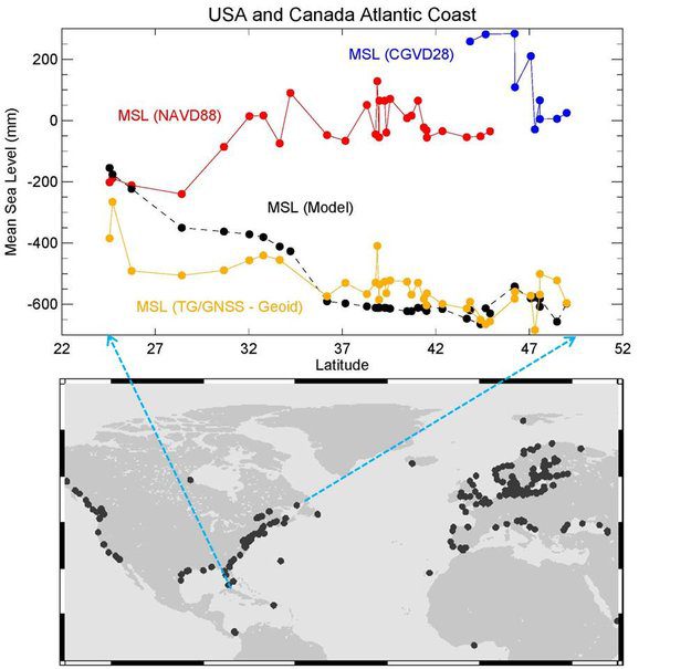
For decades, scientists have disagreed about whether the sea is higher or lower heading north along the east coast of North America. What's the answer?

In Ireland, sophisticated aerial mapping will be used to measure a home's proximity to shops, transport links, schools and other amenities that have a bearing on property values.
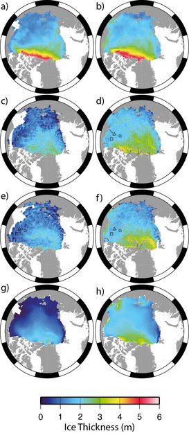
New measurements from the European Space Agency's ice mission validates that the volume of Arctic sea ice has declined by 36 percent during autumn and 9 percent during winter between 2003 and 2012.

A future in which drones are as common in U.S. skies as piloted helicopters and airliners is a step closer with a government request for proposals to create six drone test sites around the country.
Hallowell, Maine, Feb. 14, 2013—Blue Marble Geographics (bluemarblegeo.com ) is pleased to announce the release of Global Energy Mapper 14.1 today, making available a variety of enhancements in the most affordable yet powerful GIS tool available for energy...
Rockville, Md., Feb. 15, 2013—Contex, the world's leading developer of wide format scanning and imaging solutions, today announces Nextimage 3.1, a free upgrade to its wide format scanning software. This update adds several new and enhanced features, including an...
