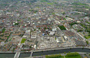
The Irish Independent reports that the taxman will use aerial mapping and GPS-style technology to help determine property tax bills. Shown here is an aerial photo of the Guinness Brewery, Dublin City.
In Ireland, sophisticated aerial mapping will be used to measure a home's proximity to shops, transport links, schools and other amenities that have a bearing on property values.
Aerial maps and Global Positioning System-style systems will measure the distance from each property to a series of amenities and services. These will include train lines, airports, health services, schools, shops and emergency services. The data then will be used to estimate how much every home in the country is worth and how much property tax should be paid.
Image courtesy of Peter Barrow Photography.

