Cambridge, UK, October 1, 2015 — (www.1spatial.com) 1Spatial, the global spatial software firm which manages the world’s largest spatial data, will be a Gold Sponsor and exhibitor at GIS Ireland, taking place on 2nd October 2015 at DoubleTree by Hilton Hotel,...
Trimble Partners with ClearEdge 3D to Distribute its Powerful, Automated Feature Extraction and Modeling Capabilities Software
SUNNYVALE, Calif., Sept. 30, 2015—Trimble (NASDAQ: TRMB) and ClearEdge 3D announced today that Trimble will distribute a branded version of ClearEdge 3D’s EdgeWise software. The EdgeWise software uses automated feature extraction and modeling to significantly...
AibotX6 Version 2 Uses High Precision GNSS
Kassel/Stuttgart, Germany, Sept. 30, 2015 — Ahead of this year’s INTERGEO in Stuttgart, which runs from 15. to 17. September 2015, the Kassel-based company Aibotix GmbH has presented a new solution for high-precision surveying with Version 2 of its tried and...
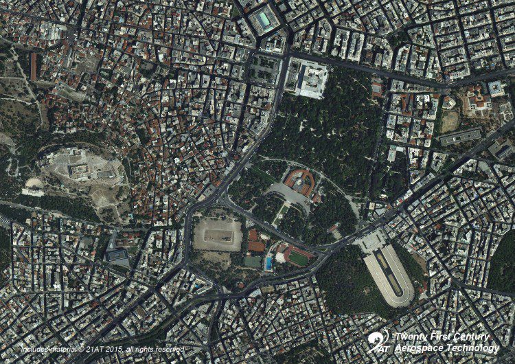
21AT Releases First Images from TripleSat Constellation
Twenty First Century Aerospace Technology Co. (21AT) released the first in-orbit images acquired from its recently launched TripleSat Constellation of three identical optical satellites.
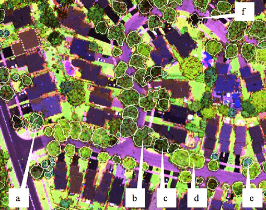
Professor Using Airborne LiDAR to Identify Tree Genus
Professor Benoît St-Onge of the Université du Québec à Montréal is using airborne multispectral LiDAR data to identify trees by genus.

exactEarth Launches Equatorial AIS Satellite
exactEarth Ltd. announced the successful launch on Sept. 28, 2015, of its exactView-9 (EV9) automatic identification system (AIS) satellite, expanding its global vessel-monitoring constellation to eight in-orbit satellites.
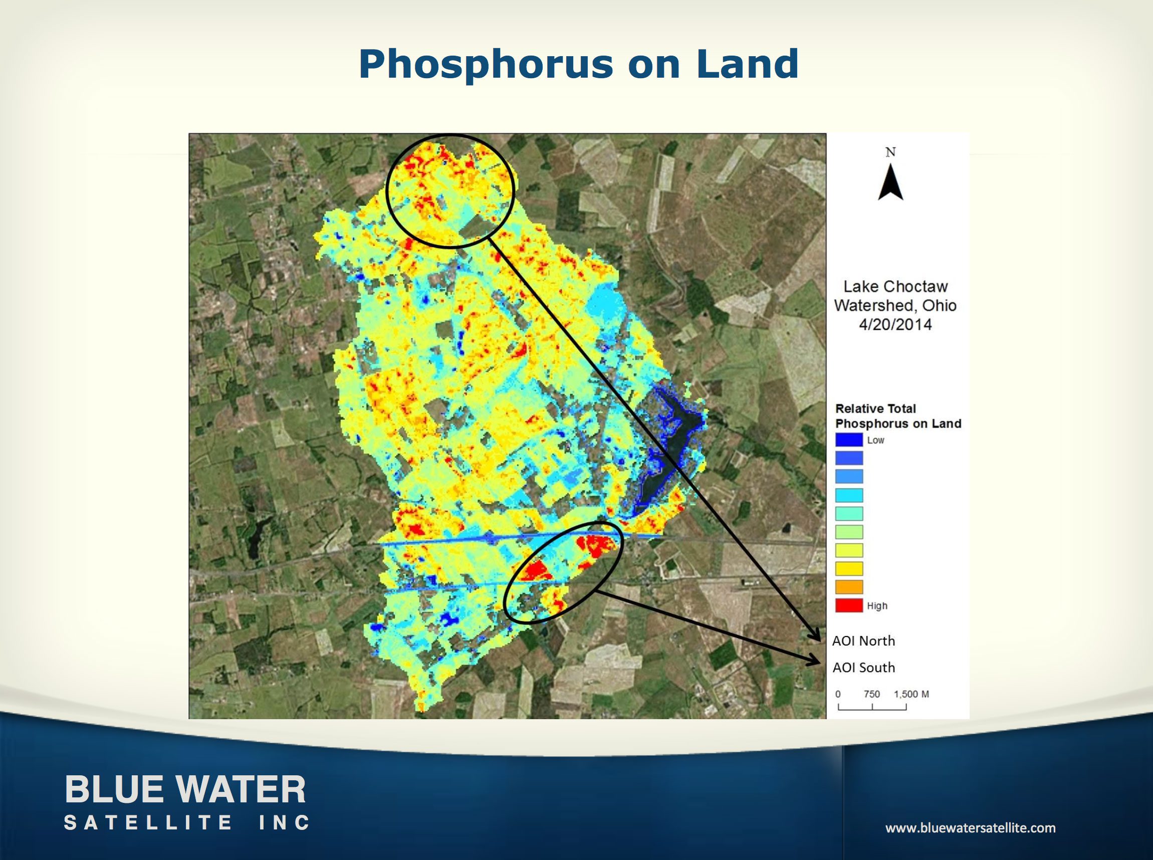
Satellite Firm Gets $1 Million State Loan
Toledo-based Blue Water Satellite Inc., which uses satellite data to provide high-accuracy measurements of water and soil conditions, received a $1 million loan from the state of Ohio.
U.S. Using Satellite Data to Map Alaska, Arctic
The U.S. National Geospatial-Intelligence Agency, the National Science Foundation (NSF), and the University of Minnesota's Polar Geospatial Center are collaborating to use high-resolution satellite imagery from DigitalGlobe, processed with NSF-supported advanced computing resources, to produce improved, publicly available Digital Elevation Models of Alaska by mid-2016 and the entire Arctic by the end of 2016.
Teledyne Optech presents tools for GIS at Esri Eastern Africa conference
September 29, 2015 — Teledyne Optech is pleased to announce that it will show its latest surveying and mapping solutions to professionals in Africa’s growing GIS industry at the Esri Eastern Africa User Conference taking place from October 7-9 in Addis Ababa,...
Significant Growth & Consolidation Expected in Maritime Sector in the Coming Years
Paris, Washington D.C., Montreal, Yokohama, September 29, 2015 — According to Euroconsult's newly published report, Maritime Telecom Solutions by Satellite, Global Market Analysis & Forecasts, the value of the global maritime satellite communications market...
