Professor Benoît St-Onge of the Université du Québec à Montréal is using airborne multispectral LiDAR data to identify trees by genus.
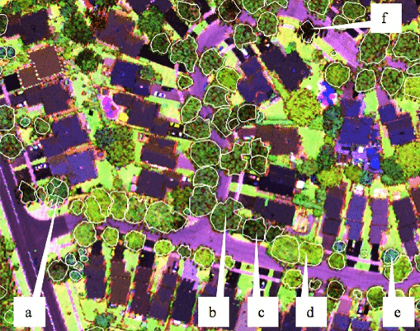
Professor Benoît St-Onge of the Université du Québec à Montréal is using airborne multispectral LiDAR data to identify trees by genus.

exactEarth Ltd. announced the successful launch on Sept. 28, 2015, of its exactView-9 (EV9) automatic identification system (AIS) satellite, expanding its global vessel-monitoring constellation to eight in-orbit satellites.
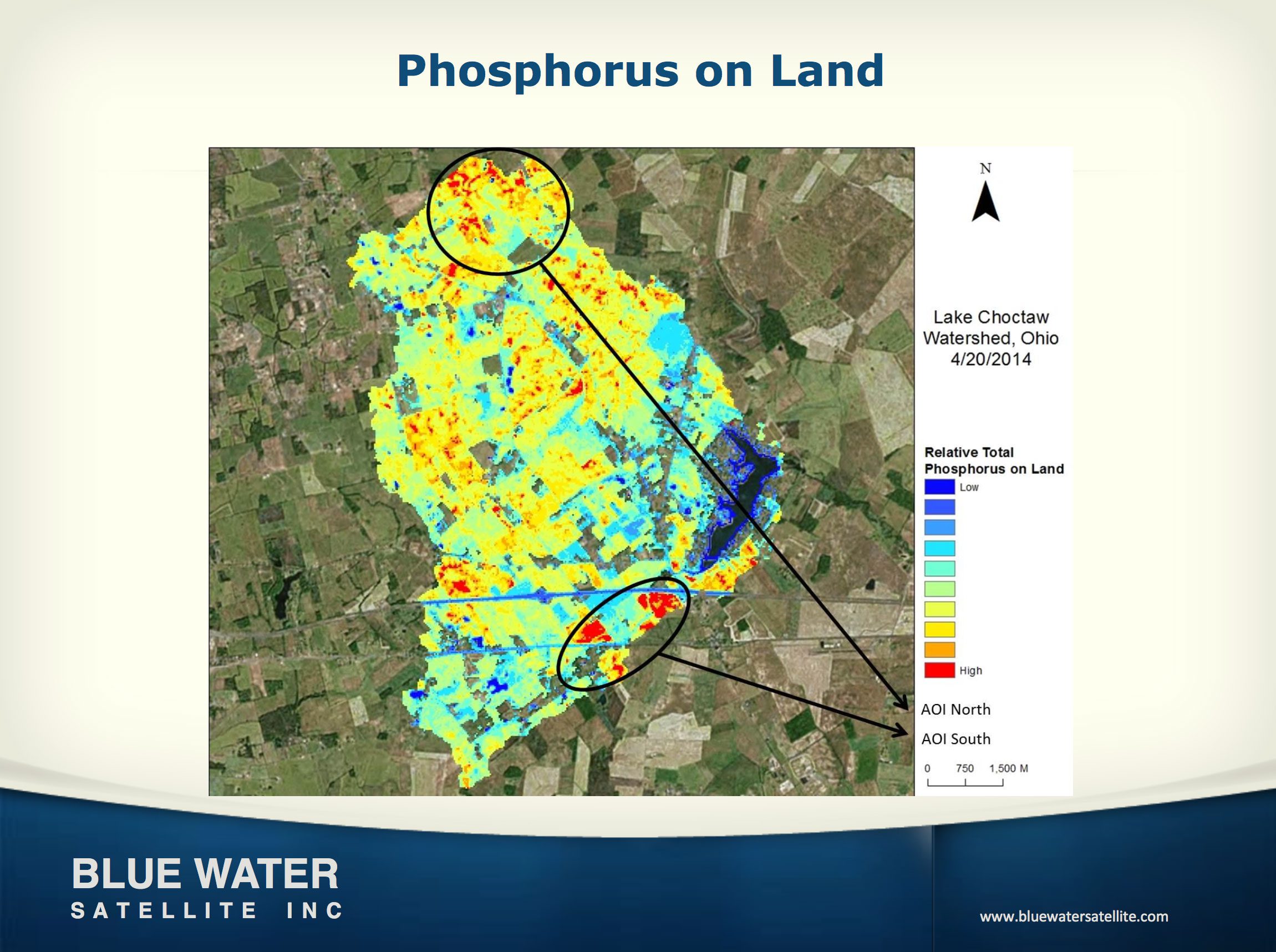
Toledo-based Blue Water Satellite Inc., which uses satellite data to provide high-accuracy measurements of water and soil conditions, received a $1 million loan from the state of Ohio.
The U.S. National Geospatial-Intelligence Agency, the National Science Foundation (NSF), and the University of Minnesota's Polar Geospatial Center are collaborating to use high-resolution satellite imagery from DigitalGlobe, processed with NSF-supported advanced computing resources, to produce improved, publicly available Digital Elevation Models of Alaska by mid-2016 and the entire Arctic by the end of 2016.
September 29, 2015 — Teledyne Optech is pleased to announce that it will show its latest surveying and mapping solutions to professionals in Africa’s growing GIS industry at the Esri Eastern Africa User Conference taking place from October 7-9 in Addis Ababa,...
Paris, Washington D.C., Montreal, Yokohama, September 29, 2015 — According to Euroconsult's newly published report, Maritime Telecom Solutions by Satellite, Global Market Analysis & Forecasts, the value of the global maritime satellite communications market...
September 29, 2015 — With the new Earth observation satellites carrying a range of technologies such as radar and multispectral imaging instruments for land, ocean and atmospheric monitoring, data are available for the next 20–30 years. However, this means little...
SUNNYVALE, Calif., Sept. 29, 2015 — Trimble (NASDAQ: TRMB) introduced today its next generation Trimble® Indoor Mobile Mapping Solution (TIMMS) that produces fast and accurate maps of even the most difficult-to-navigate indoor spaces and translates them directly...
New York, NY and Reston, Va.,September 29, 2015 — Leidos, a national security, health, and engineering solutions company, and Boundless, a leading provider of open source geospatial software and services, today announced they have entered into a strategic...
SEATTLE, Wash., Sept. 28, 2015 — LizardTech®, the creator of MrSID® and provider of software solutions for managing and distributing geospatial content, announced today it will exhibit at UAS Mapping 2015 Reno in booth number 202, Sept. 29-30, 2015 at The Reno...
