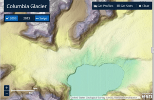
Satellite images compare the Columbia Glacier in 2009 (left) and 2013 (right). To explore the Columbia Glacier retreat, click here. (Credit: Esri)
The U.S. National Geospatial-Intelligence Agency, the National Science Foundation (NSF), and the University of Minnesota's Polar Geospatial Center are collaborating to use high-resolution satellite imagery from DigitalGlobe, processed with NSF-supported advanced computing resources, to produce improved, publicly available Digital Elevation Models of Alaska by mid-2016 and the entire Arctic by the end of 2016.
This effort will complement the ongoing Alaska Mapping Initiative, led by the U.S. Geological Survey 3D Elevation Program with support from the state of Alaska and other federal agencies, to acquire high-resolution elevation data from interferometric synthetic aperture radar that will be used to update topographic mapping in Alaska.
Read more here.

