September 29, 2015 ” With the new Earth observation satellites carrying a range of technologies such as radar and multispectral imaging instruments for land, ocean and atmospheric monitoring, data are available for the next 20“30 years. However, this means little unless there are capable people handling them.
ESA's Ocean, Land and Atmosphere Training Courses ensure this. Held in various European universities and research organisations, they involve leading European scientists and key remote-sensing experts, focused on training the participants on how to use open-source tools developed by ESA to exploit new data streams.
As Prof. Johannessen, Vice Director of Nansen Environmental and Remote Sensing Center in Norway, states: The ocean training courses that ESA arranges offer a comprehensive overview of satellite remote sensing. Attendants get a good understanding on the key steps in the processing, development and use of retrieval algorithms.
Moreover, the amount of satellite data are growing very fast and demand highly skilled capacities at all levels, to ensure full use of these very important data.
The two most recent courses took place on 7“18 September. Ocean remote sensing at Ifremer in Brest, France, and Land remote sensing at the University of Agronomic Science and Veterinary Medicine (USAMV) in Bucharest, Romania.
ESA coaches, together with local university professors, ensure that environmental issues of the hosting countries are also studied. For instance, the recent course in Romania covered flood aspects.
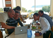
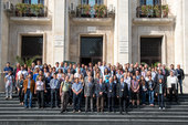
With over a hundred PhD students attending from all ESA states, the courses are hugely popular. They provided advanced scientific knowledge on theory and applications of ocean and coastal zone monitoring and land remote sensing. Including land use and land cover change, terrain motion, hazards, forest biophysical retrievals, flood monitoring and snow cover mapping. The lectures presented the new Sentinel-2A mission, giving hands-on experience with the first data, before opening it to the public next month.
Prof. Alexandru Badea, member of the Romanian Space Agency and local organiser for the USAMV course, points out that: Considering the high importance of maintaining an up-to-date level of young scientists able to process satellite data provided by Sentinel missions, we intend to assimilate the educational process of new tools for the exploitation of Earth observation satellite data, in particular of Sentinels images, during the next university years.
François Steinmetz, now a scientist at Hygeos, a small company in France where he is developing an operational algorithm for the retrieval of ocean water constituents in ESA's climate change initiative, participated in the first ocean training course in 2006, in Hamburg.
The training courses provided a unique opportunity to discover various facets of oceanography from space, from the exploration and understanding of images to the analysis of synthetic aperture radar data. There was a strong emphasis on practical sessions, where we discovered many tools that I still use on a daily basis.
As part of the Scientific Exploitation of Operational Missions programme, ESA organises these advanced training courses every year. A land course in Hungary and a first training course on the cryosphere at the University of Leeds in the UK are under preparation for next year.
