Following the March 11, 2011, tsunami that ravaged Japan’s coastline, the geospatial community has rallied around the country, providing disaster response tools on the ground and an array of geospatially based information resources via the Internet. Japan continues...
Air Combat Command's GeoBase Mission
Advanced raster management speeds disaster response and other mission-critical data to U.S. Air Force operations worldwide. By Mike Cannon, Dave Williams and Matt Moore, AECOM (http://www.aecom.com/), Virginia Beach, Va. The U.S. Air Force (USAF) is divided into Major...
Immediate Awareness Immediate Response
New Web-based platforms for delivering satellite imagery and other critical geospatial information to first responders are revolutionizing disaster management. By Tara Byrnes, director, North American channel, GeoEye (http://www.geoeye.com/), Herndon, Va. Sometimes we...
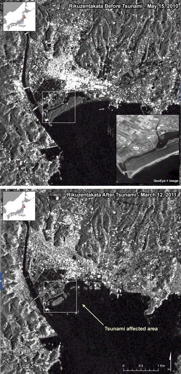
Disaster Response in JAPAN
Geospatial Community to the Rescue Following the devastating March 11, 2011, earthquake and tsunami that struck Japan, a host of geospatial companies provided pivotal disaster response information and services. Many of the same companies and more will contribute to...
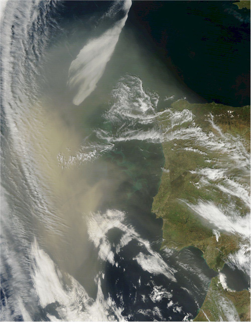
Saharan Dust Hangs Off Portugal
A low-pressure system with strong winds drove this thick cloud of dust from North Africa's Saharan Desert all the way to Portugal.

Hummingbird UAV Takes Flight
Aerovironment has achieved a new technical milestone with a tiny UAV: controlled precision hovering and fast-forward flight of a two-wing, flapping wing aircraft that carries its own energy source.
Technology Will Drive Tomorrow’s Homeland Security
By André Doumitt, CEO of Geosemble Technologies (http://www.geosemble.com/), El Segundo, Calif. The Department of Homeland Security's  all-encompassing mission is "to prevent and deter terrorist attacks,    protect against and respond to threats and hazards to...
Industry Updates – April
 Satellite Sentinel Project Aims to Deter War in Sudan DigitalGlobe collaborated with the Satellite Sentinel Project, the brainchild of actor George Clooney, to deliver the first images and analysis of the evolving situation in Sudan, following the country’s...

Sensor-Knowledge System Protects Critical Infrastructure
Threat Detection and Assessment A development team led by TerraEchos and its sister company, GCS Research, both of Missoula, Mont., have introduced a commercial sensor-knowledge system capable of detecting, locating and classifying threats to remote high-risk...
Earth-Mapping Shuttle Mission Marks 10th Anniversary
The data benefit scientists, engineers, government agencies and the public with applications that range from land-use planning to virtual Earth exploration. NASA is currently using Shuttle Radar Topography Mission data to create an even better global topographic map...
