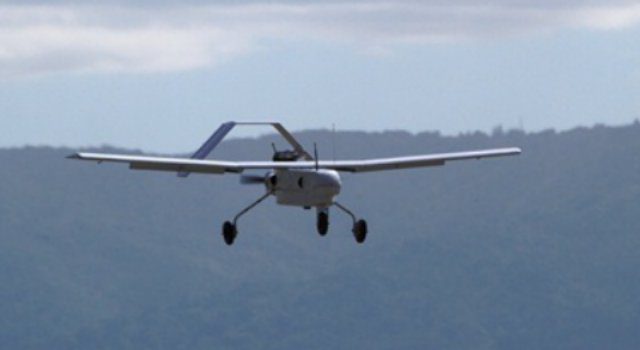
The Royal Canadian Mounted Police in Manitoba have two new unmanned aircraft systems that can be used for aerial photography and video of crime and crash scenes.
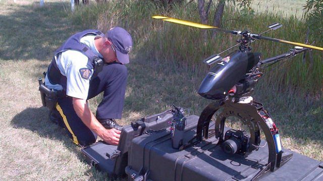
The Royal Canadian Mounted Police in Manitoba have two new unmanned aircraft systems that can be used for aerial photography and video of crime and crash scenes.
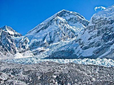
A study published in Nature shows that glaciers in the Hindu Kush“Karakoram“Himalaya region lost 12 gigatonnes annually from 2003 to 2008, much more than previously reported.
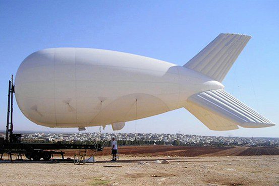
The U.S. military is partnering with border-patrol officials in an initiative that could bring dozens of surveillance blimps from the battlefields of Afghanistan to the U.S. border with Mexico.
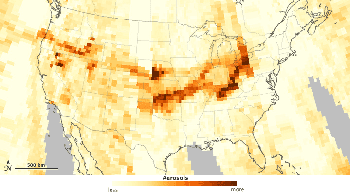
Smoke from western wildfires affected air quality as far away as the Great Lakes, and some of the thickest smoke stretched from the Dakotas to Texas.

A senior officer with the National Reconnaissance Office, the nation’s spy satellite agency, is being investigated over criminal allegations related to contracting issues.
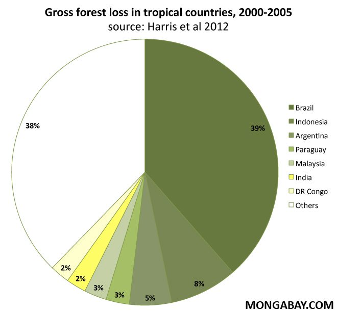
Powerful eyes in the sky and cheaper, more powerful data-crunching computers mean there will be no place to hide for palm oil, logging or mining firms that clear forests without permits.
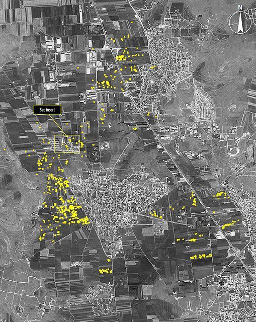
Satellite images show the intensity of artillery bombing in Aleppo, where members of the Free Syrian Army are engaged in a vicious battle with forces loyal to Syrian President Bashar al-Assad.
Researchers used LiDAR technology to identify more than 20,000 architectural features, including several small pyramids, a ball court and dwellings that housed more than 25,000 people.
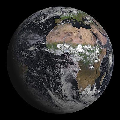
On Aug. 7, 2012, the Spinning Enhanced Visible and Infrared Imager instrument on Europe's MSG-3 geostationary satellite captured its first image of Earth.
Unmanned aircraft maker MLB Company finished a high-resolution assessment of sea grass and coral reef carbon dynamics to better understand the vulnerability of near-shore environments.
