On Jan. 8, 2018, the European Space Agency (ESA) Copernicus Sentinel-2 mission captured rare snowfall in northwest Algeria, on the edge of the Sahara desert”only the third time in nearly 40 years that this part of the desert has seen snow.
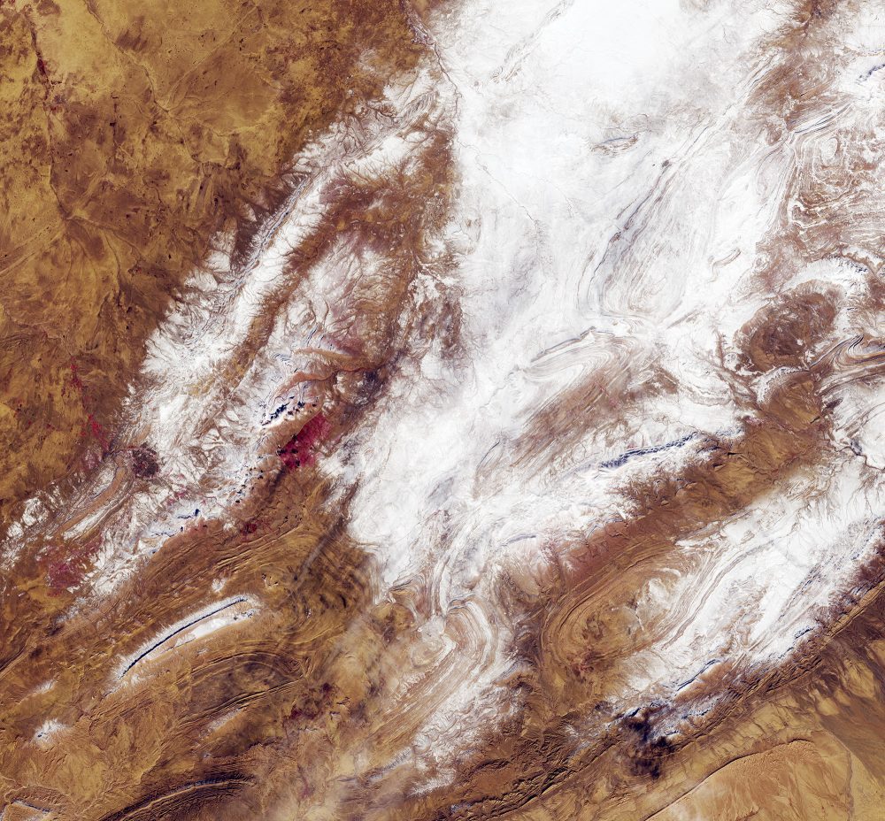
On Jan. 8, 2018, the European Space Agency (ESA) Copernicus Sentinel-2 mission captured rare snowfall in northwest Algeria, on the edge of the Sahara desert”only the third time in nearly 40 years that this part of the desert has seen snow.
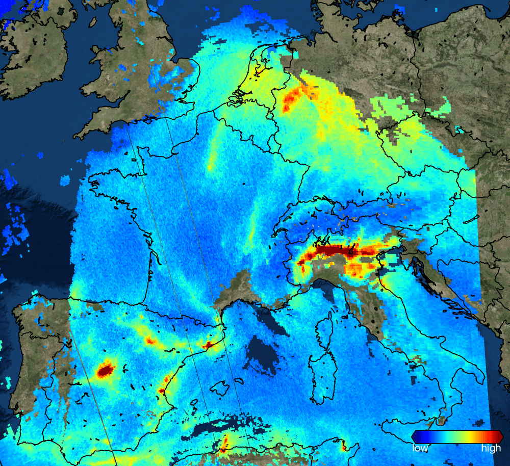
Launched on Oct. 13, 2017, the European Space Agency (ESA) Sentinel-5P satellite has delivered its first images of air pollution.
For the first time in India, a state government is using satellites to assess lost crops so farmers can benefit from speedy insurance payouts.
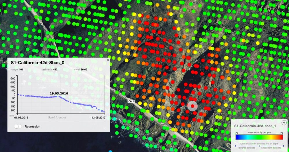
On May 20, 2017, more than a million tons of dirt and rock buried part of California's Highway 1 along the Pacific coastline in the state's Big Sur region. In addition to cutting off the route, the landslide added some 12 acres of land to the shoreline.
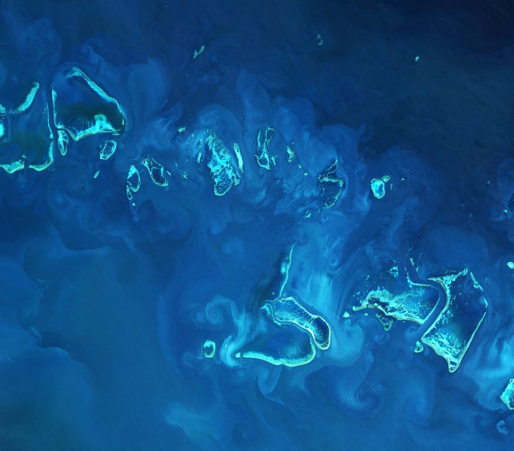
The European Space Agency (ESA) Copernicus Sentinel-2A satellite collected an image of part of the Great Barrier Reef off Australia's northeast coast on April 1, 2017.
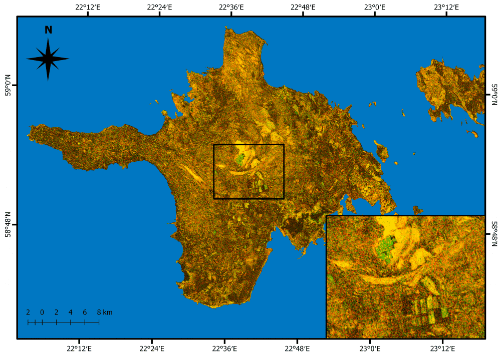
Grasslands cover approximately 37 percent of Earth's land surface when calculated with shrub-lands and savannas. In Western Europe, grasslands comprise 40 percent of agricultural land. And now European Space Agency (ESA) Copernicus Sentinel satellites are being used to detect and better evaluate management practices of grasslands in Estonia.
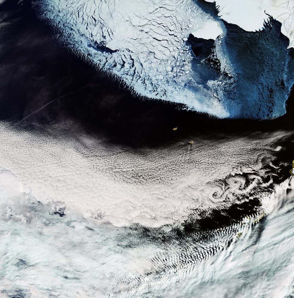
The European Space Agency (ESA) Copernicus Sentinel-3A satellite collected this image of the Bering Sea, north of the Alaska Peninsula, on March 26, 2017.
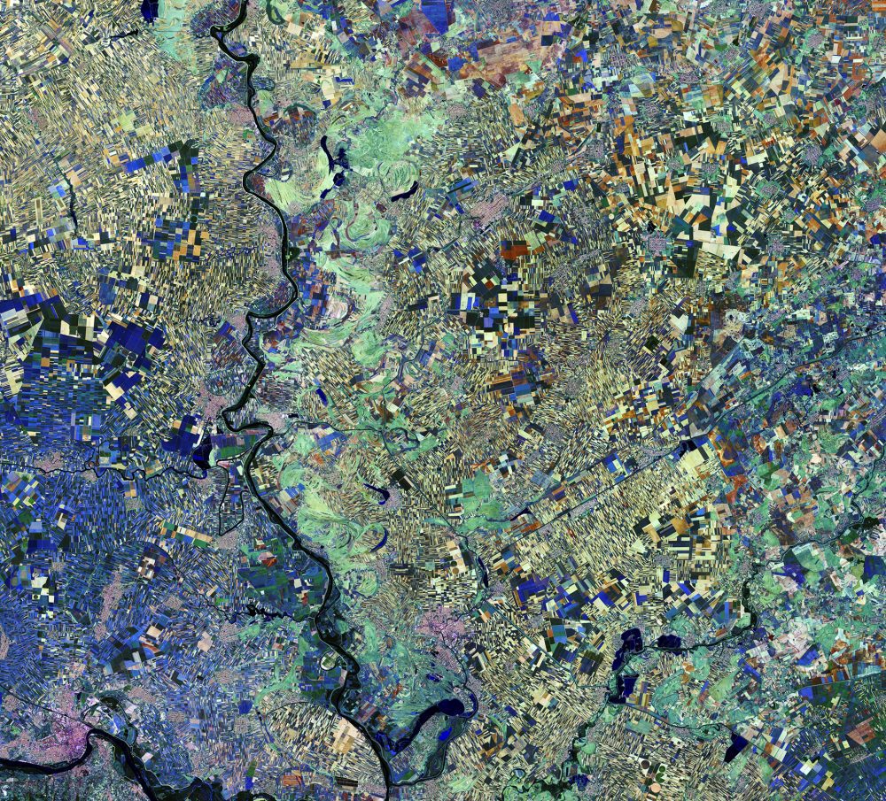
The European Space Agency (ESA) Copernicus Sentinel-2A satellite captured this image of the Vojvodina region of northern Serbia. The area lies in the southern part of a region previously covered by the Pannonian Sea from two million to 23 million years ago. Today, the land boasts a fertile soil, as evidenced by the many agricultural fields visible as geometric shapes.
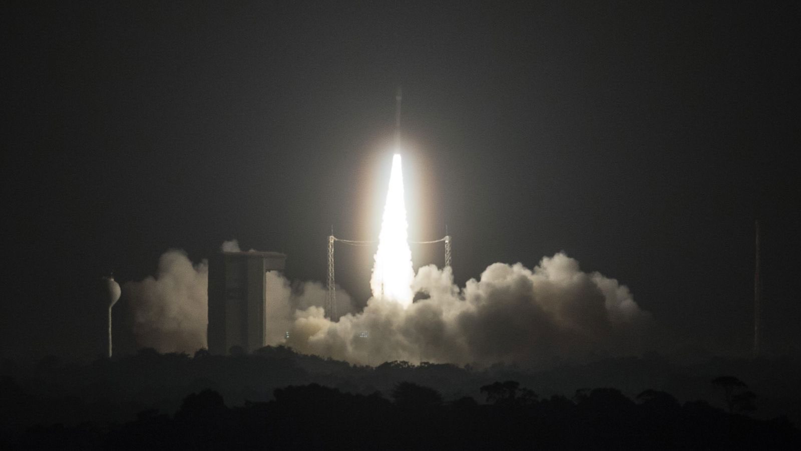
The European Space Agency (ESA)-developed Sentinel-2B satellite was launched on March 7, 2017, doubling the coverage of high-resolution optical imaging in the Sentinel-2 mission for the European Union Copernicus environmental monitoring system.
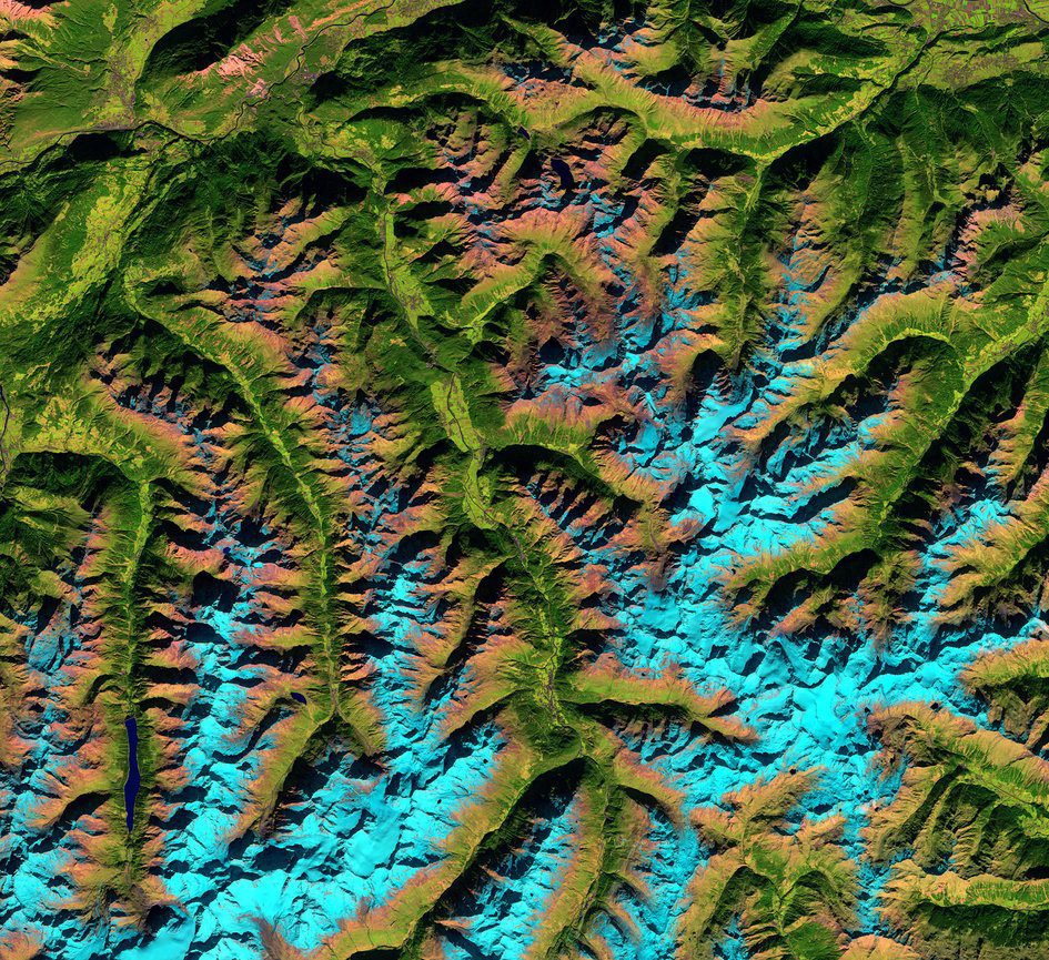
The shadows across this image taken by the European Space Agency (ESA) Copernicus Sentinel-2A satellite image may play tricks on the human eye, making the valleys”the green areas”look like they stand higher than the light blue mountains. Sometimes rotating the image so the shadows fall in a different direction can fix this optical illusion.
