Massive Mountain Range in China

Massive Mountain Range in China

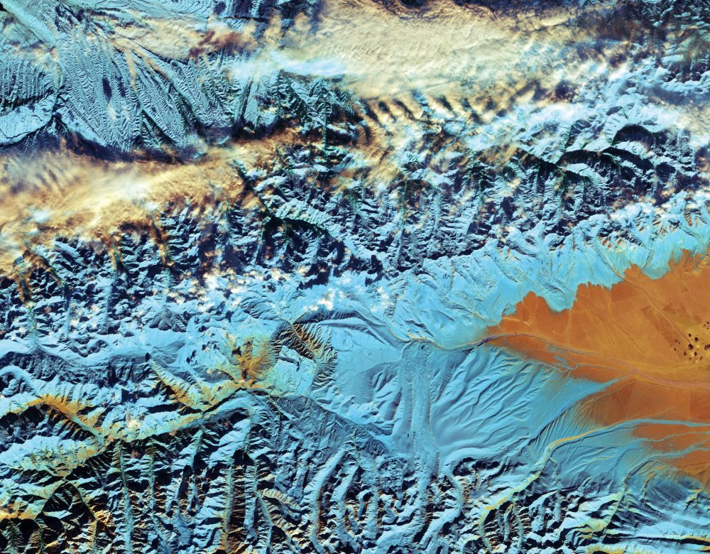
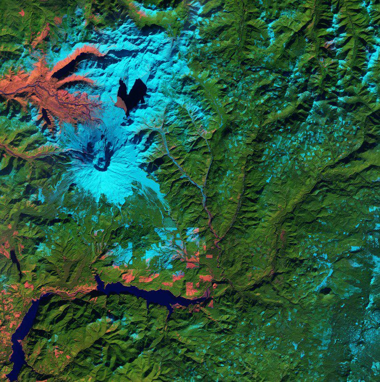
The European Space Agency (ESA) Sentinel-2A satellite collected this false-color image over northwestern China near the border with Kazakhstan and Kyrgyzstan. The featured Tian Shan mountain range stretches about 2,800 kilometers across this border region, making it one of the longest mountain ranges in Central Asia.

Satellites Reveal Ground Shift from Italian Earthquake

Satellites Reveal Ground Shift from Italian Earthquake

Scientists from Italy's Institute for Electromagnetic Sensing of the Environment of the National Research Council as well as the National Institute of Geophysics and Volcanology used radar imagery from the Copernicus Sentinel-1 satellites to identify significant east“west ground displacement in central Italy where an earthquake struck on Oct. 30, 2016.

Salt and Ice in Kazakhstan

Salt and Ice in Kazakhstan

Kazakhstan’s Alakol Lake typically freezes for about two months at the end of winter and breaks up in early spring, beautifully captured in this European Space Agency Sentinel-2 image. The salt lake’s mineral-rich water and mud is considered therapeutic, and...

Bosphorus Bridge Construction Chronicled

Bosphorus Bridge Construction Chronicled

An image from the European Space Agency's Sentinel-2A satellite shows Turkey's Third Bosphorus Bridge as it was being constructed on Feb. 8, 2016. The hybrid cable-stayed suspension bridge, which opened on Aug. 26, 2016, forms part of the ongoing 150 kilometer-long Northern Marmara Highway project.

Tonga's Beautiful Beaches, Reefs and Lagoons

Tonga's Beautiful Beaches, Reefs and Lagoons

The Kingdom of Tonga in the southern Pacific Ocean has a population dispersed across 36 of its 169 islands, but about 70 percent of the people live on the main island captured in this image from the European Space Agency (ESA) Sentinel-2A satellite.

Copernicus Accelerator Seeking Applications

Copernicus Accelerator Seeking Applications

Until July 18, 2016, the European Commission is taking applications from individuals and teams from startups, SMEs, industrial companies, research institutes and universities for its Copernicus Accelerator, which hopes to foster development of commercial space applications and products.

Sentinel Shows Sinking Land

Sentinel Shows Sinking Land

Focusing on The Netherlands and Denmark, scientists have been using radar images from the European Space Agency Sentinel-1A satellite to determine where ground is stable or how much it may be rising or sinking.

NEWEST V1 MEDIA PUBLICATION

April Issue 2024