A new study shows that winds are responsible for the widespread growth of ponds in three watersheds along the Mississippi River.
A new study shows that winds are responsible for the widespread growth of ponds in three watersheds along the Mississippi River.
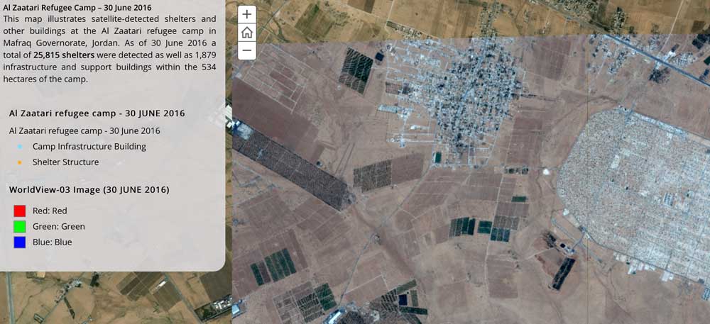
The United Nations Institute for Training and Research (UNITAR), through its Operational Satellite Applications Programme (UNOSAT), and Radiant.Earth agreed to explore new Earth observation data innovations supporting humanitarian disaster management, global health, climate change, sustainable water management and cultural heritage.
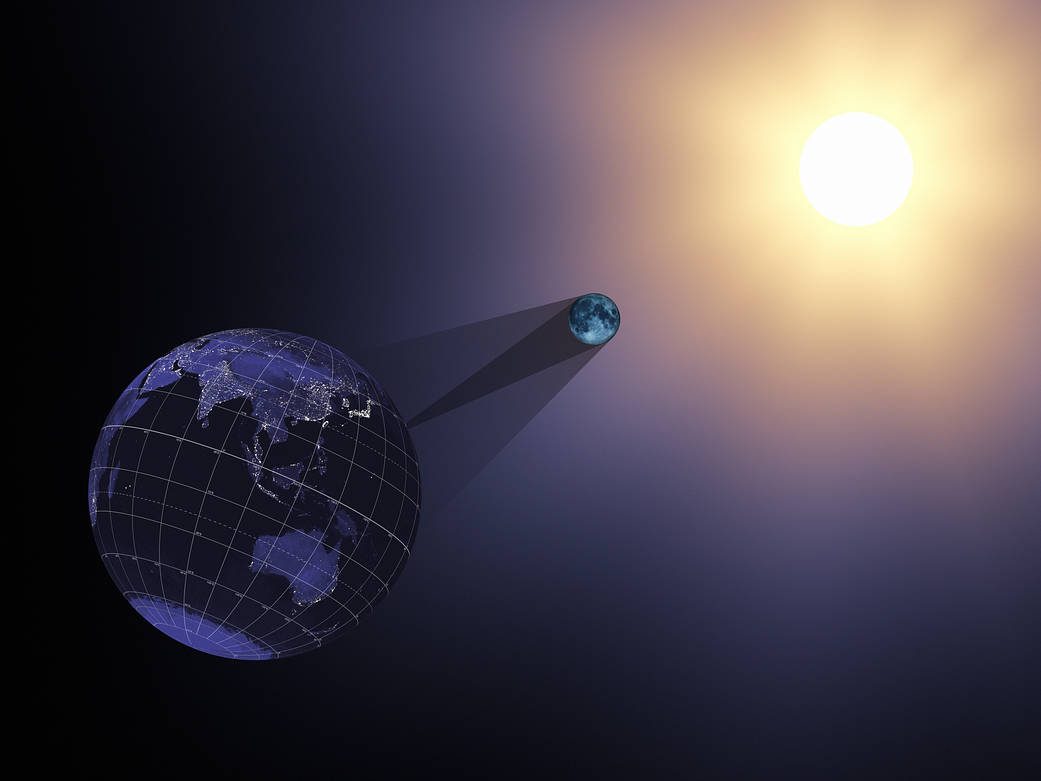
On Aug. 21, 2017, the Earth will cross the shadow of the moon, creating a total solar eclipse. Eclipses happen about every six months, but this one is special. For the first time in almost 40 years, the path of the moon’s shadow passes through the continental United States.
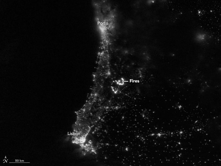
On June 17, 2017, lightning reportedly ignited a deadly wildfire that spread across the mountainous areas of Pedrógão Grande”a municipality in central Portugal located about 160 kilometers northeast of Lisbon.
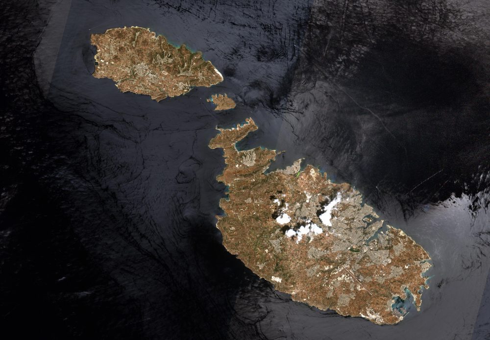
This image of Malta, captured by the European Space Agency (ESA) Copernicus Sentinel-2B satellite, is one of the first sets of images delivered via Alphasat, which is in geostationary orbit 36,000 kilometers above Earth.
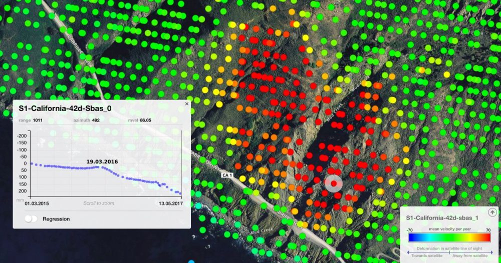
On May 20, 2017, more than a million tons of dirt and rock buried part of California's Highway 1 along the Pacific coastline in the state's Big Sur region. In addition to cutting off the route, the landslide added some 12 acres of land to the shoreline.
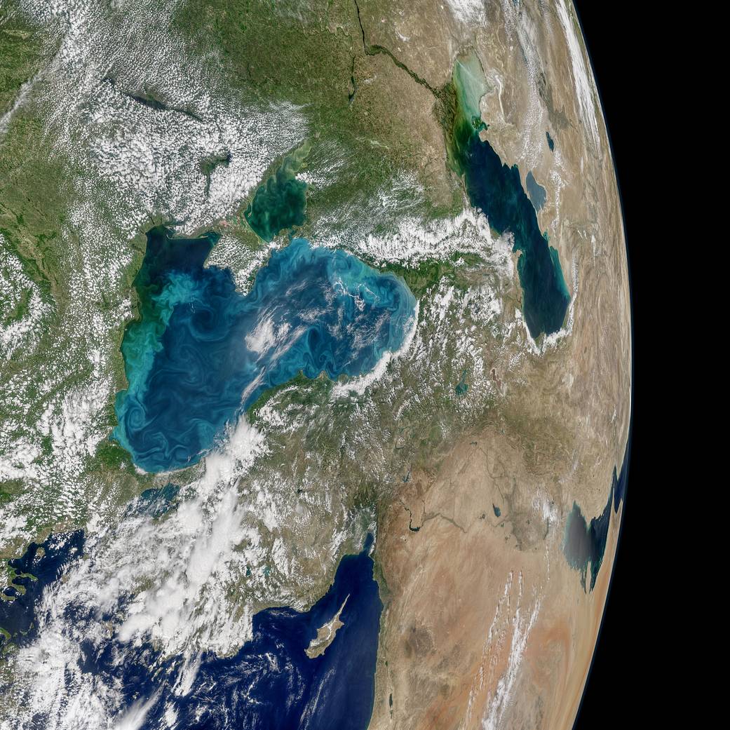
Most summers, jewel-toned hues appear in the Black Sea, a result of phytoplankton that trace the flow of water currents and eddies. The Moderate Resolution Imaging Spectroradiometer (MODIS) on NASA's Aqua satellite recently collected imagery of such an ongoing phytoplankton bloom.
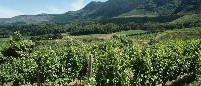
Noveltis, a French company, has been using SimActive's Correlator3D software to help with precision viticulture. Based on multispectral drone imagery, mapping products are generated to determine vine health and detect missing plants.
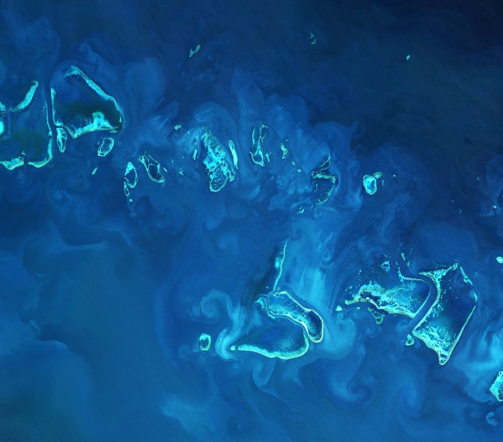
The European Space Agency (ESA) Copernicus Sentinel-2A satellite collected an image of part of the Great Barrier Reef off Australia's northeast coast on April 1, 2017.

Earth-i teamed with WeatherSafe to support coffee farmers of Burundi through Earth-i's ACCORD program, which combines high-resolution satellite imagery with crop analysis to provide stakeholders with critical insights on key coffee farming decisions to improve crop quality, thereby supporting sustainable growth for coffee farmers large and small.
