An RS-25 rocket engine with a new flight-model engine controller and flight configuration software was successfully tested for the first time at NASA's Stennis Space Center on March 23, 2017.
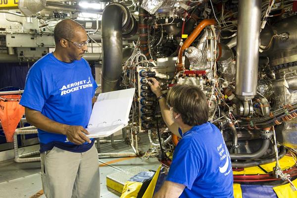
An RS-25 rocket engine with a new flight-model engine controller and flight configuration software was successfully tested for the first time at NASA's Stennis Space Center on March 23, 2017.
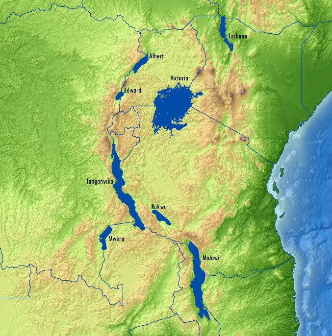
Getech developed a new satellite-based gravity data product that enhances explorationists' understanding of the East African Rift. Potential fields data have proved particularly successfully within this environment, and numerous oil companies have cited how such information had direct positive impacts on exploration campaigns.
MacDonald, Dettwiler and Associates (MDA) announced on Feb. 24, 2017, that it will acquire commercial remote-sensing company DigitalGlobe for $2.4 billion, the biggest deal to date in the ongoing consolidation in the Earth-imaging market.
MINNEAPOLIS – East View Geospatial is enthusiastic to announce the expansion of analytic services in the South China Sea for foundation data and satellite imagery.  The South China Sea serves as an international crossroads of culture, commerce and security...

GOES-16, the first spacecraft in NOAA's next-generation of geostationary satellites, sent back to Earth the first high-resolution images from its Advanced Baseline Imager (ABI) instrument.
Dr. Curtis E. Woodcock, a longtime innovator in space-based Earth observation at Boston University, and the Tropical Rainfall Measuring Mission (TRMM) team, which paved the way for the next generation of satellite precipitation observations, received the 2016 William T. Pecora Award for achievement in Earth remote sensing.
Toulouse - SES-10, the 10th Eurostar satellite built by Airbus Defence and Space for Luxembourg-based satellite operator SES, has left the Airbus cleanrooms in Toulouse, France, and has been shipped to Cape Canaveral for its forthcoming launch by SpaceX. SES-10 is the...
VANCOUVER, Jan. 17, 2017Â - UrtheCast Corp. (TSX:UR) ("UrtheCast" or the "Company"), the geospatial and geo-analytics company developing two Earth Observation (EO) satellite constellations, known as OptiSARTM and UrtheDailyTM, today announces that it has entered into...
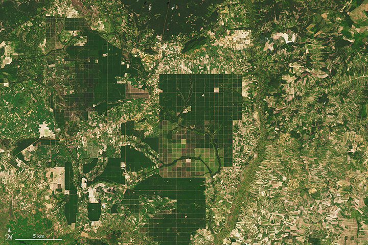
Between 2001 and 2014, the annual forest loss rate in Cambodia increased by 14.4 percent: a total of 1.44 million hectares”5,560 square miles”of forest. In broad swaths of the country, densely forested landscapes”even those in protected areas”have been clear-cut during the last decade for rubber plantations and timber.
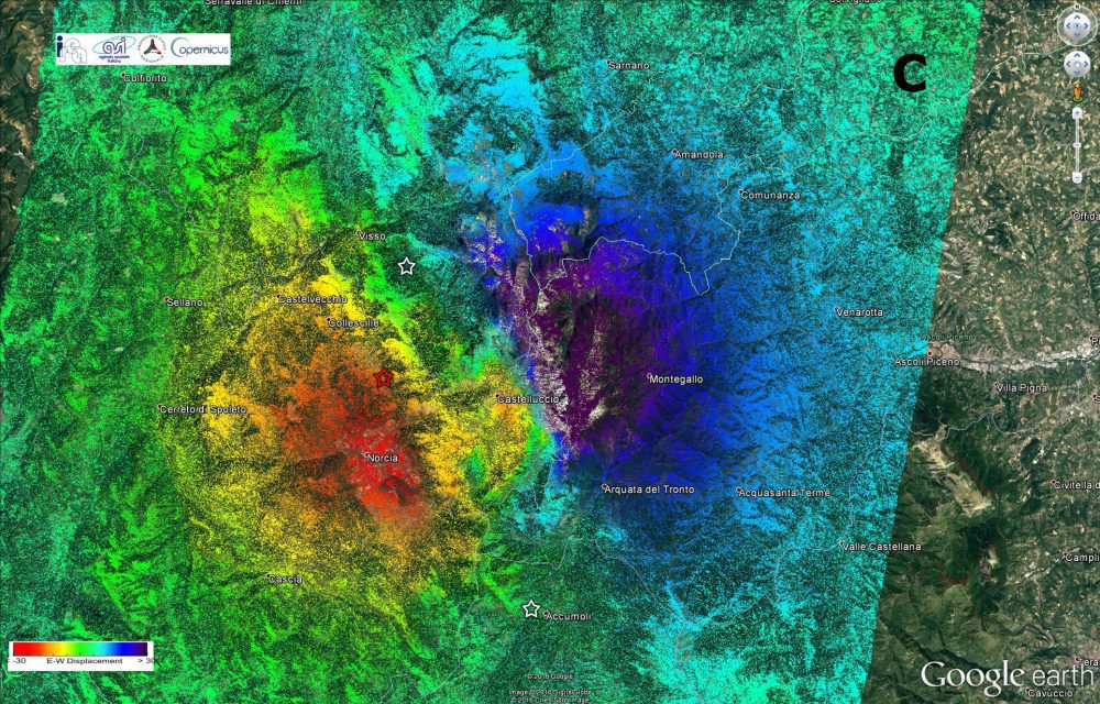
Scientists from Italy's Institute for Electromagnetic Sensing of the Environment of the National Research Council as well as the National Institute of Geophysics and Volcanology used radar imagery from the Copernicus Sentinel-1 satellites to identify significant east“west ground displacement in central Italy where an earthquake struck on Oct. 30, 2016.
