The spectacular exposed geology of northwestern China offers an ideal landscape for illustrating how satellite measurements can identify minerals from afar.
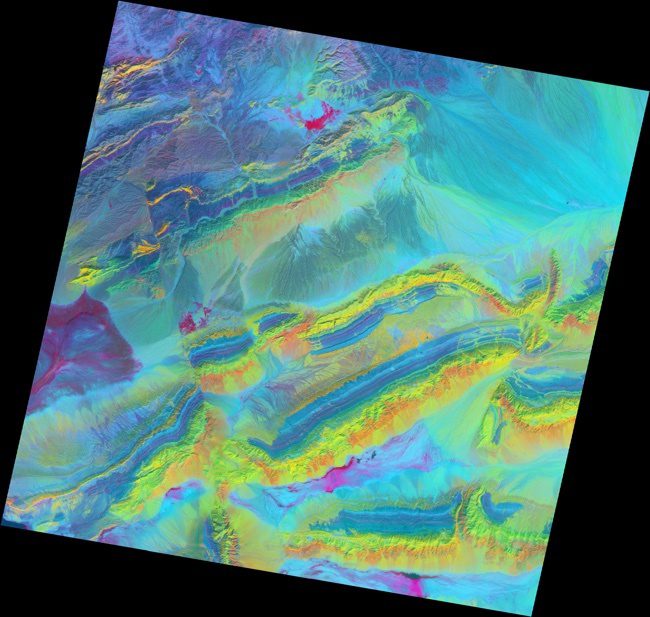
The spectacular exposed geology of northwestern China offers an ideal landscape for illustrating how satellite measurements can identify minerals from afar.
Aircraft have several advantages over satellite platforms when collecting imagery. For example, aircraft can collect data on specific dates and times. Another advantage is the ability to put new sensors in aircraft as technology advances.
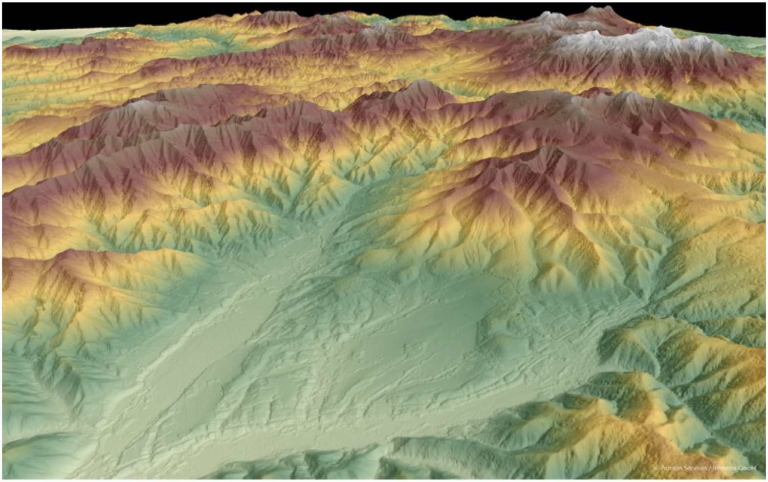
Whether planning an infrastructure network, conducting a military intervention mission in unknown terrain or analyzing terrain features for oil and gas exploration, precise, reliable elevation data support a wide range of applications and form the foundation of any accurate geospatial product.
Just 15 years ago, besides the familiar hurricane swirls and other weather-related phenomena, the average person had seen few, if any, images collected by an Earth observation (EO) satellite. Meanwhile, in relative obscurity, the scientific community was benefiting...
By Mladen Stojic, president, Hexagon Geospatial (www.hexagongeospatial.com), Norcross, Ga. One constant in our world is change, which can have a dramatic effect on virtually any organization around the globe. Today’s dynamically transforming landscape, whether...
By Dale Lehner, Office of Corporate Communications, National Geospatial-Intelligence Agency (www.nga.mil), Springfield, Va. The National Geospatial-Intelligence Agency (NGA) Advanced Visualization Branch, known as ASCSV, is taking imagery to new heights of...
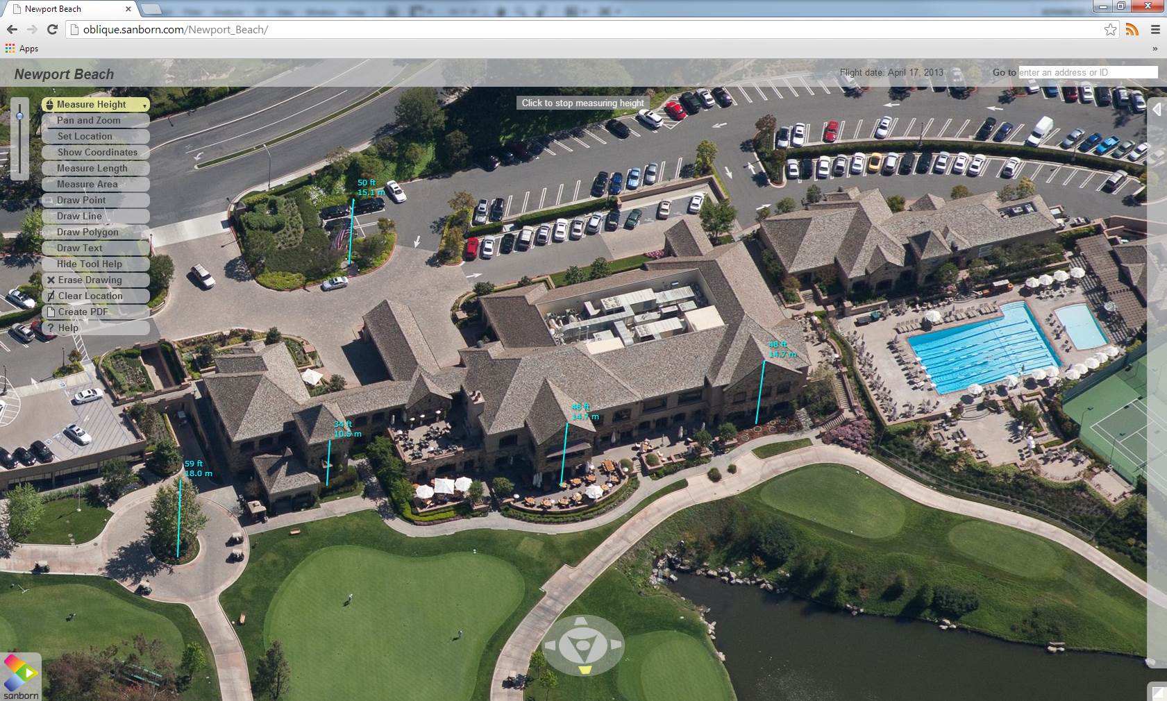
Although oblique imaging products have been part of the mainstream mapping industry for more than a decade, none of the accredited mapping societies have provided standards that define accuracy requirements for oblique imagery.

More than a decade ago, the U.S. Army established the motto that every soldier is a sensor. Fast forward to today and that vision has become fact, with linked mobile devices and applications routing geospatial data back and forth between command and the field.
By Mladen Stojic, president, Hexagon Geospatial (www.hexagongeospatial.com), Norcross, Ga. Situated on the Mississippi River, the city of Baton Rouge, La., offers a vibrant culture that comes from Louisiana State University (LSU), Southern University and numerous...
Geospatial advances allow users to create national maps at unprecedented scales and speed. By Kumar Navulur, director, Next Generation Products, DigitalGlobe (www.digitalglobe.com), Longmont, Colo., and Mark Cygan, Map, Chart, Data Production and SDI Industry...
