By Jason Moll, Office of Corporate Communications, National Geospatial-Intelligence Agency (www.nga.mil), Bethesda, Md. The National Geospatial-Intelligence Agency (NGA) and Penn State University entered into the fourth of a five-year partnership in January...
A Great Time for Earth Observers
In less than four months, DigitalGlobe plans to launch its WorldView-3 Earth observation (EO) satellite. In addition to offering 0.31-meter-resolution panchromatic and eight-band multispectral imagery, WorldView-3 was licensed by the National Oceanic and Atmospheric...
Open Standards Benefit Earth Imaging Community
By Peter Baumann, Jacobs University Bremen, chair of the Open Geospatial Consortium (OGC) Web Coverage Service Standards Working Group, and Lance McKee, OGC senior staff writer. his year marks the 20th anniversary of the founding of the Open Geospatial...
BYOD (Bring Your Own Drone!)
By Rob Mott, vice president of Geospatial  Solutions, Intergraph Government Solutions  (www.intergraphgovsolutions.com), Madison, Ala. Unmanned aircraft system applications are endless, and the technology promises widespread benefits. The field of unmanned aircraft...
U.S. Geological Survey Leads Ambitious 3D Elevation Program
The program is being developed to respond to growing needs for high-quality topographic data and a wide range of other 3-D representations of natural and constructed features. By Larry Sugarbaker, senior advisor, U.S. Geological Survey National Geospatial Program...
Finding a Smarter Way to Go Solar
Earth imagery and image analysis software help lead more customers to the solar grid. By Mary Jo Wagner, a freelance writer based in Vancouver, Canada. Read any recent report on the health of the solar industry, and you’ll likely reach the same conclusion:...
Emerging Space Programs Spark Earth Observation Growth
Despite a downward trend in government spending on space, Earth observation programs continue to expand globally. By Adam Keith, director of Space and Earth Observation, Euroconsult (www.euroconsult-ec.com), Montreal, Canada. Last year marked the first year of...
Democratizing Geospatial Data for Disaster Response
By A.J. Clark, president, Thermopylae Sciences & Technology (www.t-sciences.com), Arlington, Va. Picture a spectrum. On the left is the old world of geo-spatial intelligence in which a satellite collects an image and sends it to a ground station. From there it...

Geospatial Data Play Key Roles in Next-Generation Aviation Map Production
Aviation maps and navigation products have gone digital in both two and three dimensions. A current trend in the development of such mapping products is the integration of information that can enhance situational awareness for pilots in the air and on the ground. By...
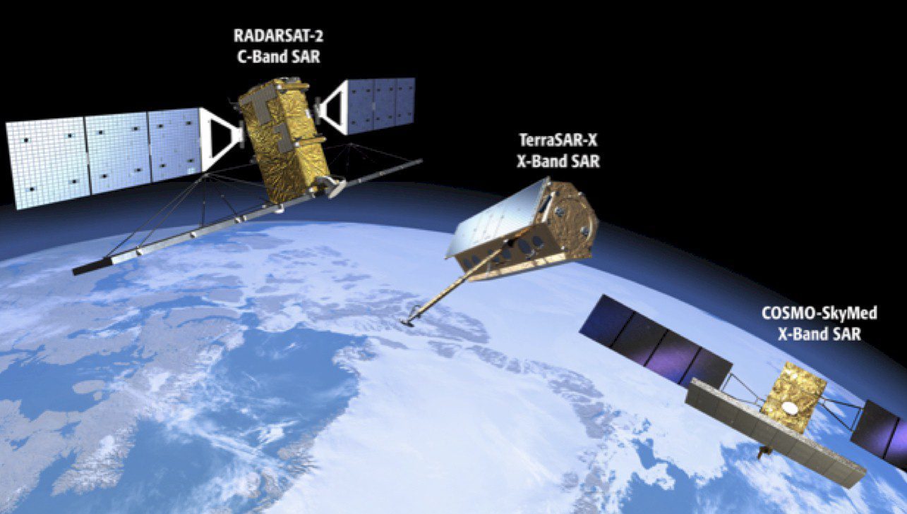
Unlocking Radar's Full Potential
More individuals and organizations are harnessing the power of radar mapping data. By Rob Mott, vice president of Geospatial Solutions, Intergraph Government Solutions (www.intergraphgovsolutions.com), Madison, Ala. Radar has become one of the most versatile remote...
