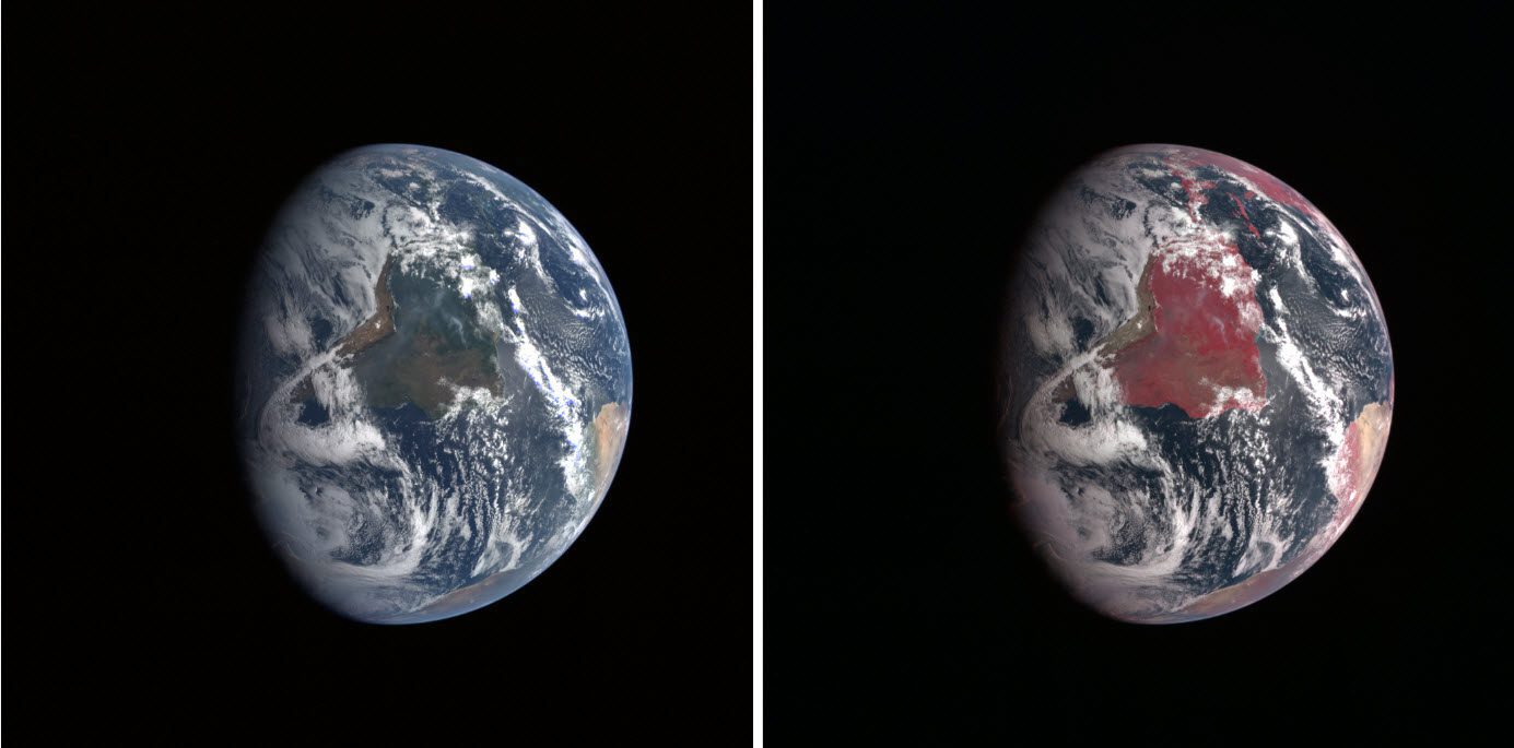
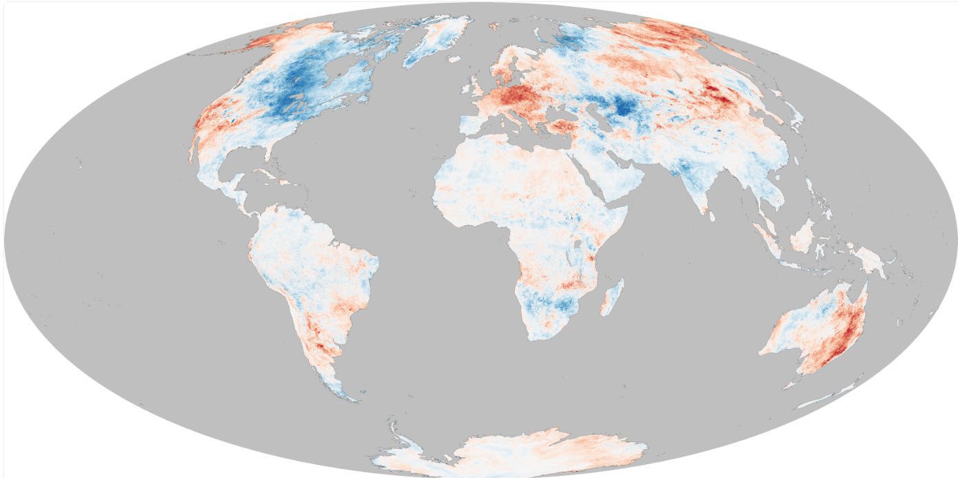
How can a forest be red and a cloud blue? It depends on the processes used to transform satellite measurements into images. In our photo-saturated world, it’s natural to think of the images on NASA’s Earth Observatory website as snapshots from space. But most...
Maximizing Orthoimagery QA/QC Procedures
Aerial imagery guidelines developed by Loudoun County, Va., help ensure accurate base maps and analyses. By Mita Mathur, Office of Mapping and Geographic Information, Loudoun County, Va. Effective data management is the foundation for any successful mapping project. A...
Crowdsourcing Satellite Imagery
GEOINT of the people, by the people, for the people offers big benefits for the geospatial intelligence community. By Luke Barrington, senior manager, DigitalGlobe (www.digitalglobe.com), Longmont, Colo. How many vehicles, fighters and refugees are involved in the...
Gaining Some Perspective on Winter 2014
For many North American residents, the winter of 2013-2014 seemed like one of the coldest in many years. Waves of Arctic air brought extended periods of cold weather and above-average snowfall to the middle and eastern portions of the United States and Canada. Seven...
Reflecting on Dr. Roger Tomlinson's Contributions to GIS
“The beginning is the most important part of the work.†—Plato, The Republic On Feb. 9, 2014, Dr. Roger Tomlinson passed away at the age of 80. Anyone who has spent much time around a geographic information system (GIS) likely is familiar with Tomlinson’s...
Landsat 8 Celebrates High-Flying Rookie Season
By Jon Campbell and Rebecca L. Johnson, U.S. Geological Survey (www.usgs.gov), Reston, Va., and Kate Ramsayer, NASA’s Goddard Space Flight Center (www.nasa.gov/center/goddard), Greenbelt, Md. It’s hard to believe a year has passed since the launch of Landsat 8. On...
Tracing GEOINT's Evolution
By S. Eugene Poteat, president, Association of Former Intelligence Officers (www.afio.com), Falls Church, Va. From its early beginnings, technology has been the common thread that has advanced geospatial intelligence (GEOINT) to where it is today. The CIA’s U-2...
Lake Erie Ice Thickest in Decades
The intense cold snap that gripped much of central Canada and the United States in early January 2014 brought thick and widespread ice to the Great Lakes. Though parts of the lakes freeze every winter, several news media and meteorologist accounts suggested that...
Lake Erie Ice Thickest in Decades
The intense cold snap that gripped much of central Canada and the United States in early January 2014 brought thick and widespread ice to the Great Lakes. Though parts of the lakes freeze every winter, several news media and meteorologist accounts suggested that...
Seeking a Technology Edge
Technology is developing so rapidly that it’s becoming more and more challenging to put a value on it. For instance, reflect on Google’s 2012 purchase of Motorola Mobility for around $12.5 billion. The acquisition gave the company access to more than 17,000...