From seismic planning to pipeline routing, accurate elevation data can support a range of oil and gas applications. By Michael Hall, geologist, Airbus Defense and Space (www.geo-airbusds.com), Leicester, United Kingdom. Oil and gas exploration and development...
Energy Firms Turn to Space for Offshore Data
Satellite-derived bathymetry reduces risk and cost of offshore seismic surveys. By David Critchley, CEO, Proteus (www.proteusgeo.com), Abu Dhabi, UAE, and Bristol, United Kingdom. In recent years, energy companies have relied increasingly on high-resolution satellite...
BYOD (Bring Your Own Drone!)
By Rob Mott, vice president of Geospatial  Solutions, Intergraph Government Solutions  (www.intergraphgovsolutions.com), Madison, Ala. Unmanned aircraft system applications are endless, and the technology promises widespread benefits. The field of unmanned aircraft...
U.S. Geological Survey Leads Ambitious 3D Elevation Program
The program is being developed to respond to growing needs for high-quality topographic data and a wide range of other 3-D representations of natural and constructed features. By Larry Sugarbaker, senior advisor, U.S. Geological Survey National Geospatial Program...
Finding a Smarter Way to Go Solar
Earth imagery and image analysis software help lead more customers to the solar grid. By Mary Jo Wagner, a freelance writer based in Vancouver, Canada. Read any recent report on the health of the solar industry, and you’ll likely reach the same conclusion:...
Emerging Space Programs Spark Earth Observation Growth
Despite a downward trend in government spending on space, Earth observation programs continue to expand globally. By Adam Keith, director of Space and Earth Observation, Euroconsult (www.euroconsult-ec.com), Montreal, Canada. Last year marked the first year of...
Democratizing Geospatial Data for Disaster Response
By A.J. Clark, president, Thermopylae Sciences & Technology (www.t-sciences.com), Arlington, Va. Picture a spectrum. On the left is the old world of geo-spatial intelligence in which a satellite collects an image and sends it to a ground station. From there it...

Geospatial Data Play Key Roles in Next-Generation Aviation Map Production
Aviation maps and navigation products have gone digital in both two and three dimensions. A current trend in the development of such mapping products is the integration of information that can enhance situational awareness for pilots in the air and on the ground. By...
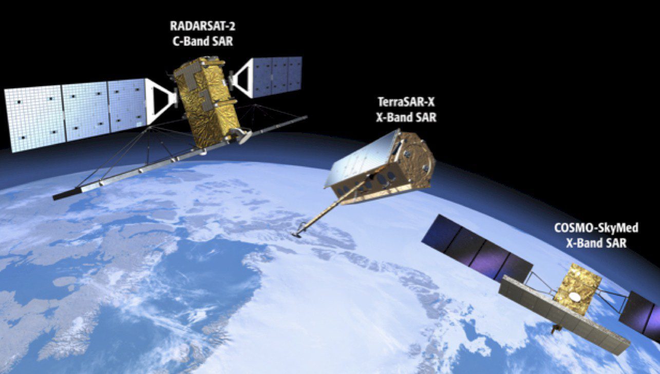
Unlocking Radar's Full Potential
More individuals and organizations are harnessing the power of radar mapping data. By Rob Mott, vice president of Geospatial Solutions, Intergraph Government Solutions (www.intergraphgovsolutions.com), Madison, Ala. Radar has become one of the most versatile remote...

How to Interpret a False-Color Satellite Image
How can a forest be red and a cloud blue? It depends on the processes used to transform satellite measurements into images. In our photo-saturated world, it’s natural to think of the images on NASA’s Earth Observatory website as snapshots from space. But most...
