We are pleased to announce the release of the EARSC position paper around the development of a European Marketplace for EO services as a leverage for the exploitation of Copernicus data and services alongside commercial offerings. A European Marketplace for EO...
Pictometry Continues to Experience Rapid Growth in Government Sector
Bothell, Wash., February 9, 2016 — EagleView Technology Corporation, a leading technology provider of aerial imagery, data analytics and GIS solutions, announced that its wholly owned subsidiary, Pictometry International Corp., continues to be the provider of...
Orbital ATK to Feature Advanced Products and Capabilities at Singapore Airshow 2016
DULLES, Va. —Orbital ATK, Inc. (NYSE: OA), a global leader in aerospace and defense technologies, will exhibit a wide range of the company’s products and advanced capabilities during the Singapore Airshow 2016. The biennial airshow takes place at the Changi...
Aerojet Rocketdyne Continues New Year with Placement of Navigation Satellite into Orbit for U.S. Military
SACRAMENTO, Calif., Feb. 9, 2016 — Aerojet Rocketdyne, a subsidiary of Aerojet Rocketdyne Holdings, Inc. (NYSE:AJRD), continues the New Year with the successful placement of the last in a block of 12 Global Positioning Systems (GPS IIF) navigation satellites into...
Intermap Executes US$175 Million Orion Platform Spatial Data Infrastructure Contract
DENVER, CO, Feb. 9, 2016 — Intermap Technologies Corporation ("Intermap" or the "Company"), (TSX: IMP), (ITMSF: BB), a leading provider of geospatial solutions, today announced that it has entered into definitive agreements (collectively, the "Contract"),...
HP DesignJet Printing Technology Helps New Jersey Search and Rescue Save Lives
New Jersey Search and Rescue (NJSAR), a team of more than 50 highly trained volunteers who conduct an average of 25 missing-person searches per year, installed an HP DesignJet T2500 Multifunction Printer (MFP) to produce large-format maps to aid in search-and-rescue...
2016 URISA Vanguard Cabinet Announced
Des Plaines, IL, February 9, 2016 — URISA is pleased to announce the 2016 members of its Vanguard Cabinet. The Vanguard Cabinet (VC) is a URISA initiative (which debuted in 2011) to engage young GIS practitioners, increase their numbers in the organization, and...
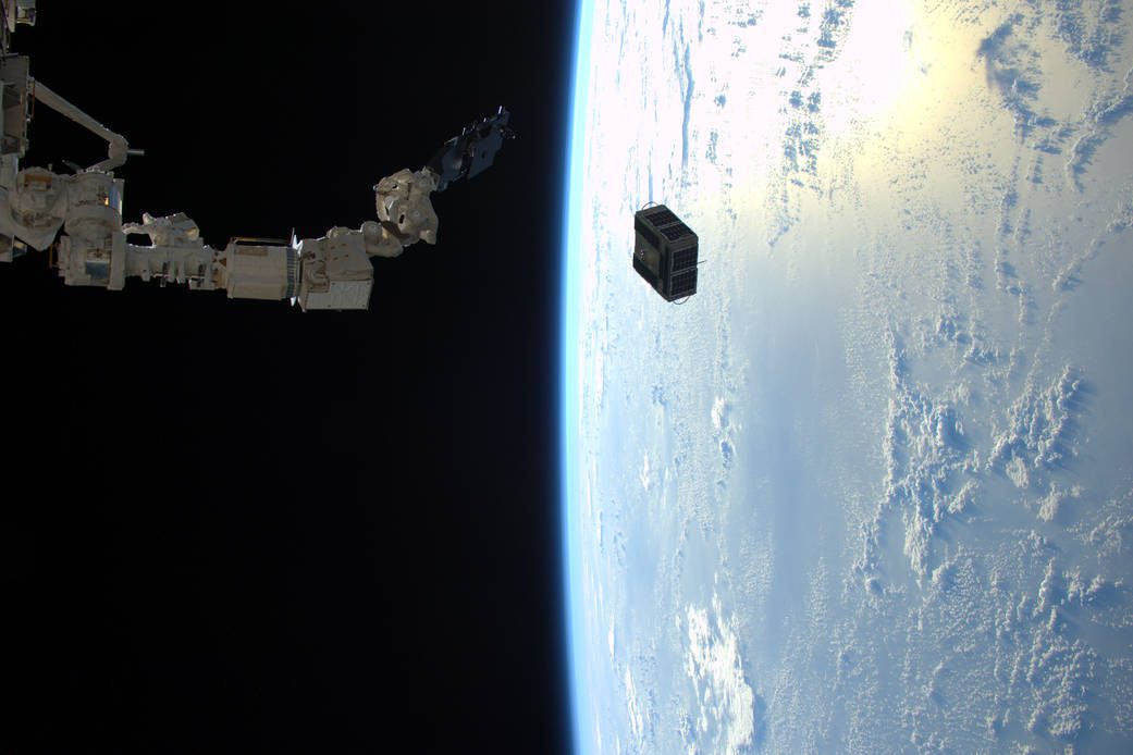
Space Station Deploys Student-Built Satellites
On Feb. 2, 2016, a robotic arm aboard the International Space Station deployed a pair of satellites built by students at Texas A&M University and the University of Texas.
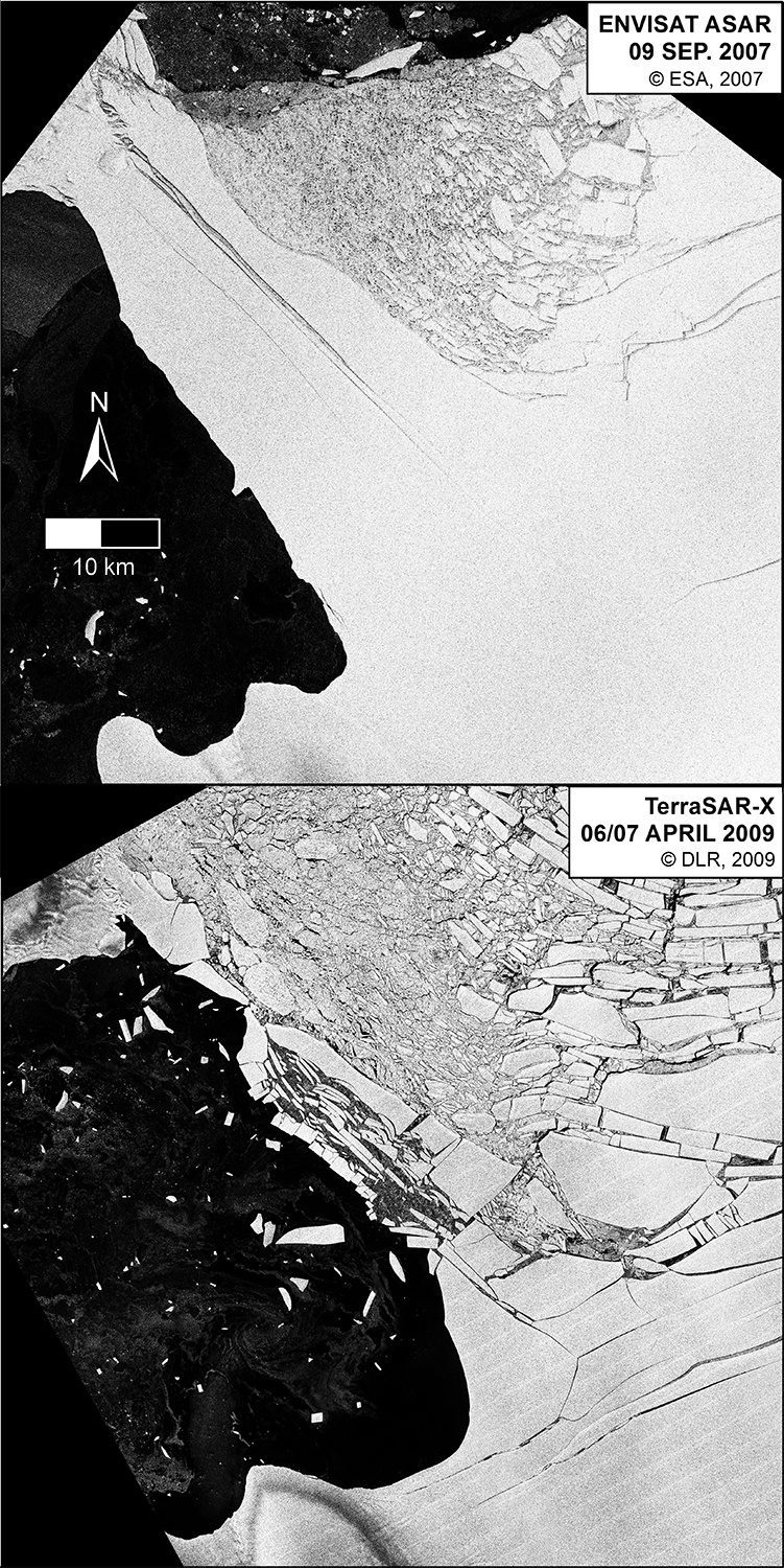
Antarctica Losing Ice ˜Safety Band'
According to a report recently published in Nature Climate Change, satellite data is helping to reveal that there's a critical point where Antarctica's huge ice shelves act as a safety band, holding back the ice that flows to the sea.
ExpoDronica 2016 Brings for the First Time in the World Land, Sea and Air Drones
ExpoDronica 2016 Brings for the First Time in the World Land, Sea and Air Drones - The drone industry has taken off in 2015 and it expects to have an exponential growth throughout 2016, which will allow to develop new applications and a greater choice of solutions. -...
