Despite the hype created by smallsat LEO constellations, the traditional market is expected to remain the dominant source of revenue globally for building and launching satellites.
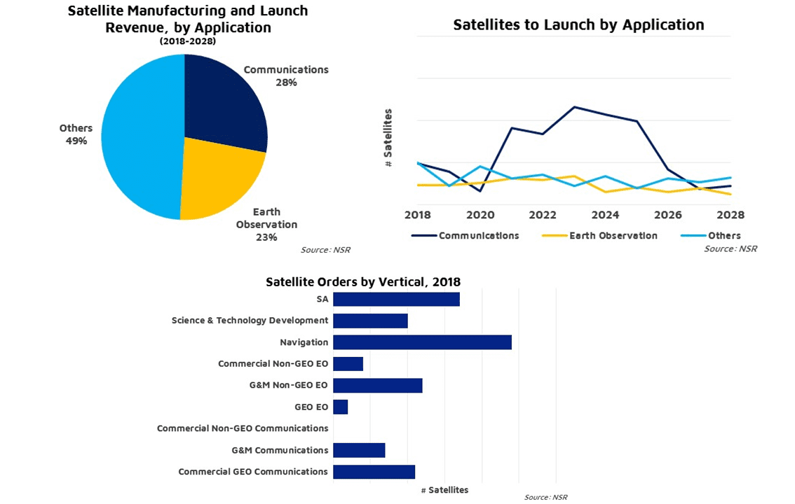
Despite the hype created by smallsat LEO constellations, the traditional market is expected to remain the dominant source of revenue globally for building and launching satellites.
The Space Report contains worldwide space facts and figures, and is illustrated with photographs, charts, and graphs detailing the benefits of space exploration and utilization, the challenges facing the space sector, opportunities for future growth, and the major factors shaping the industry.
On July 2, 2019, skywatchers in the beach city of La Serena, Chile, looked up at 4:38 p.m. local time to see a black circle in the sky.
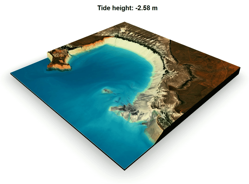
Thanks to the Moon, the Sun and gravity, the place where the land meets the sea is not a fixed line. What we see on a map is just a representation of where mean sea level is found, and the coast of any landmass is really a moving target between low and high tides.

NSR's Big Data Analytics via Satellite report finds continued growth for downstream Big Data applications through the next decade, driven by applications built on Earth Observation and M2M/IoT satcom data across multiple market verticals.
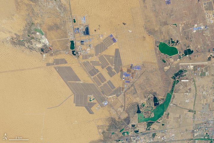
The largest solar park in the world now, seen in this Landsat 8 image collected in April 2019, stands in China's northwestern Ningxia province.
The E-TBEx CubeSats focus on how radio signals that pass through Earth’s upper atmosphere can be distorted by structured bubbles in this region, called the ionosphere.

Smoke from several large wildfires in Canada was so thick and widespread that it was easily visible from 1.5 million kilometers (1 million miles) away from Earth.
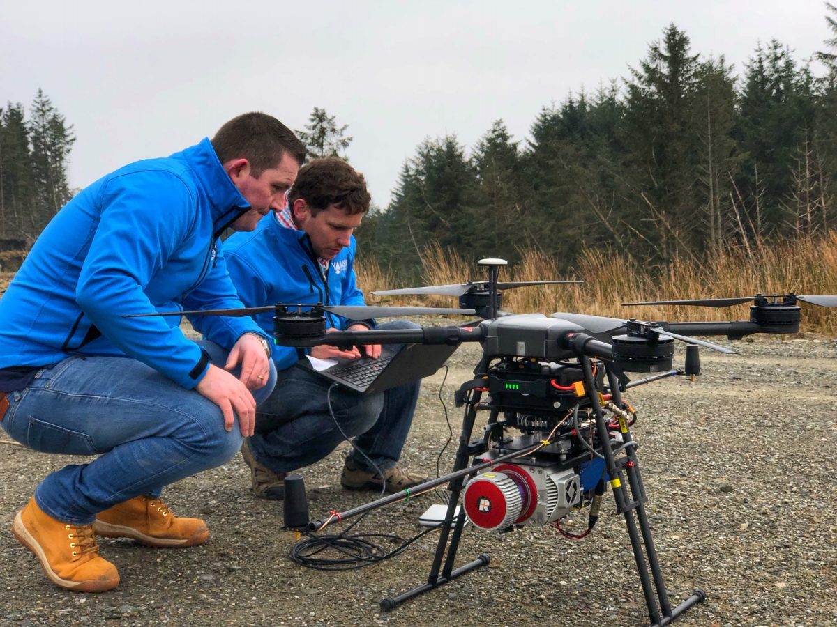
Soaring over Scotland's majestic landscape and beautiful forests, drones are helping to map the species growing under the upper canopy of the trees thanks to advanced laser technology.
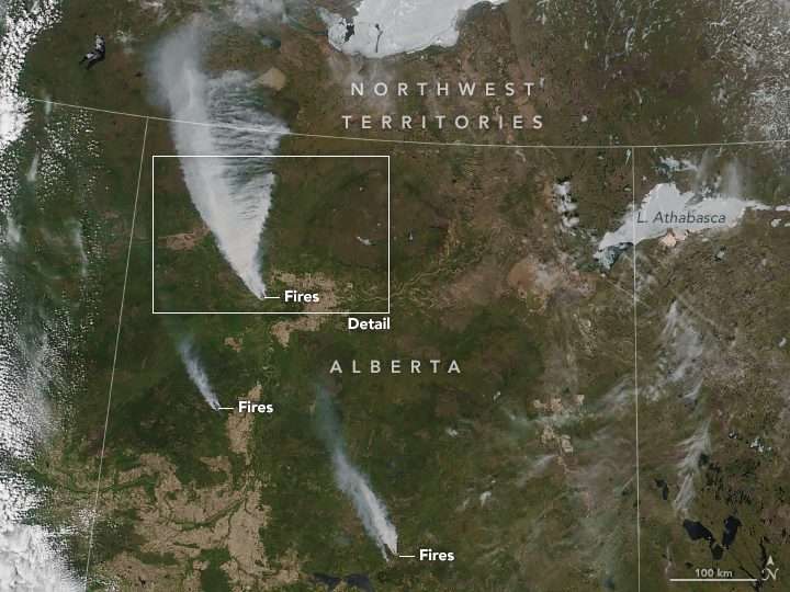
Some residents of High Level, Alberta, Canada, were told on May 20, 2019, to evacuate in the face of a large and out-of-control wildfire that has started advancing toward the town.
