NASA's Advanced Spaceborne Thermal Emission and Reflection Radiometer (ASTER) instrument aboard the Terra satellite imaged some of the burned area on June 29, 2020.
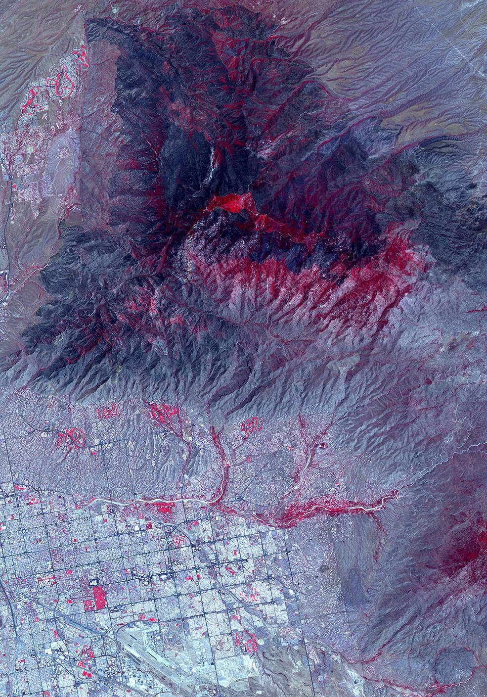
NASA's Advanced Spaceborne Thermal Emission and Reflection Radiometer (ASTER) instrument aboard the Terra satellite imaged some of the burned area on June 29, 2020.
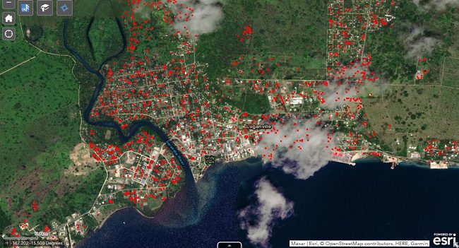
Powerful satellite technology can help Caribbean countries better manage natural disasters and boost climate resilience, as the region braces for a busy hurricane season in 2020.
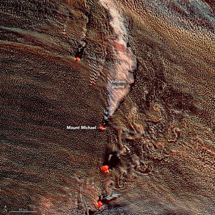
For two weeks in mid-May, NASA satellites observed volcano tracks nearly every day.
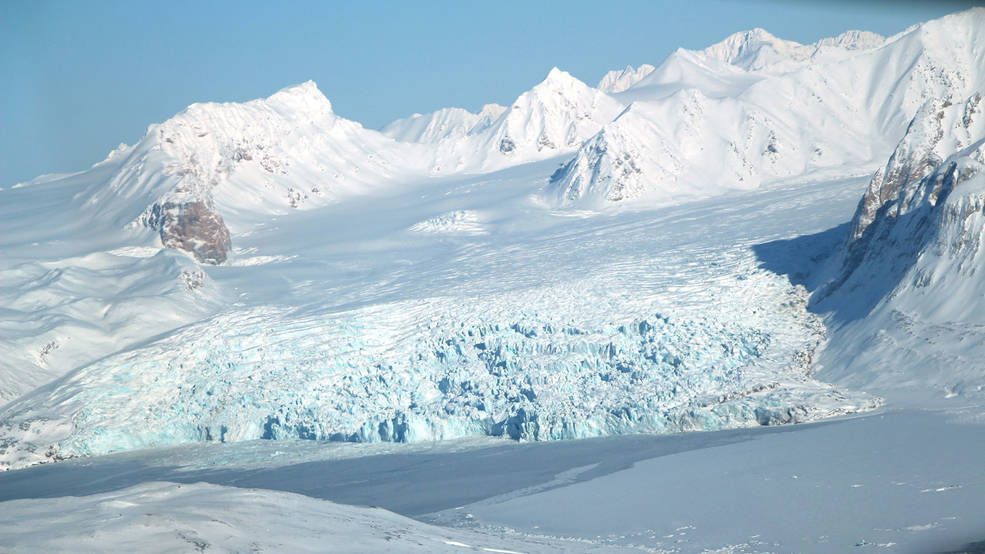
Seven of the regions that dominate global ice-mass losses are melting at an accelerated rate, a new study shows, and the quickened melt rate is depleting freshwater resources that millions of people depend on.
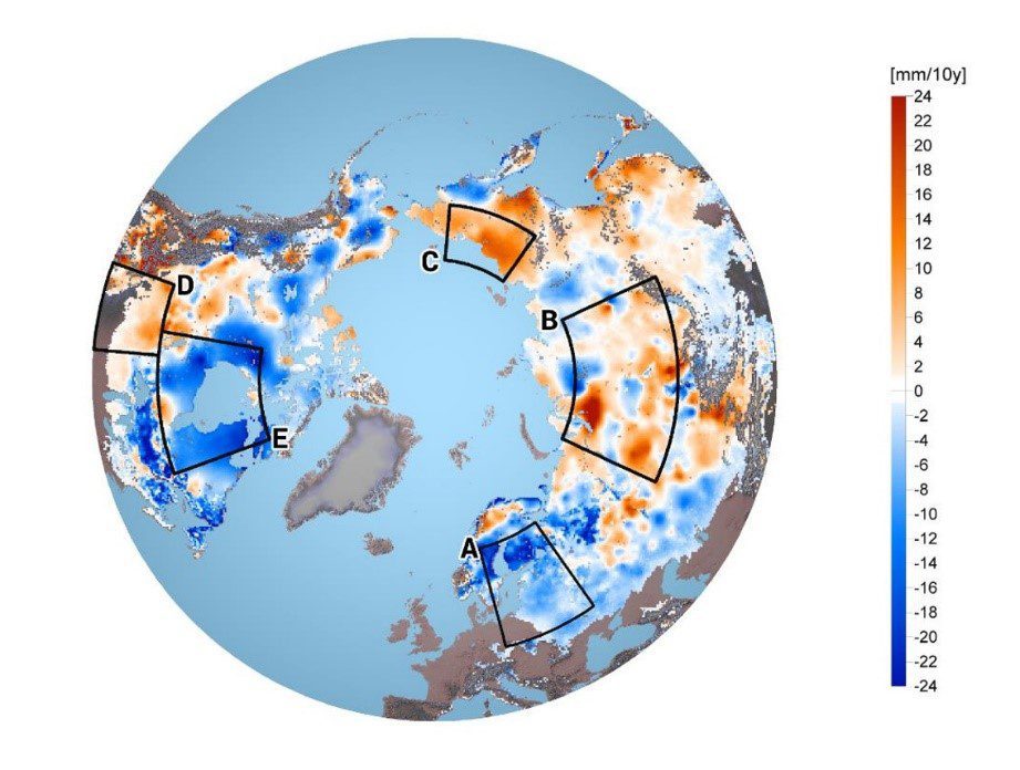
Warming surface temperatures are known to have driven substantial reductions in the extent and duration of northern hemisphere snow cover.
Scientists are using information from NASA's Earth-observing satellites, on-the-ground sensors and computer-based datasets to study the environmental, economic and societal impacts of the COVID-19 pandemic.
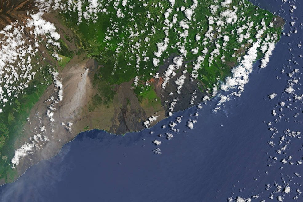
Volcanoes erupt when molten rock called magma rises to the surface, and many factors, from the shape of the volcano to the composition of the magma, factor into the timing of eruptions. In the case of KÄ«lauea, a new, NASA-funded study published April 22, 2020, in the journal Nature points to another eruption factor: prolonged, sometimes heavy rainfall in the months leading up to the event.
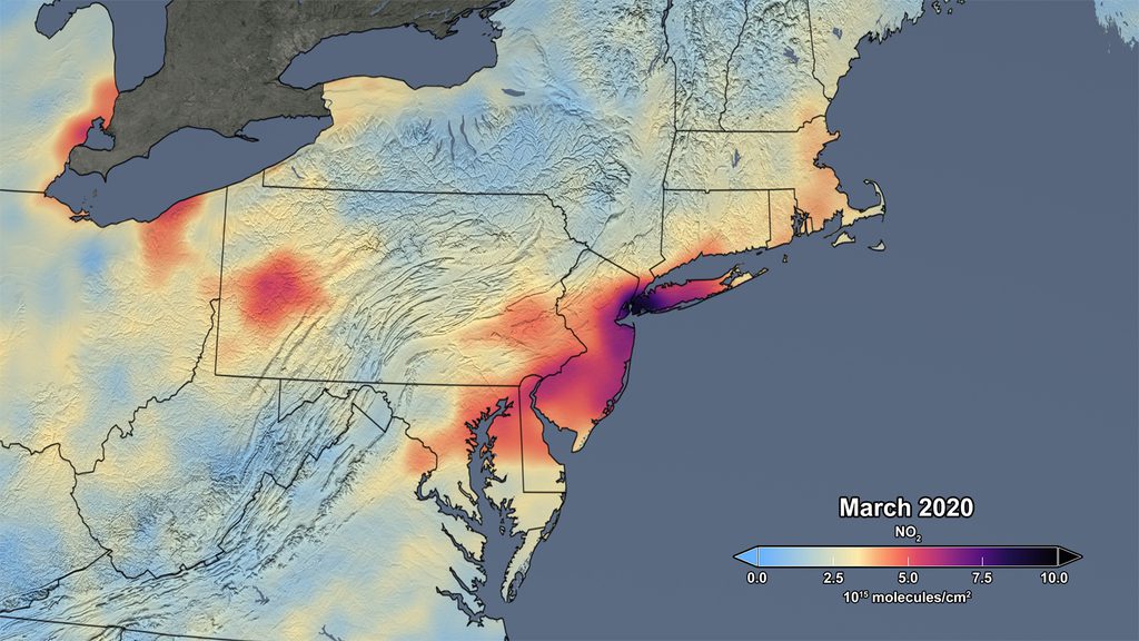
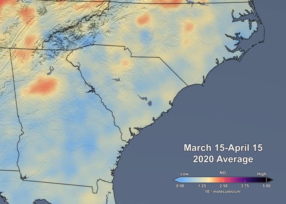
Over the last several weeks, NASA satellite measurements have revealed significant reductions in air pollution over the major metropolitan areas of the Northeast United States.
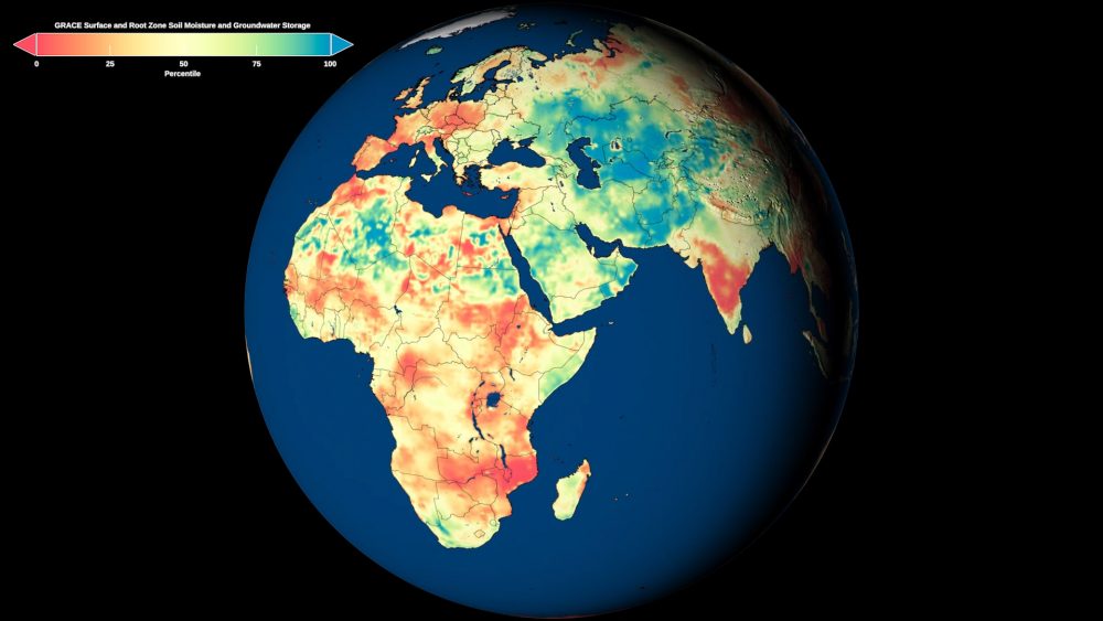
NASA researchers developed new satellite-based, weekly global maps of soil moisture and groundwater wetness conditions and one- to three-month U.S. forecasts of each product.
On Feb. 18, 2020, a new era began in an international effort to improve air-quality science and forecasting around the world to help reduce the impact of air pollution on human health and the environment.
