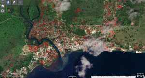
 Powerful satellite technology can help Caribbean countries better manage natural disasters and boost climate resilience, as the region braces for a busy hurricane season in 2020.
A virtual event co-organised by the Commonwealth Secretariat and the UN Institute for Training and Research (UNITAR) showed how remote sensing satellite technology was recently used to support Asian and Pacific countries in responding to super cyclones Amphan and Harold.
These cutting-edge tools, provided by the UNITAR Operational Satellite Applications programme (UNOSAT), are even more vital as the Caribbean grapples with multiple threats linked to both climate disasters and the COVID-19 pandemic. Experts predict up to 10 hurricanes in the Atlantic by the end of the year.

