Unmanned Aircraft System (UAS) manufacturer senseFly was the first to bring RTK survey-grade mapping to a UAS platform with its fixed-wing senseFly eBee RTK in June 2014. This platform is capable of three-centimeter accuracy without the need for ground-control points,...
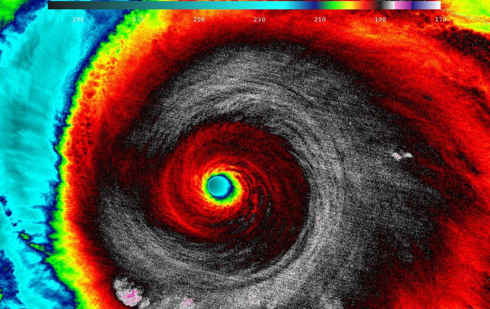
NASA Satellites Track Historic Hurricane Patricia
Hurricane Patricia made landfall on Oct. 24, 2015, along the southwestern coast of Mexico. NASA's Aqua satellite captured Patricia making landfall, while the Global Precipitation Measurement mission core satellite added up Patricia's high rain totals, which exceeded more than 409 millimeters (16.1 inches) over open waters.

Industry Overview: Pursuing Three Pillars of Practice
The Earth-observation (EO) market enjoys a strong diversity of civil and commercial applications. And use cases will continue to increase, as the capacity for satellite-based observations is projected to explode this coming decade, with the launch of 80 percent more...

Interview: Earth-Imagery Automation Via Flexible API
Earth Imaging Journal's Editorial Director Matt Ball spoke with Bronwyn Agrios, co-founder of Astro Digital, about the company's creation of an online image-processing and distribution platform to send real-time alerts when satellite imagery is collected across an area to be monitored.
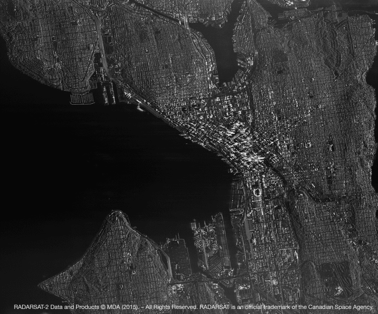
Intriguing Images of 2015
Earth imagery's unparalleled insights and transparency are elevating our understanding of today's interconnected world. The following graphics highlight a few of the many ways Earth observation chronicled some of 2015's noteworthy events and interesting phenomena.
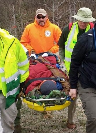
SAR Professionals Require Data Analysis on the Fly
As with any first responders, getting relevant data about the situation is important, but understanding what the data mean is something completely different. Data analysis comes down to two things: speed and meaning.

Transparency Is Challenging the Status Quo
More industry and academia collaboration, easier points of entry for a wider audience to interact in the agency's tradecraft and business practices, and initiatives creating a larger public conversation ” all signs welcoming outsiders to a state of greater transparency at NGA.
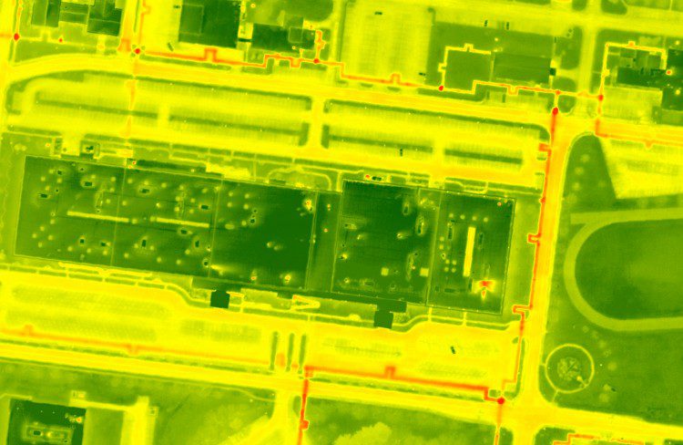
Thermal Imagery Adds Monitoring Options
As traditional imagery becomes more of a commodity in the mapping industry, professionals are exploring new ways to utilize different sensors in a geospatial context. Thermal imagery is a promising technology that can benefit a variety of applications, although it remains underutilized in large-scale geographic acquisitions.
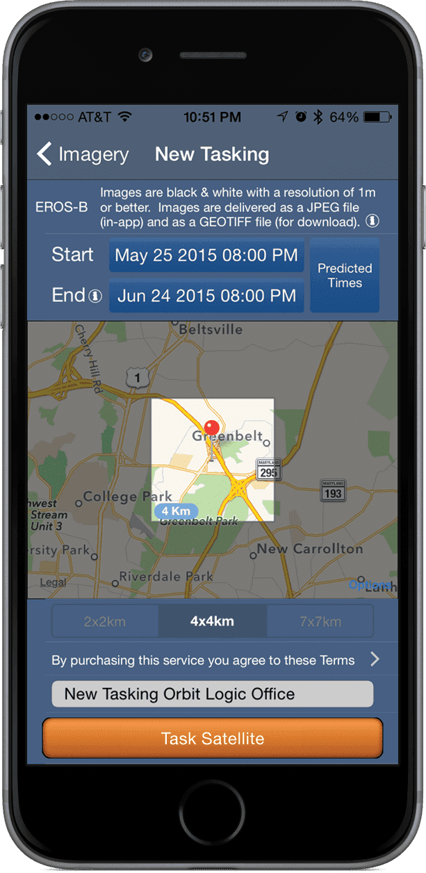
A Pivot Point for Space Accessibility
Space often is viewed as a high-tech futuristic dream available only to the world’s top-notch scientists. Online satellite maps, TV and GPS have snuck into common usage, but with the controlling powers being large companies or institutions. But we’re now at a...
Learn the Ground Rules: InSAR Enables Proactive Urban Infrastructure Monitoring
Multi-temporal Interferometric Synthetic Aperture Radar (InSAR) is a complementary technology that makes traditional monitoring more efficient. It can help monitor large areas and deliver the critical information that urban planners and engineers need to understand the state of urban infrastructure such as buildings, bridges, roads, airports and underground tunnels.
