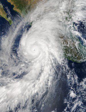
Hurricane Patricia made landfall on Oct. 24, 2015, along the southwestern coast of Mexico. NASA's Aqua satellite captured Patricia making landfall, while the Global Precipitation Measurement mission core satellite added up Patricia's high rain totals, which exceeded more than 409 millimeters (16.1 inches) over open waters.
Hurricane Patricia made history when it became the strongest storm ever recorded in the Western Hemisphere, with maximum sustained winds reported at 200 mph by the National Hurricane Center, said Research Meteorologist Steve Lang.
Patricia’s estimated minimum central pressure of 880 millibars was also the lowest ever recorded in the Western Hemisphere. For comparison, Hurricane Katrina, the costliest storm in U.S. history, had a minimum central pressure of 902 millibars and peak sustained winds of 175 mph.
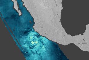
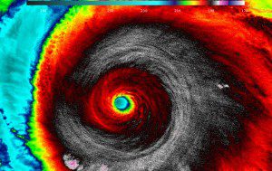
On Oct. 23, 2015, the Moderate Resolution Imaging Spectroradiometer on NASA's Terra satellite acquired the top image of Hurricane Patricia over the eastern Pacific Ocean. When this image was acquired, the hurricane was a category 5 storm with maximum sustained winds of 325 kilometers (200 miles) per hour. The middle image shows wind speed and direction near the ocean surface, as measured by the International Space Station-Rapid Scatterometer. And when NASA-NOAA's Suomi NPP satellite passed over Patricia on Oct. 23, its VIIRS instrument looked at the storm in infrared light, resulting in the bottom image. Cloud-top temperatures of thunderstorms around the eyewall were between 180-190 Kelvin (-135.7F/-93.1C to -117.7F/-83.1C). (Credit: Jeff Schmaltz, LANCE/EOSDIS Rapid Response; Joshua Stevens, using RapidScat data from JPL; UW/CIMSS/William Straka III)


