WASHINGTON, October 27, 2015  — A new report from the National Academies of Sciences, Engineering, and Medicine offers NASA a framework for prioritizing satellite observations and measurements of Earth based on their scientific value. NASA's Earth Science Division...
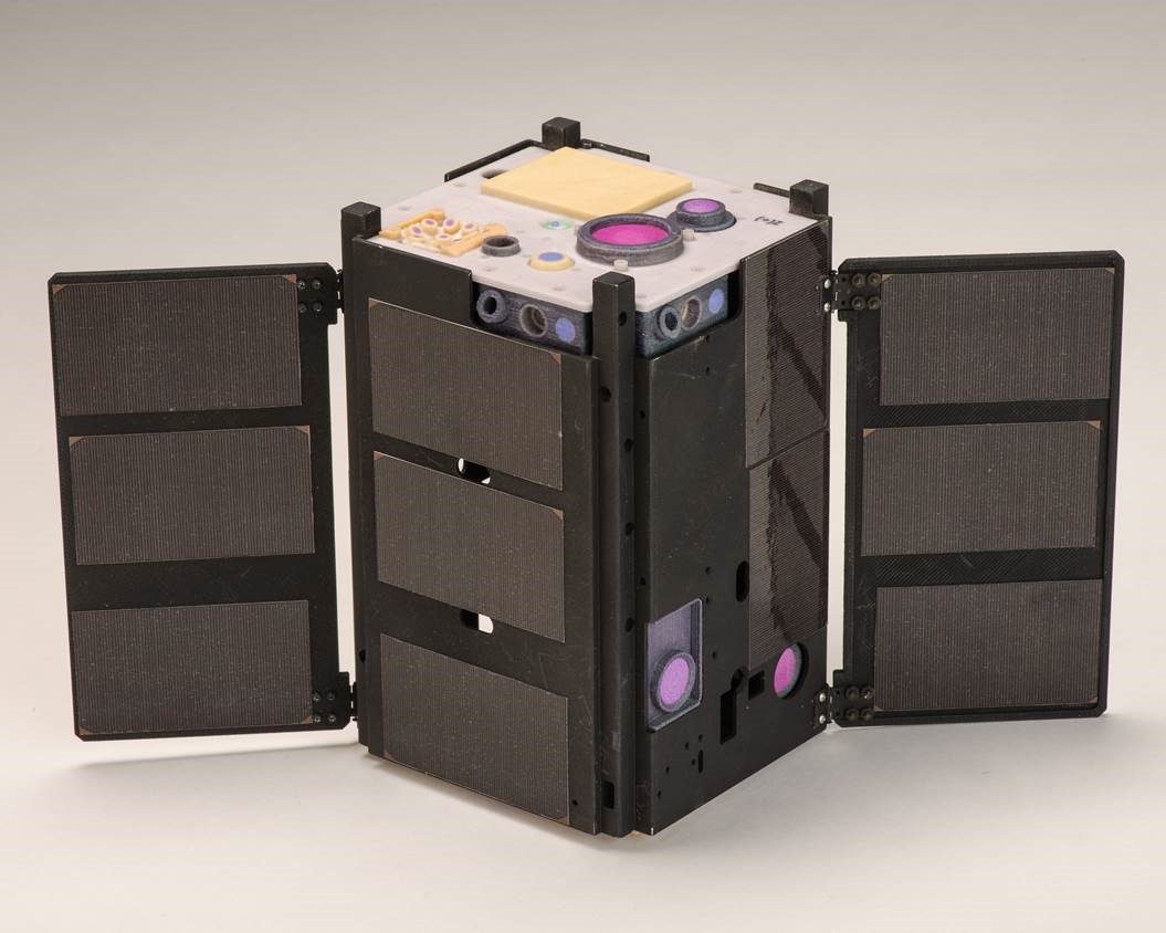
New NASA Cubesat Experiencing Problems
NASA and The Aerospace Corp. received confirmation that the Optical Communications and Sensor Demonstration (OCSD) CubeSat spacecraft is in orbit and operational, but it currently is experiencing a problem with its attitude control system.
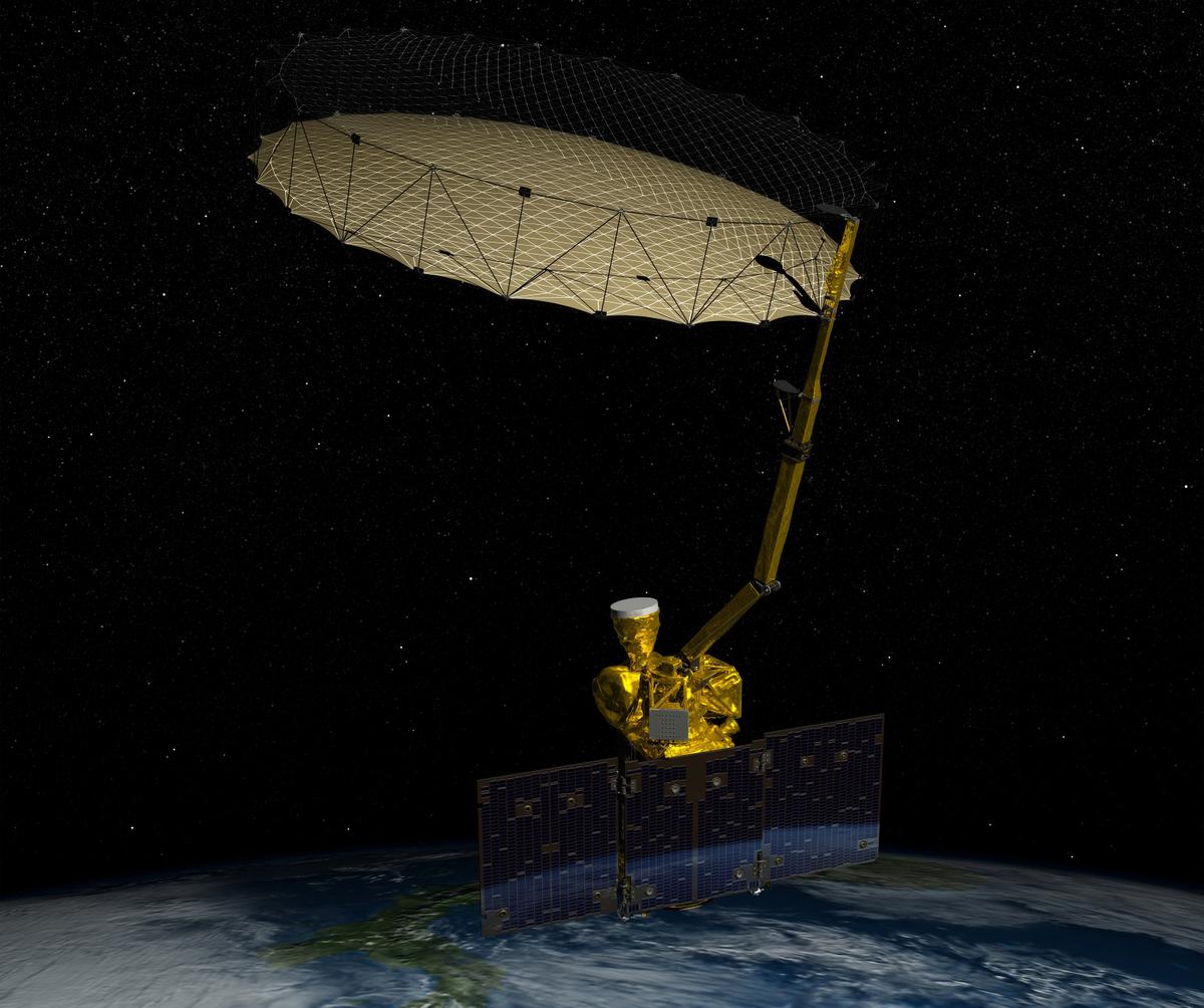
New Soil-Moisture-Mapping Satellite Carries on After Lost Instrument
A NASA satellite launched just seven months ago lost the use of one of two science instruments, but the space agency said the mission to map global soil moisture will continue.
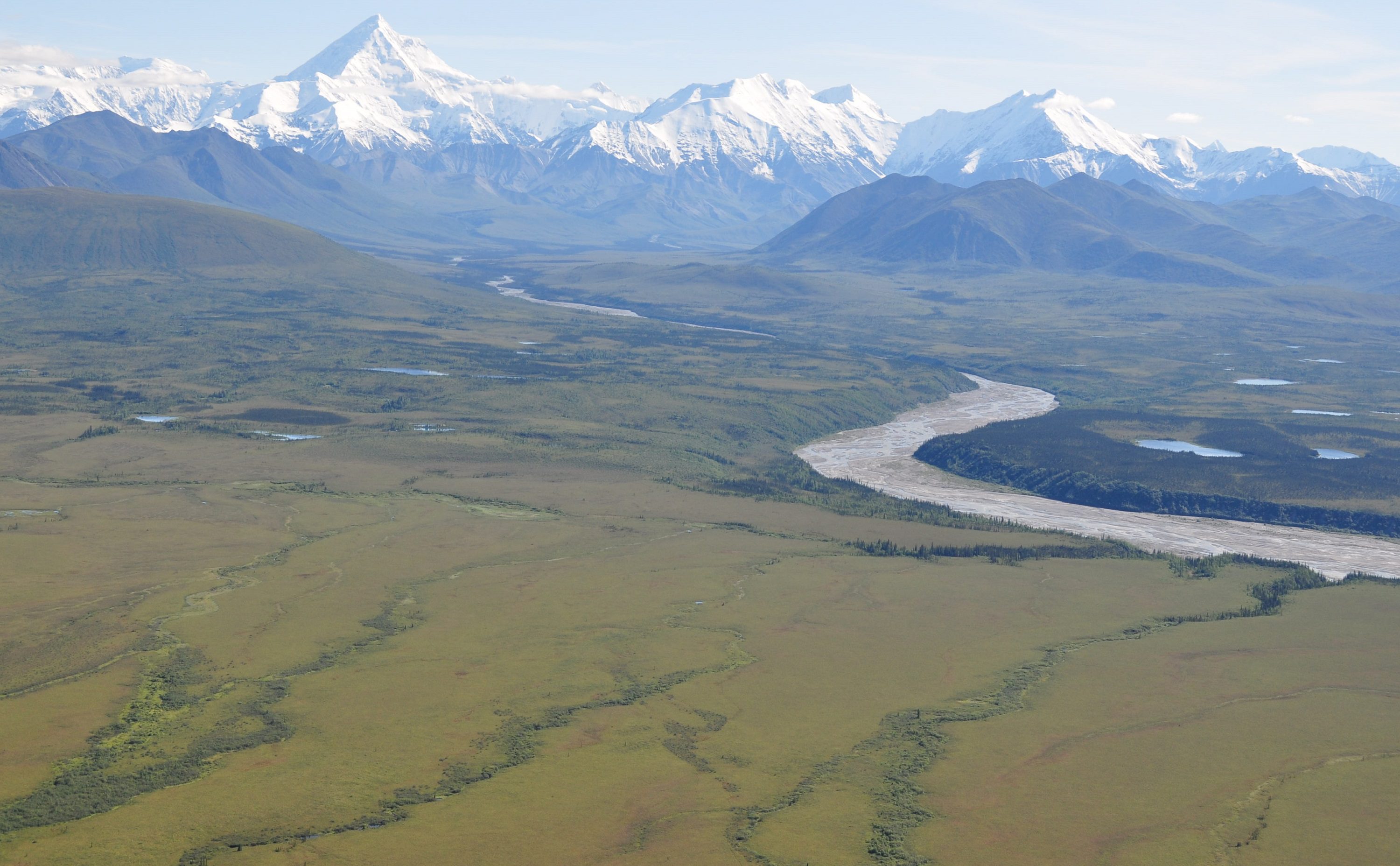
ABoVE Campaign to Examine Climate Change in Arctic
As part of a broad effort to study the environmental and societal effects of climate change, NASA has begun a multiyear field campaign to investigate ecological impacts of the rapidly changing climate in Alaska and northwestern Canada, such as the thawing of permafrost, wildfires and changes to wildlife habitats.
Sierra Nevada Corporation Congratulates NASA, NOAA and Lockheed Martin on Extraordinary EPIC Instrument Images
SPARKS, Nev., September 3, 2015 – Sierra Nevada Corporation's (SNC) Space Systems  congratulates NASA, NOAA and Lockheed Martin on successfully capturing the first-ever continuous images of the entire sunlit side of planet Earth. SNC is proud to have supplied...
Locata Positioning Will Underpin Future Unmanned Aerial System Research at NASA’s Famed Langley Research Center
CANBERRA, AUSTRALIA and LAS VEGAS, NV, September 2, 2015Â -Â Locata Corporation announced today that NASA plans to install a Locata network (LocataNet) as the core positioning technology for safety-critical Unmanned Aerial Systems (UAS) research at its world-renowned...
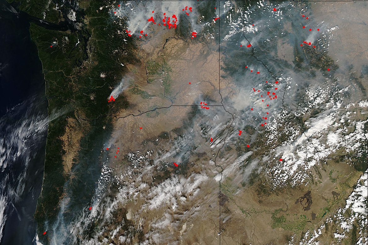
Pacific Northwest Wildfires Severe in Intensity
The Pacific Northwest is abundantly dotted with wildfires in Washington, Oregon, Idaho and Montana, and satellite imagery from a variety of sensors is being used extensively to monitor the situation.
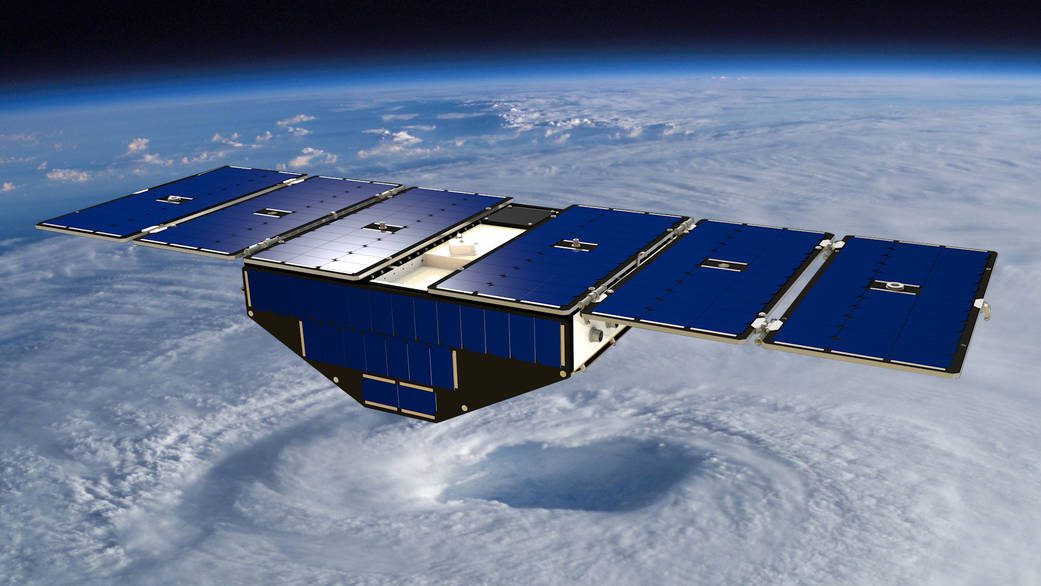
NASA Satellite Mission to Improve Hurricane Forecasting
Ten years after Hurricane Katrina formed in the Atlantic Ocean, construction of NASA's next-generation hurricane-observing satellite mission is underway. NASA's Cyclone Global Navigation Satellite System (CYGNSS), a constellation of eight microsatellites, will improve hurricane forecasting by measuring ocean surface winds in and near the eye wall of tropical cyclones, typhoons and hurricanes throughout their lifecycle.
UCI, NASA Researchers Find Link Between Amazon Fire Risk, Devastating Hurricanes
Irvine, Calif., August 20, 2015 — Researchers from the University of California, Irvine and NASA have uncovered a remarkably strong link between high wildfire risk in the Amazon basin and the devastating hurricanes that ravage North Atlantic shorelines. The climate...
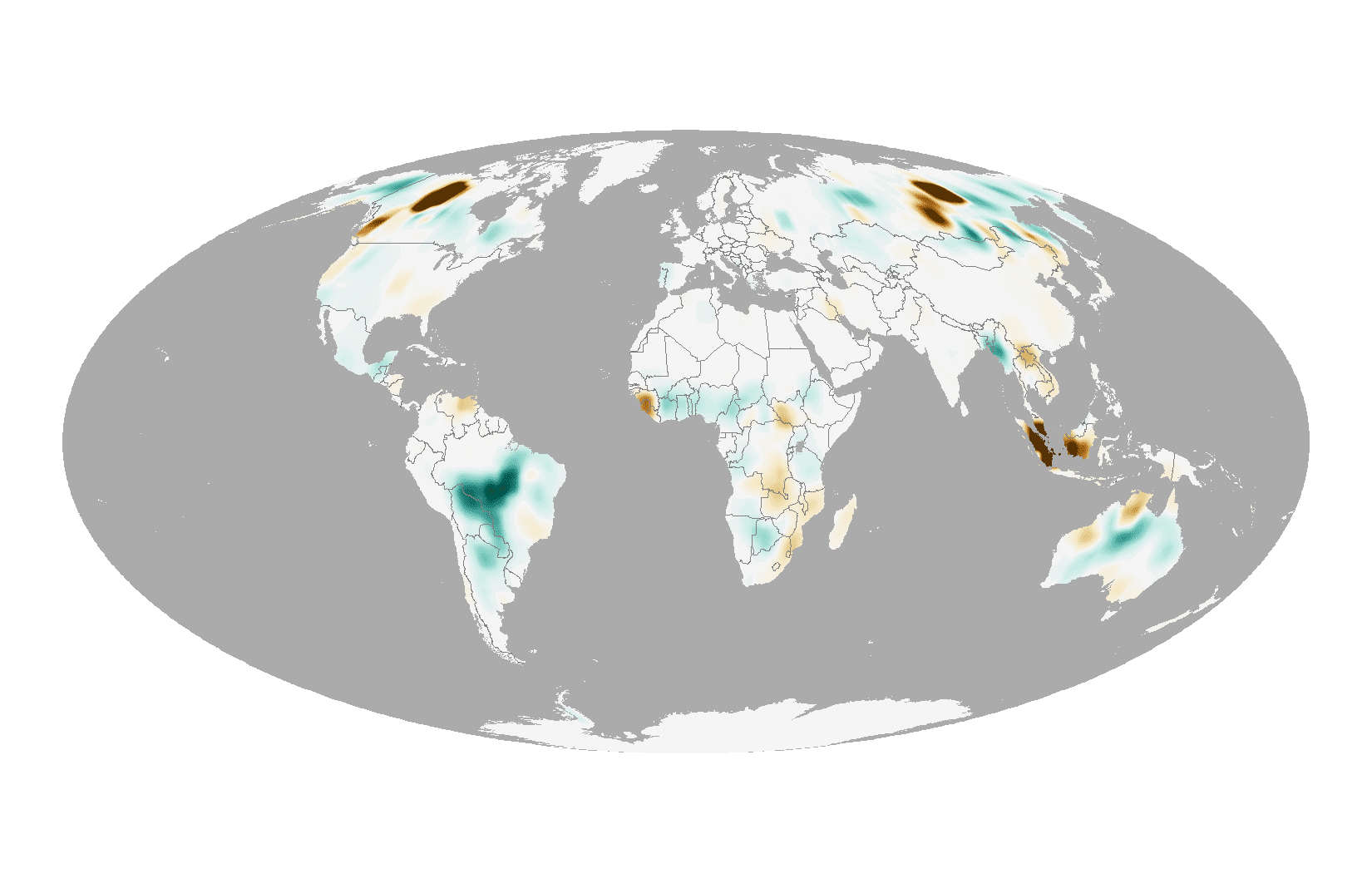
Taking Stock of 2014 Fire Emissions
On a typical day in August, the Moderate Resolution Imaging Spectroradiometers (MODIS) on NASA's Aqua and Terra satellites detect approximately 10,000 active fires, as well as huge swaths of freshly charred land in ecosystems ranging from boreal forests to savanna to tropical forests.
