August 27, 2015 — The Town of Snowmass Village, Colorado is a resort community with some of the best recreational opportunities in North America. Visitors come from all over the world to enjoy the world-class ski slopes, trails, and festivals. The Town of Snowmass...
Commercial UAV Expo Issues Report on UAVs and Construction
Portland, Maine, USA, August 27, 2015 — The organizers of Commercial UAV Expo today announced the release of their most recent report, titled “Progressive Construction Firms Mobilize to Put UAVs to Work.†This free report provides key insights into how UAV...
Bluesky Maps Solar Potential of 100,000 Properties
Leicestershire, UK, August 27, 2015 — Working with resource efficiency company Sustain, Bluesky has mapped around 100,000 Housing Association properties across the UK, measuring their potential for energy generation from solar panels. Using a combination of high...
New NordMap Web-Mapping Tool: Create and Compare Nordic Regions
August 26, 2015 — NordMap is a web-mapping tool for municipal and regional data that enables users to create customised maps. It is a new online version of the Nordregio map collection, focusing on demography, labour market and accessibility throughout the Nordic...
U.S. Intelligence Community Provides Innovation Exchange With Industry, Federal Civil Sector, Local Law Enforcement & First Responders Communities “ Call for Presentations
CLEVELAND, Ohio, August 26, 2015 — Global Marketing Insights Inc. today issued an invitation for Industry, Federal Civil, First Responders and Local Law Enforcement communities to participate in a Community Innovation Exchange with the U.S. Intelligence Community....

Digital Map of Alaska Seeing Progress
Alaska officials celebrated the progress of a long-standing mission to upgrade a dated and often-erroneous digital map of the state. The new map is being created with interferometric synthetic aperture radar (IfSAR) technology.
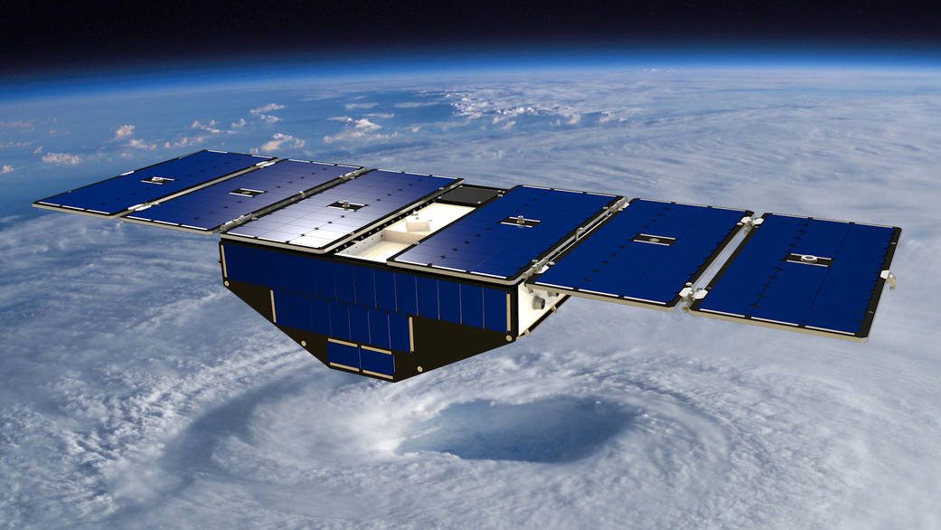
NASA Satellite Mission to Improve Hurricane Forecasting
Ten years after Hurricane Katrina formed in the Atlantic Ocean, construction of NASA's next-generation hurricane-observing satellite mission is underway. NASA's Cyclone Global Navigation Satellite System (CYGNSS), a constellation of eight microsatellites, will improve hurricane forecasting by measuring ocean surface winds in and near the eye wall of tropical cyclones, typhoons and hurricanes throughout their lifecycle.
Researchers Model Tsunami Hazards on Northwest Coast
Stretching offshore from northern California to British Columbia, the Cascadia subduction zone could slip at any time, causing a powerful earthquake and triggering a tsunami that would impact communities along the coast.
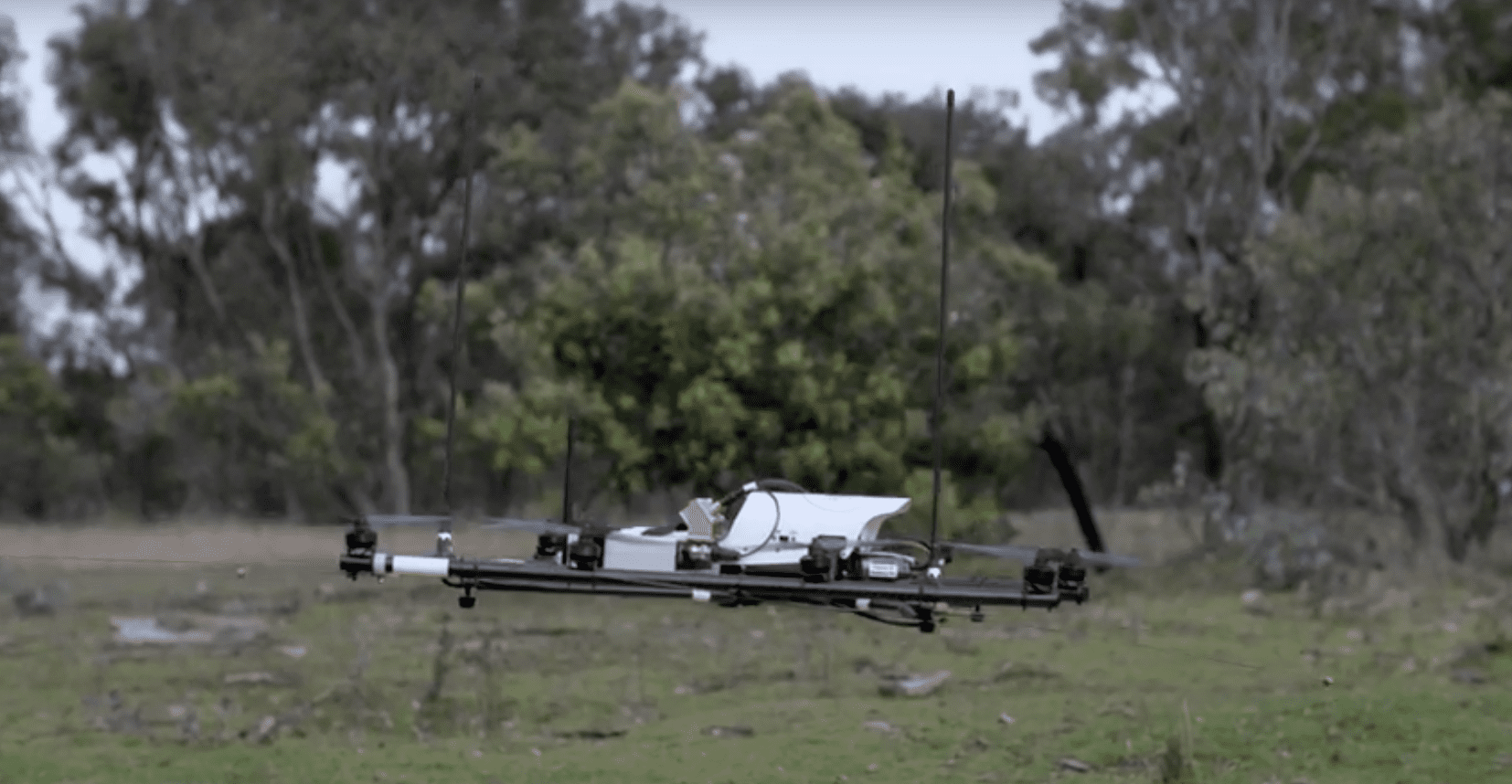
Drones Used to Track Wildlife
Researchers at The Australian National University and The University of Sydney developed a radio-tracking drone to locate radio-tagged wildlife.
GeoVisionary Used to Visualise Flood Risk by Cardiff University
August 25, 2015 — Cardiff University has been successfully using GeoVisionary within the MAREN2 project to accurately visualise large LIDAR data sets of water levels, coastal land forms and bathymetry, so stakeholders can assess the impact of proposed renewable...
