By combining nationwide airborne laser-scanning data and data on berries collected in connection with forest inventories, it's possible to make small-scale berry-yield predictions for an entire country.
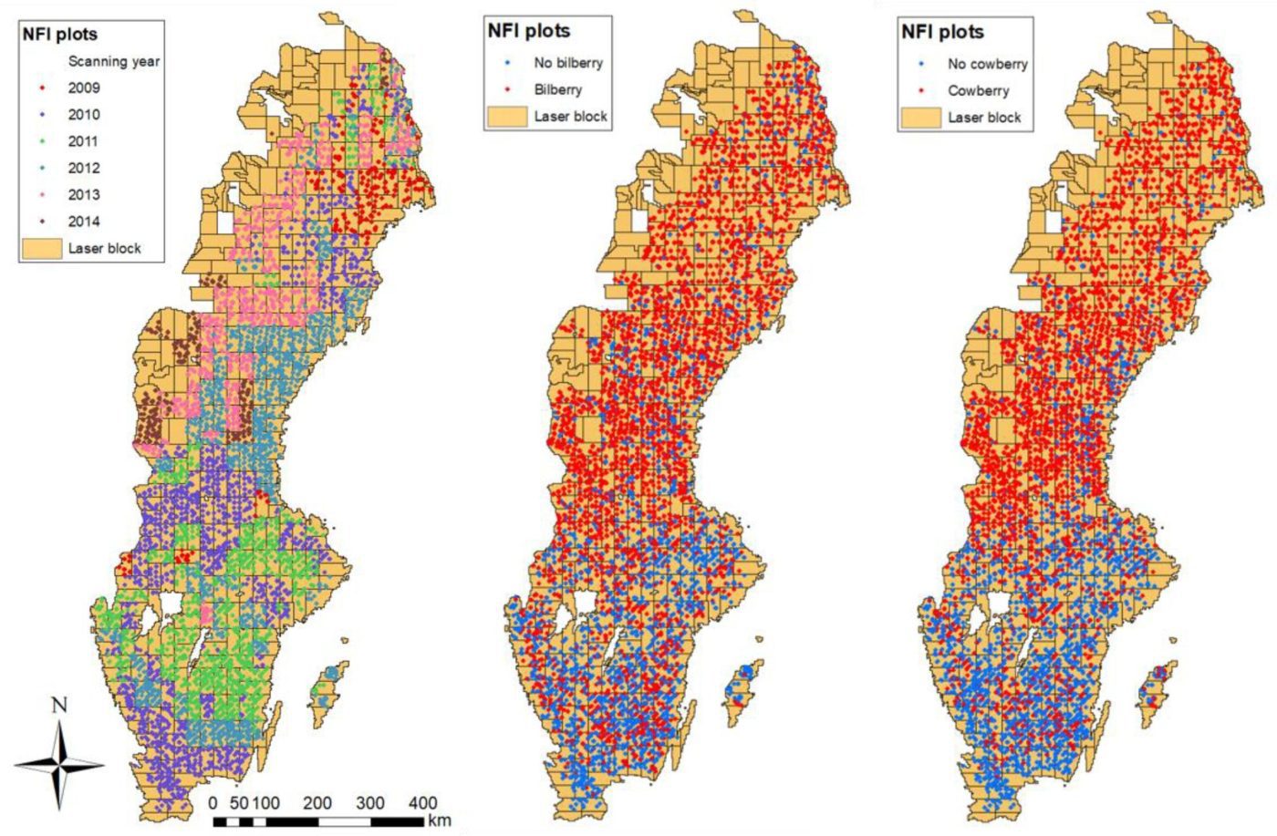
By combining nationwide airborne laser-scanning data and data on berries collected in connection with forest inventories, it's possible to make small-scale berry-yield predictions for an entire country.
Constructed in 1938, the refugee shelters were built to protect the local population from air strikes by the Italian Air Force and Franco forces.
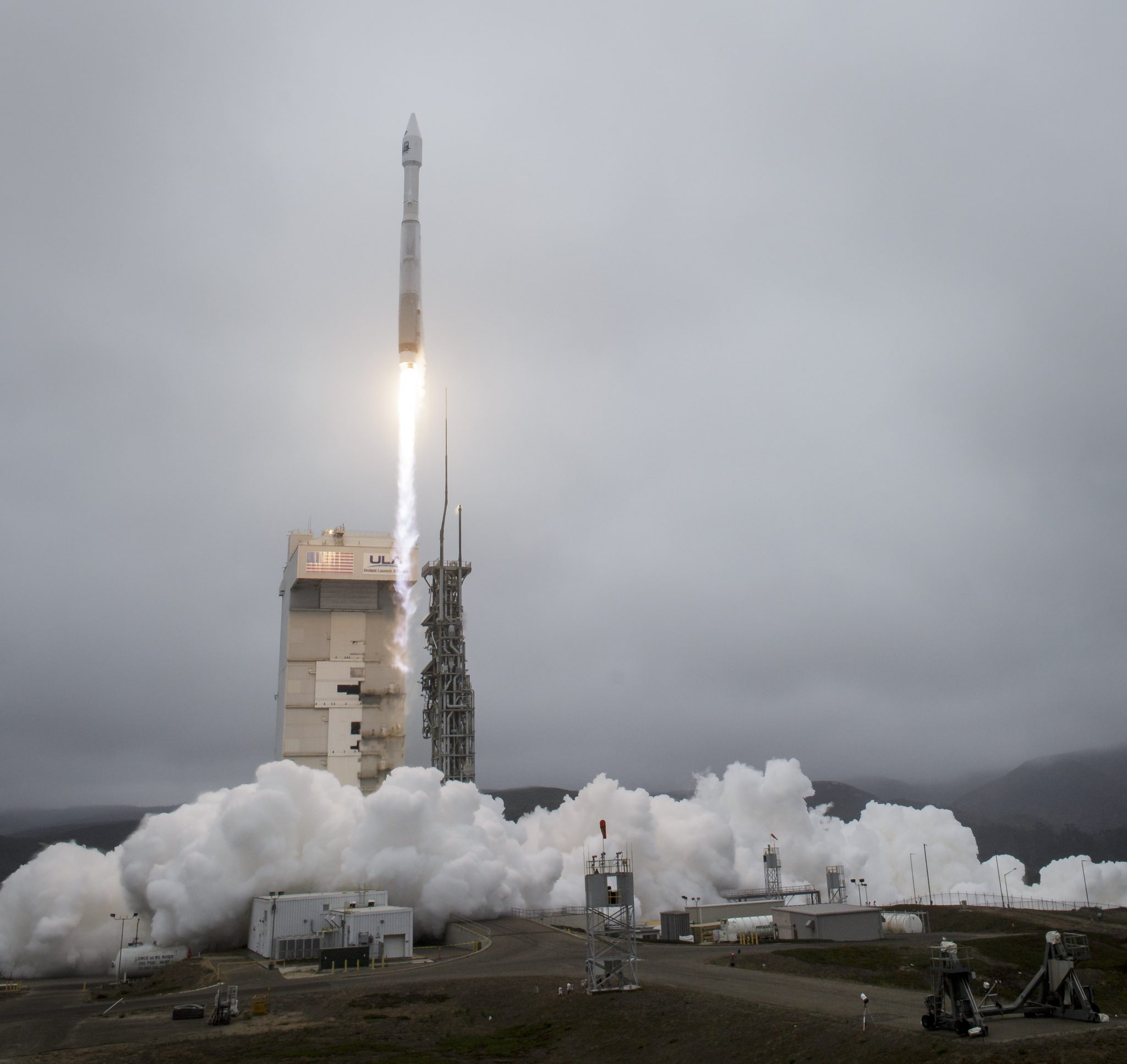
The United Launch Alliance (ULA) Atlas V rocket with the Landsat 9 satellite onboard launched on Monday, Sept. 27, 2021, from Space Launch Complex 3 at Vandenberg Space Force Base in California.
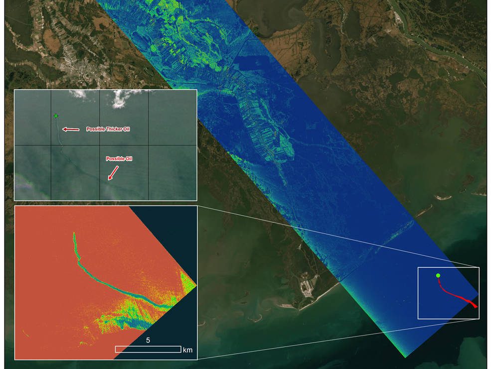
Oil tends to smooth out the bumps on the ocean's surface, which results in a distinct radar signal that the Delta-X mission was able to pick out of their data.
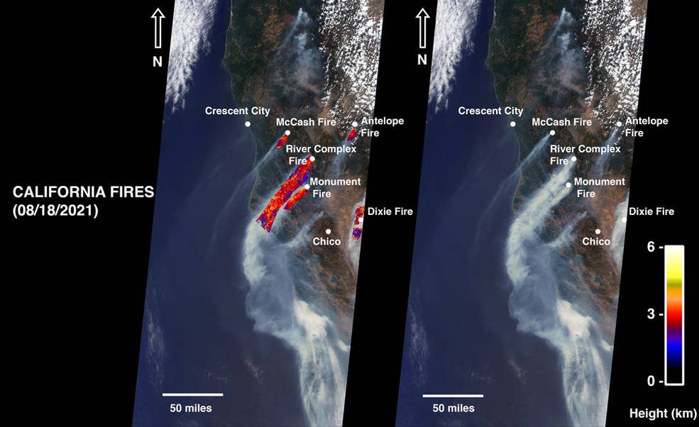
As of Aug. 24, 2021, wildfires in Northern California—including the McCash, Antelope, River Complex, Monument and Dixie fires—have scorched more than 1 million acres of land. The Dixie Fire, the state’s second-largest in history, accounts for 731,310 acres. On...
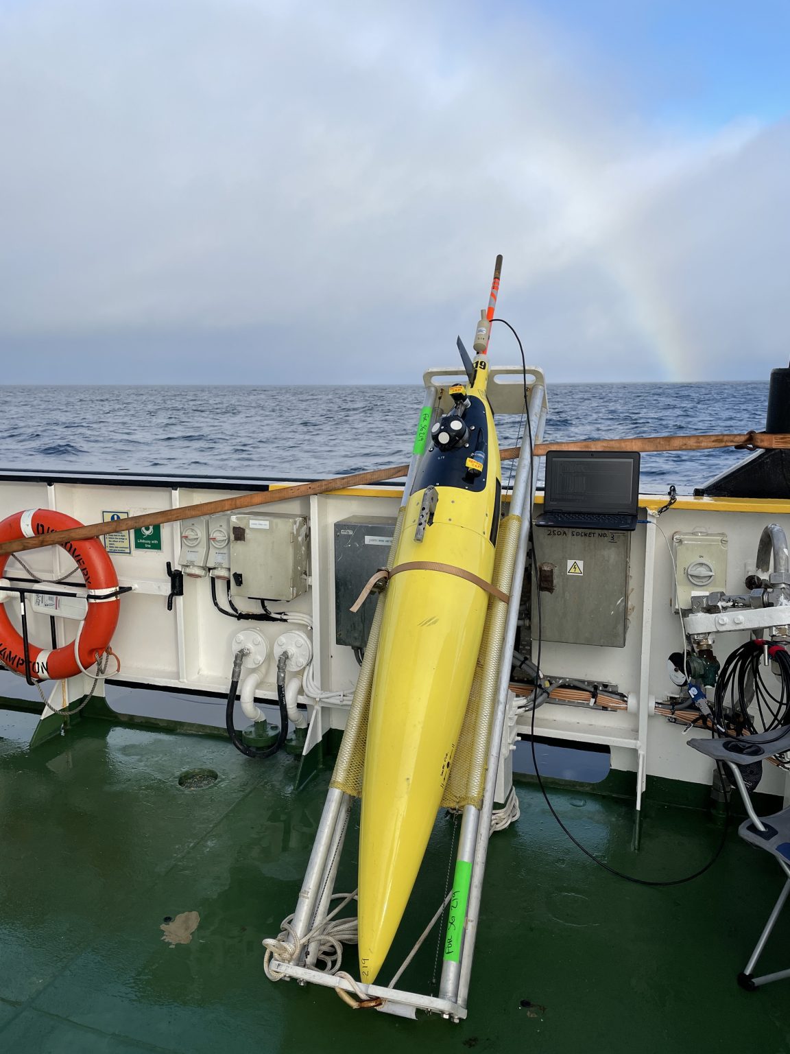
Satellites have undoubtedly opened up new ways for scientists to study the ocean, giving us global coverage of the surface of the ocean without ever having to step foot on a ship. But how can we learn what lies beneath the surface? The classic way oceanographers study...

Carried aboard the June 30, 2021, SpaceX Transporter 2 mission, the Cluster 3 formation-flying microsatellites join in orbit the HawkEye 360 Cluster 2 and Cluster 1 Pathfinder satellites.
Scientists are flying an airborne campaign out of NASA's Langley Research Center in Hampton, Va., to contribute to a joint U.S.-Canadian study on air quality in a region with high surface ozone levels.
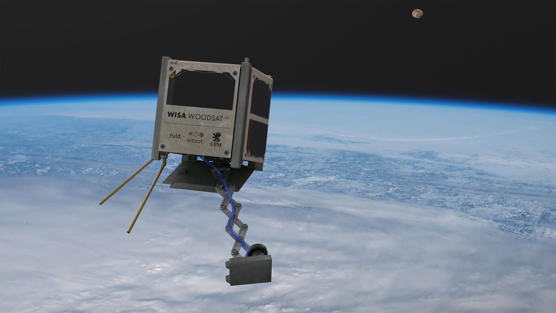
WISA Woodsat is a 10x10x10 centimeter CubeSat, a type of nanosatellite built up from standardised boxes, but with surface panels made from plywood.
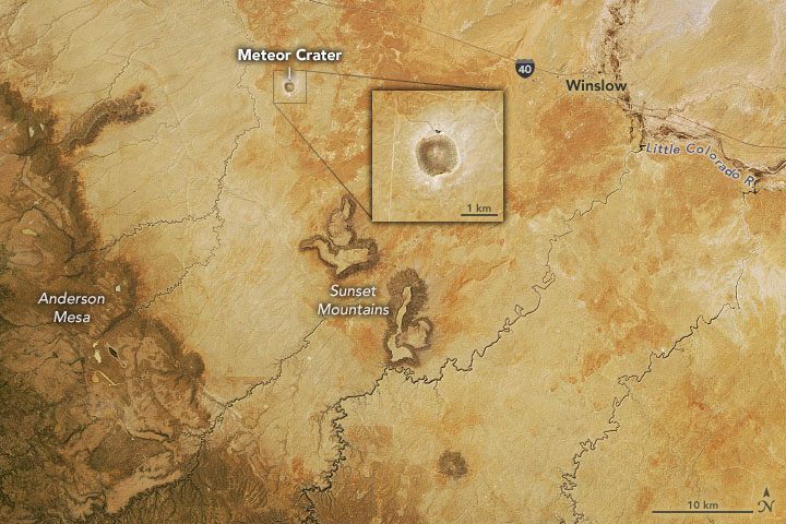
Meteor Crater (also called Barringer Meteor Crater) is located between Flagstaff and Winslow on the Colorado Plateau. The Operational Land Imager (OLI) on Landsat 8 acquired this image of the area on May 16, 2021.
