According to BI Intelligence, sales of drones will surpass $12 billion in 2021, and most of this will occur across the three main segments of the drone industry.

According to BI Intelligence, sales of drones will surpass $12 billion in 2021, and most of this will occur across the three main segments of the drone industry.
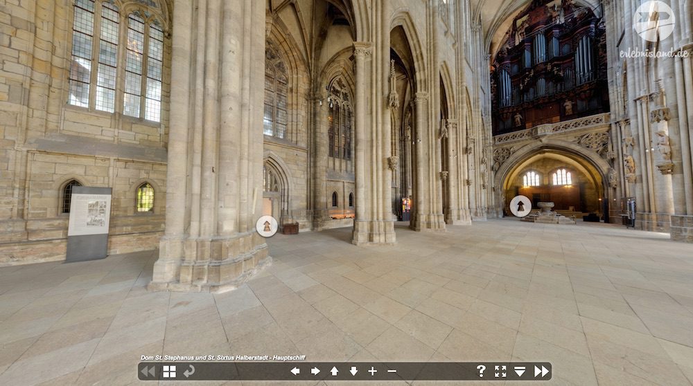
The 15th-century Halberstadt Cathedral in Saxony – Anhalt, Germany, is getting help from 21st-century technology.
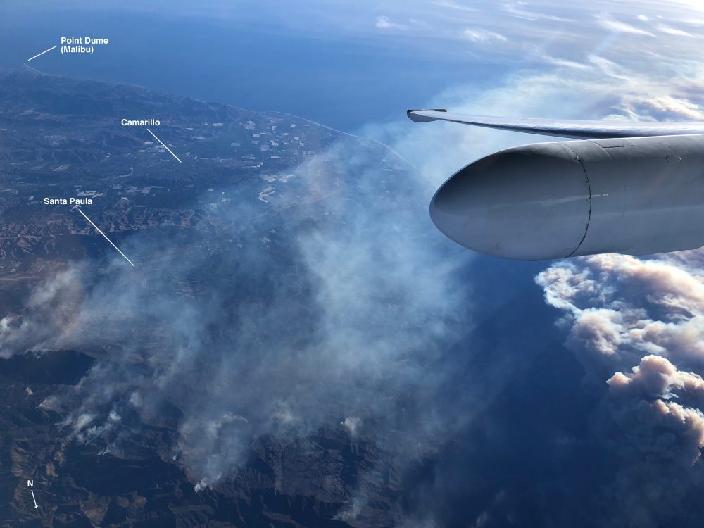
A team of NASA scientists is using a high-altitude aircraft and a sophisticated imaging spectrometer to study environmental impacts caused by the devastating Southern California wildfires.
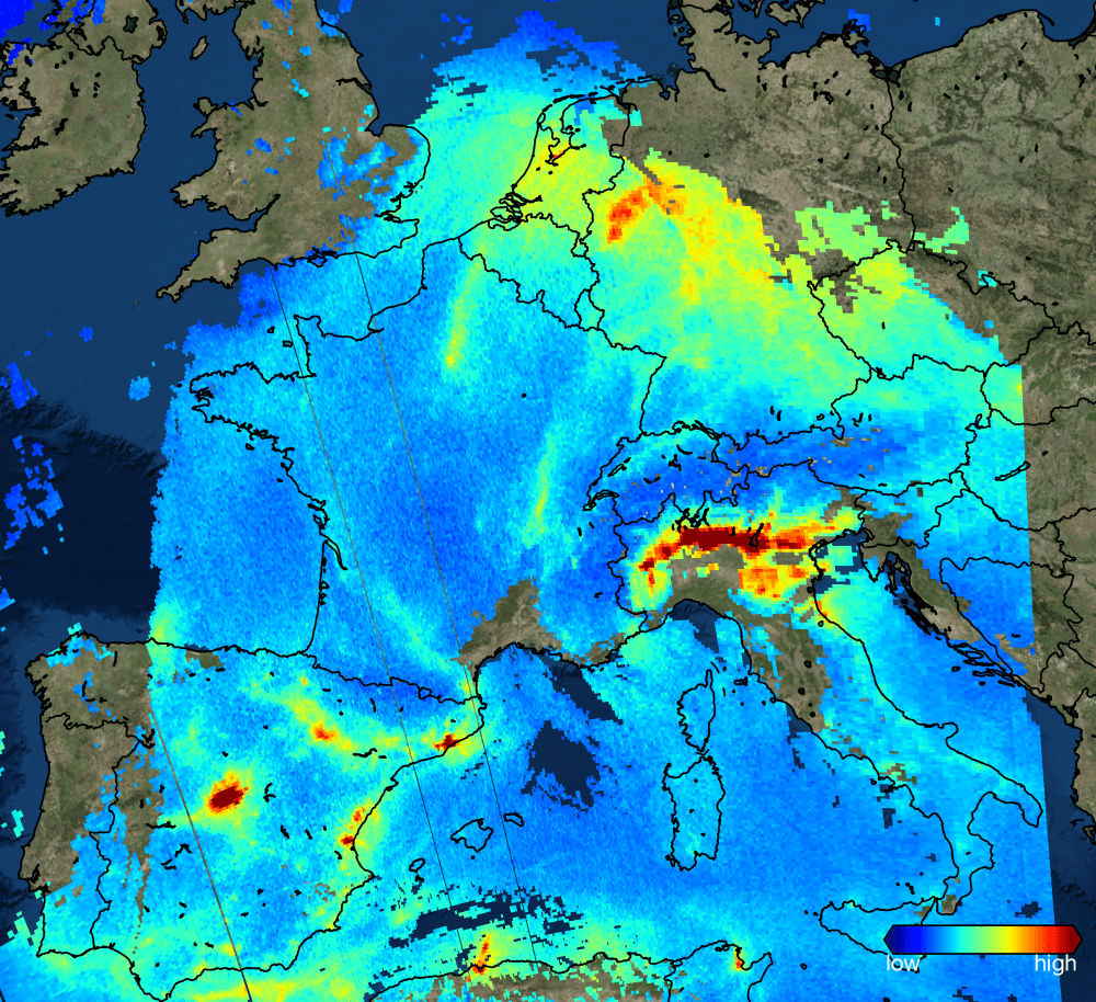
Launched on Oct. 13, 2017, the European Space Agency (ESA) Sentinel-5P satellite has delivered its first images of air pollution.
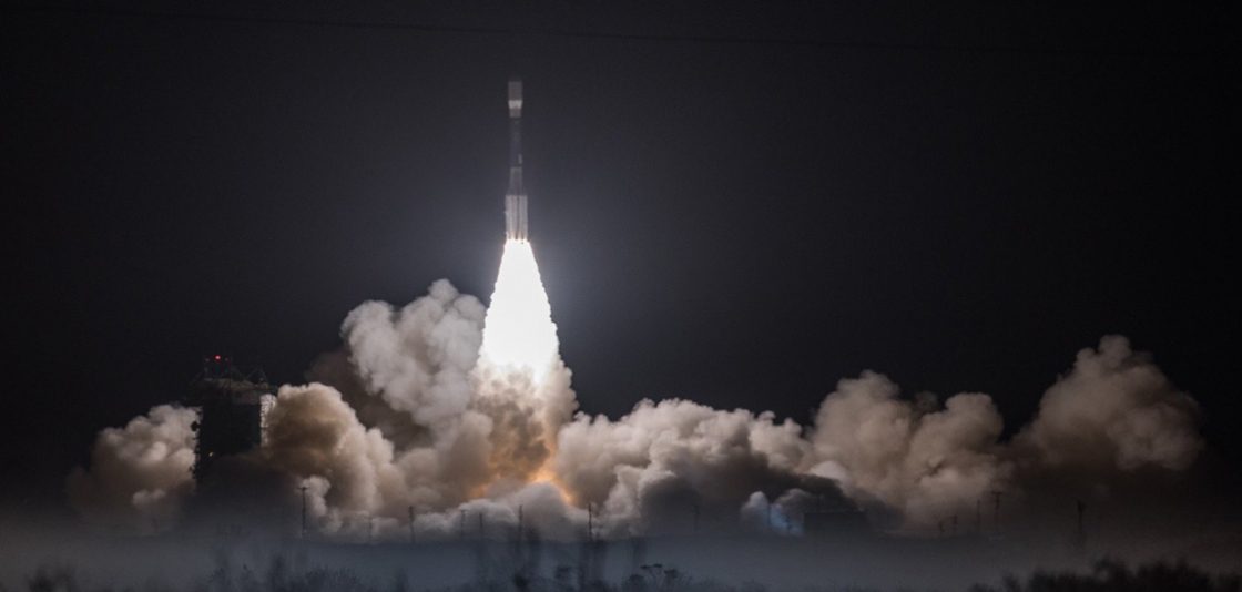
JPSS-1 will join the NOAA/NASA Suomi NPP satellite in the same polar orbit, also providing scientists with observations of atmospheric temperature and moisture, clouds, sea-surface temperature, ocean color, sea-ice cover, volcanic ash, and fire detection.
On Nov. 18, 2017, the Joint Polar Satellite System-1, the first in a new series of four highly advanced NOAA polar-orbiting satellites, lifted off from Vandenberg Air Force Base, Calif.
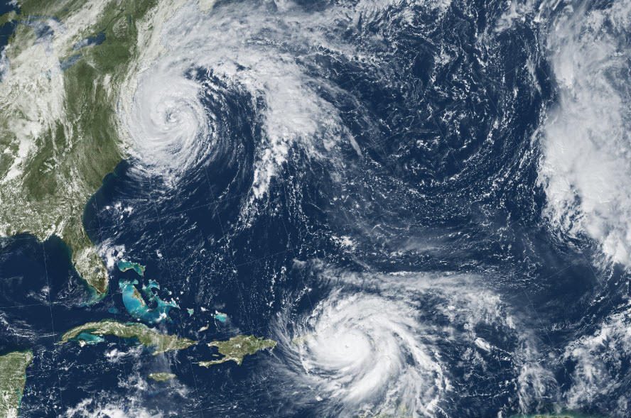
Remotely sensed imagery was provided”at no cost and almost daily”through the USGS Hazard Data Distribution System (HDDS) for analysis on the extent, severity and evolution of hurricanes Harvey, Irma and Maria.
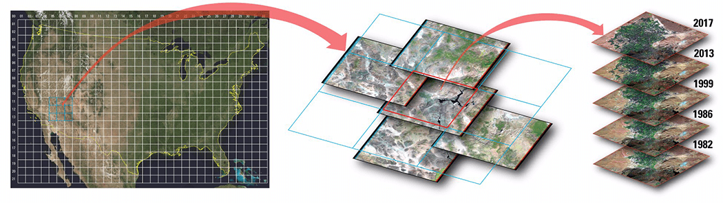
Improvements to the quality and usability of Landsat satellite data have been made with the release of a new USGS product called Landsat Analysis Ready Data (ARD), which will help reduce the time needed to process and analyze data and imagery, a significant advantage to scientists studying landscape changes, including changes from wildfires, hurricanes, vegetation cover, drought and other events.

What better way to celebrate GIS Day than to host or attend an open house or a workshop that demonstrates the power of mapping.
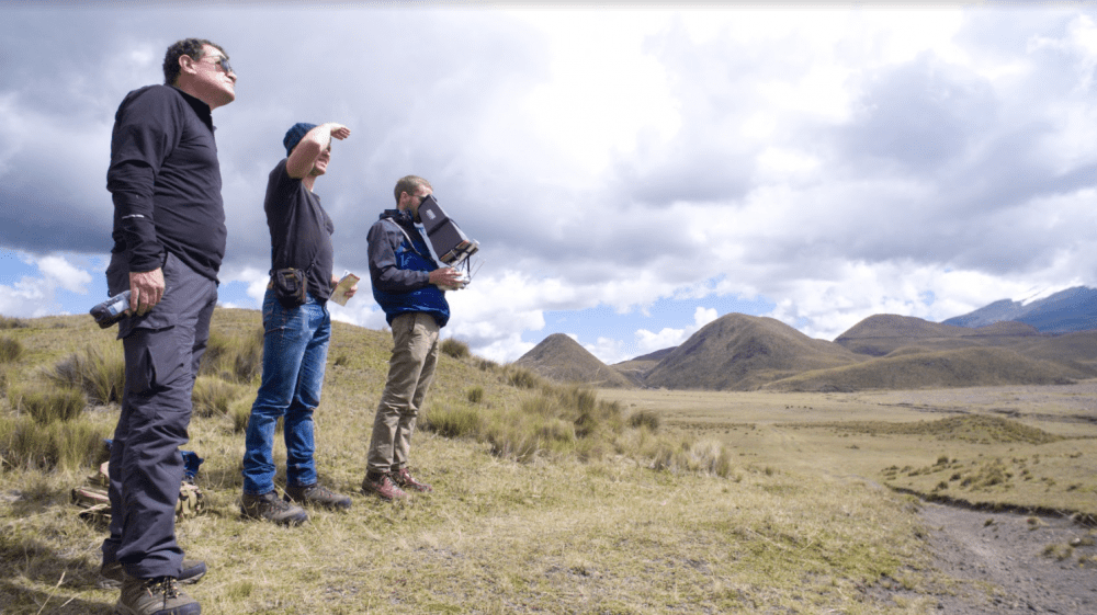
Drone mapping provides a fast, accurate and noninvasive way to document archeological sites, creating a historical record of a country's cultural heritage and giving archaeologists a rich set of data and models to be used for further research.
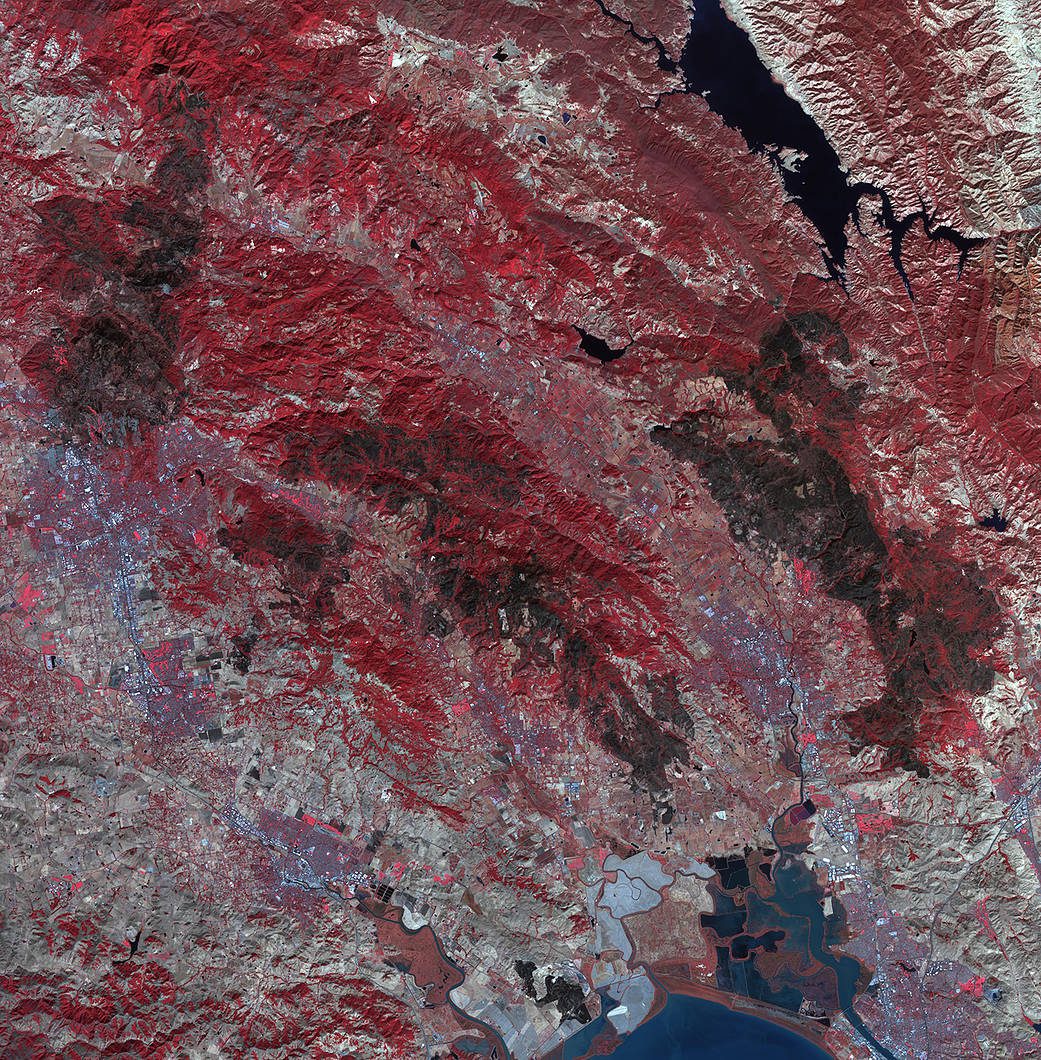
As firefighters continue to work toward full containment of the rash of wildfires burning in Northern California, a new image from the Advanced Spaceborne Thermal Emission and Reflection Radiometer (ASTER) instrument on NASA’s Terra satellite shows the growing fire scar on the landscape.
