By Adam Keith, Euroconsult (www.euroconsult-ec.com), Montreal. The upswing in Earth observation (EO) satellite capacity looks set to continue, matching growing commercial and political demand for EO data, services and supporting missions. In total, 111 satellites were...

State of the Industry Report
What Are the Most Significant Forces Shaping the Remote Sensing Industry? How would you respond to this question? Perhaps even more important, what are the key industry challenges and their possible solutions? Earth Imaging Journal’s staff solicited the professional...

ESA Earth Observation Program in Jeopardy
The European Space Agency's director general threatens to keep its GMES satellites grounded rather than place them in orbit without sustainable funding guarantees by the European Union.
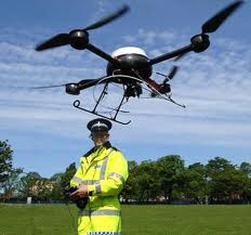
Lawsuit Asks: Who's Flying Civilian Drones Today?
As the introduction of unmanned aircraft into civil airspace edges closer, digital rights watchdog group Electronic Frontier Foundation raises Earth observation privacy concerns in court.
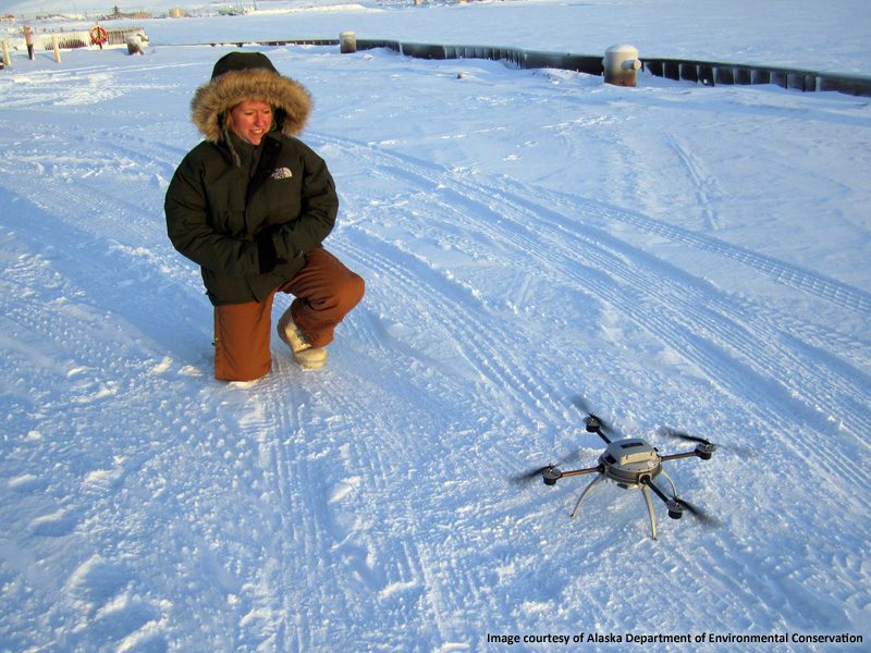
EO Drone Guides Tanker to Alaska Port
As citizens of Nome, Alaska, anxiously await critical fuel supplies, a small Earth observation drone helps assess potentially dangerous ice conditions and environmental impacts in and around the harbor.
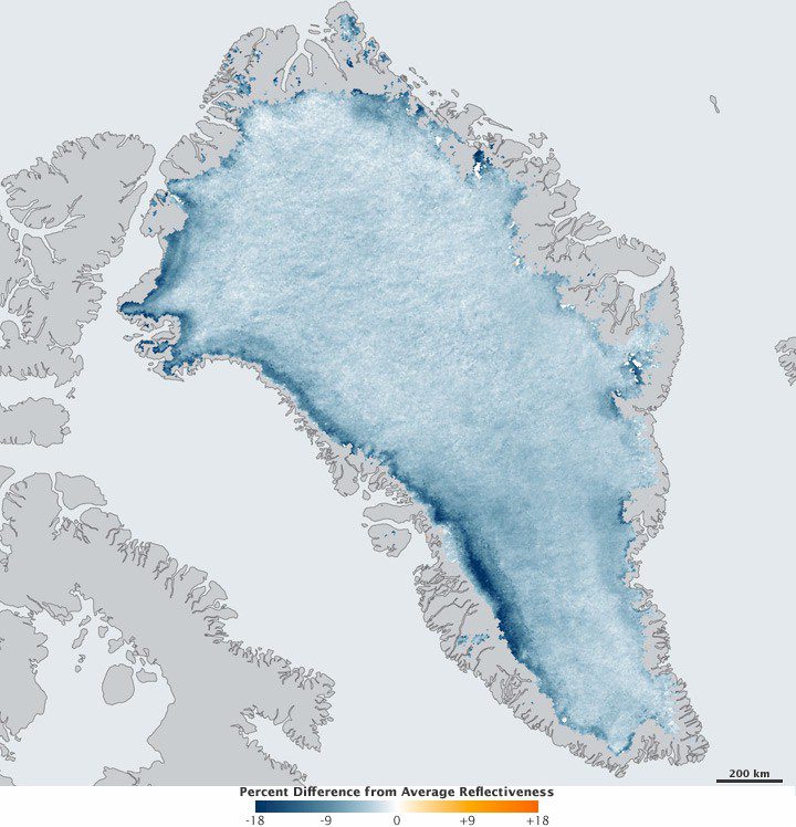
Greenland Ice Growing Darker
During the last decade, satellites have observed a decrease in the bright surface of the Greenland Ice Sheet reflectiveness”the darker surface now absorbs more sunlight, which accelerates melting.
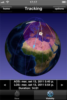
Earth's Ice Data Now at Your Fingertips
You can use your iPhone or iPad to track the European Space Agency's CryoSat mission in real time, as well as visualize the satellite's latest ice sheet measurements with a vertical profile tool.
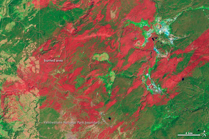
Yellowstone Forests at Risk from Fires
The high mountain forests of western North America need fire, but Yellowstone National Park is at a tipping point”more frequent fires could wipe out its dense conifer forests as early as 2050.
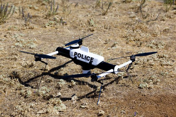
Civil UAV Rule Revisions Could Benefit Cops
Expected rule revisions by the Federal Aviation Administration for civilian unmanned aircraft flying below 400 feet above ground level could be good news for law enforcement agencies.
GeoEye Inks Deal to Map World's Largest Country
GeoEye is working with its Russian partner, ScanEx Research and Development Center, to provide millions of square kilometers of high-resolution satellite imagery of Russia.
