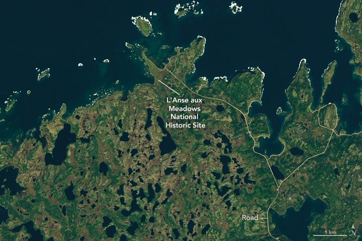
Since the 1960s, archaeologists have been gathering physical evidence that Norse people landed and settled for at least a few years in far northern Newfoundland, Canada, long before Columbus sailed to the Americas.
Since the 1960s, archaeologists have been gathering physical evidence that Norse people landed and settled for at least a few years in far northern Newfoundland, Canada, long before Columbus sailed to the Americas.
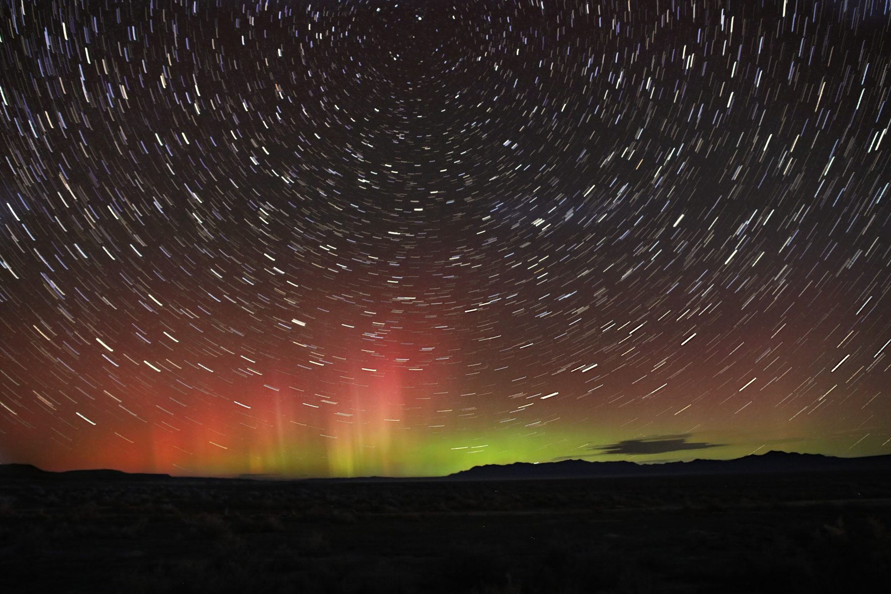
The aurora borealis glows on the northern horizon while stars wheel overhead in this long exposure taken near the Bonneville Salt Flats in Utah on Nov. 4, 2021.
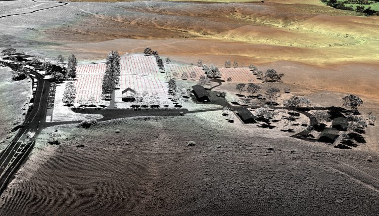
In August 2015, the National Park Service (NPS) contracted Woolpert for the Little Bighorn National Monument Mapping Project to record the locations of thousands of headstone markers at the Custer National Cemetery as well as hundreds of battlefield markers at the Little Bighorn National Monument site, which covers approximately 5.5 square miles.
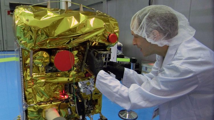
On Sept. 9, 2016, the Bi-Spectral Infrared Optical System (BIROS) fire-detection satellite, developed and built by the German Aerospace Center (DLR), released the Berlin Educational and Experimental Picosatellite (BEESAT-4) into space 515 kilometers above the Norwegian Svalbard archipelago.
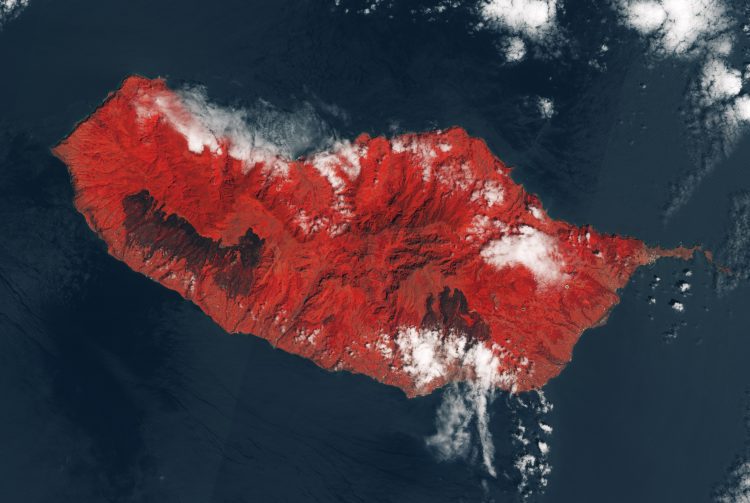
While hundreds of wildfires raged over mainland Portugal, the normally peaceful and idyllic resort island of Madeira was also hit by deadly fires, killing three people and destroying more than 150 homes.
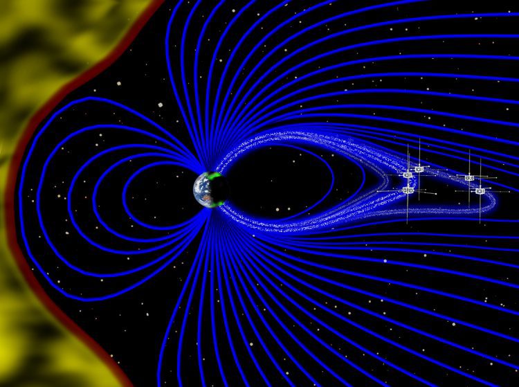
Using data from NASA's Time History of Events and Macroscale Interactions during Substorms (THEMIS) satellites, scientists have observed Earth's vibrating magnetic field in relation to the northern lights in the night sky over Canada.
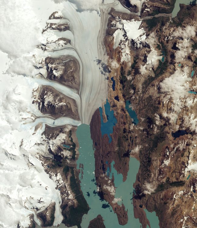
Argentina's Los Glaciares National Park was named a UNESCO World Heritage site in 1981 and is the largest park in the country, covering more than 7,000 square kilometers. One of its most recognizable features is the Upsala Glacier, which is pictured in this European Space Agency (ESA) Sentinel-2A image from January 2016.
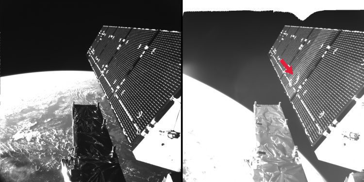
ESA engineers discovered that a solar panel on the Copernicus Sentinel-1A remote-sensing satellite was hit by a millimeter-sized particle on Aug. 23, 2016.
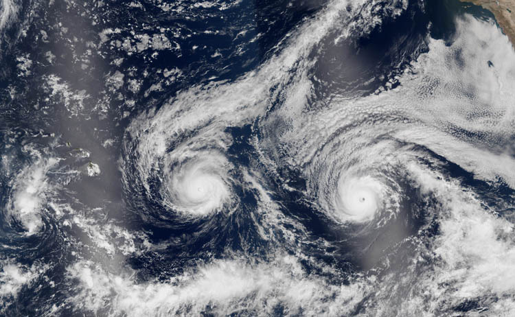
The island of Hawaii continued its decades' long streak of not being directly when Hurricanes Madeline and Lester, which at one point were considered threats for landfall, veered south and north, respectively.
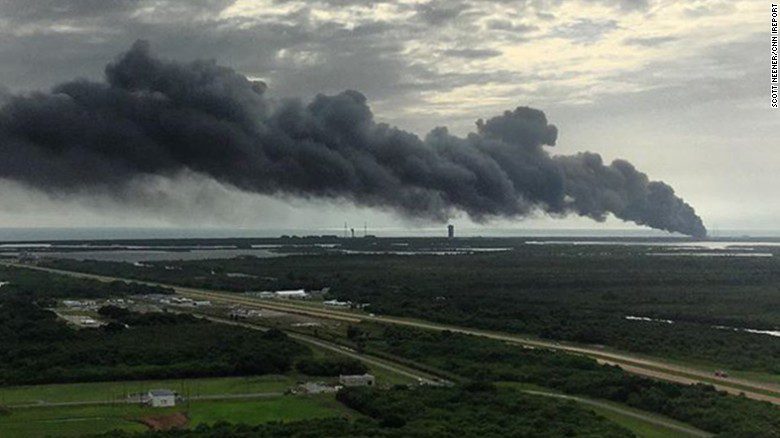
A SpaceX rocket exploded at its Cape Canaveral launch pad Thursday morning, Sept. 1, destroying the rocket and the satellite it was due to launch on Saturday.
