Small satellite technology has ignited a revolution in Earth observation, enabling the launches of hundreds of imaging platforms into orbit in just the past few years.
Small satellite technology has ignited a revolution in Earth observation, enabling the launches of hundreds of imaging platforms into orbit in just the past few years.
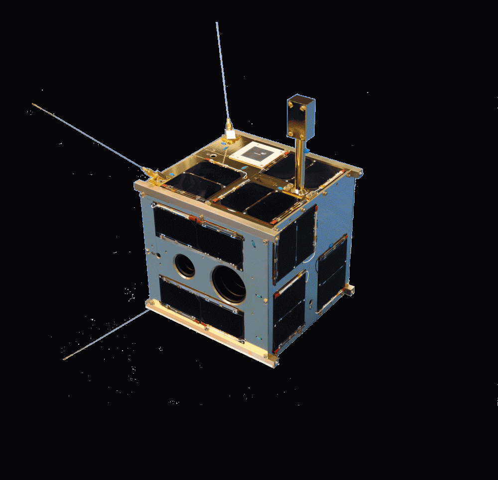
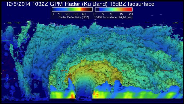
In June 2016, GHGSat Inc. of Montreal launched a microsatellite called Claire on an ambitious demonstration mission to prove that greenhouse gas emissions from point sources on the ground could be monitored from space.
Successful drone entrepreneur Petr LnÄ›niÄka went from award-winning filmmaker to drone inspection leader in his native Czech Republic. Here he lays out 3 pieces of advice and explains why for him, the transition seemed logical, and why he believes the future of drone mapping services will place less and less emphasis on drones and more and more weight on mapping data.
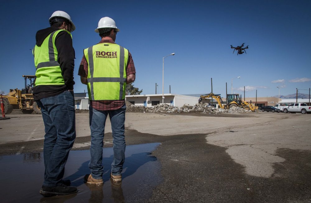
Headquartered in Beaumont, California, Bogh Engineering is a 3rd generation family owned construction and engineering company with 65 employees. It focuses on construction of public schools, and is currently working on 14 job sites including building the 1.4 million...
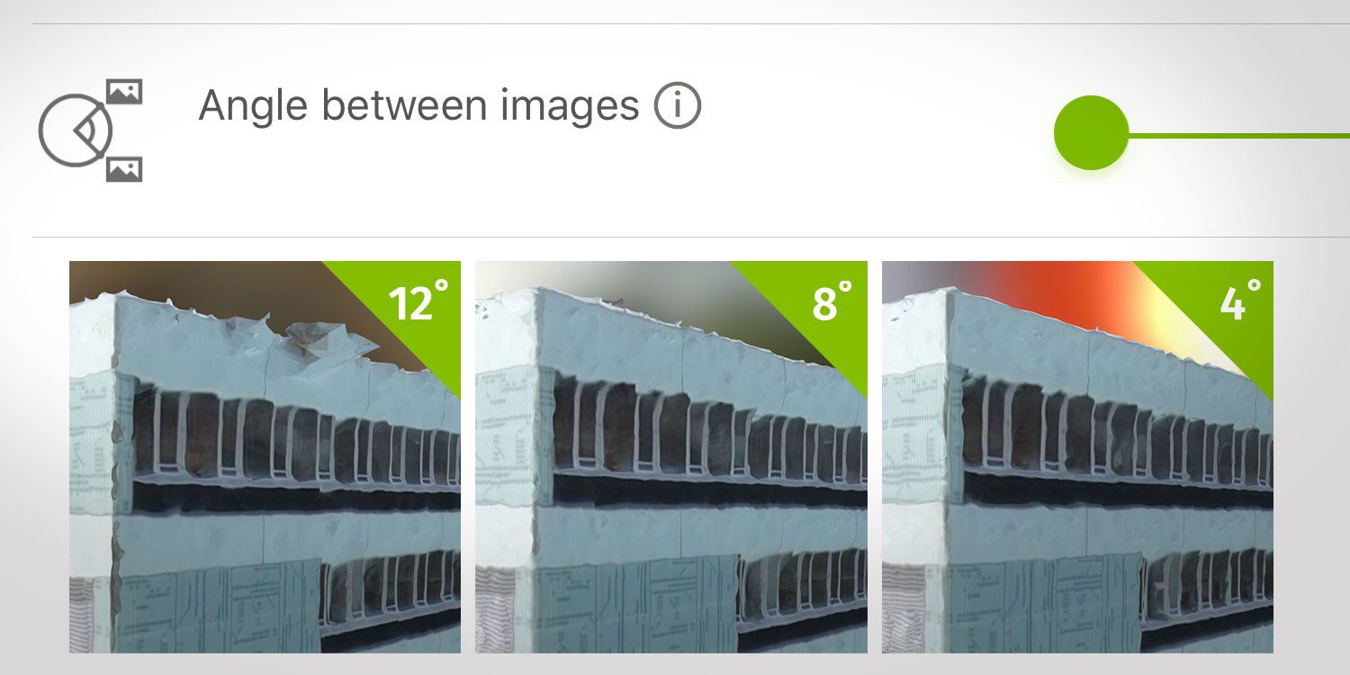
What are the effects of the angle between images setting in circular missions when it comes to 3D reconstruction?
In August 2015, the National Park Service (NPS) contracted Woolpert for the Little Bighorn National Monument Mapping Project to record the locations of thousands of headstone markers at the Custer National Cemetery as well as hundreds of battlefield markers at the Little Bighorn National Monument site, which covers approximately 5.5 square miles.
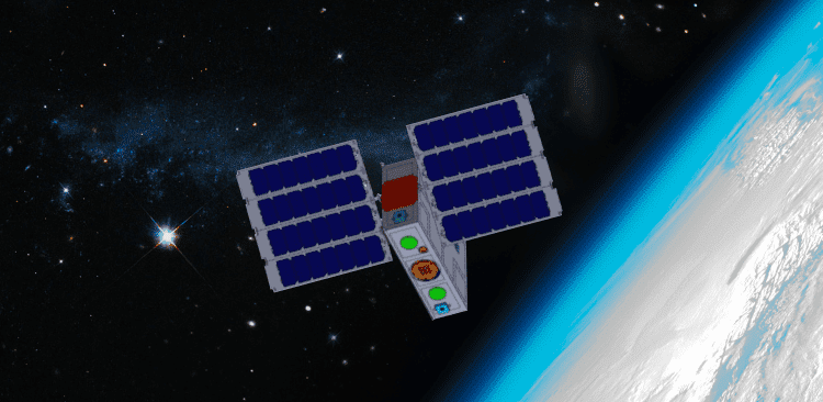
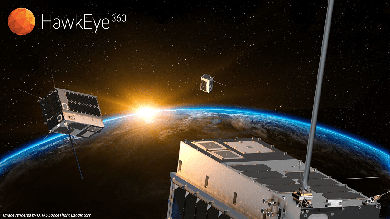
For what SmallSats lack in size, they more than make up for in quantity and breadth of coverage, and that goes beyond just their physical dimensions. Along with unmanned aerial systems (UASs or drones), SmallSats (which have several related subsets such as cubesats, nanosats, microsats and others) seem to dominate headlines and conversations in Earth-observation industries and media.
To help Earth observation (EO) at Big Data scales, teams outside GIS and remote sensing are increasingly rising to the challenge to understand data sources, management and processing.
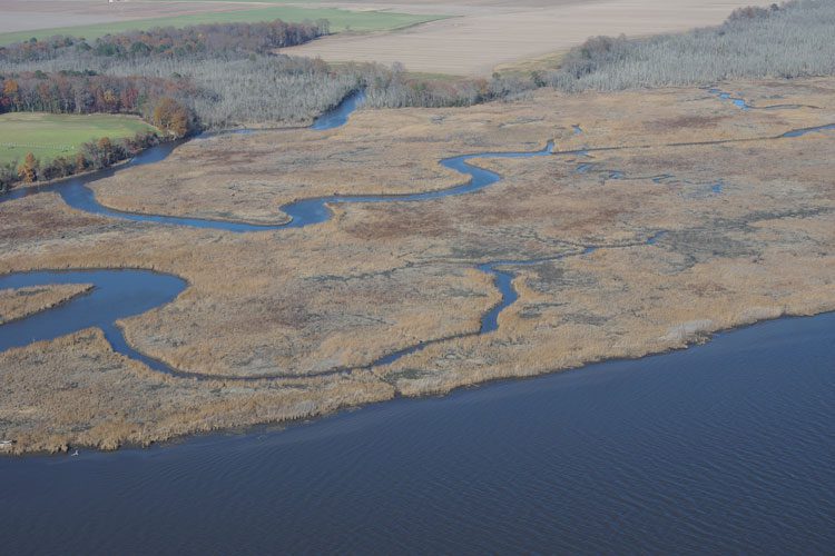
Building on the practice of precision agriculture and exploiting recent computer advances, the Chesapeake Conservancy (CC) is developing open-source geoprocessing and analysis tools that help environmental nonprofits and local-government agencies prioritize conservation and restoration decision making. From creating new, high-resolution land-cover data and flow-path analyses based on LiDAR elevation data to developing custom Web applications, it's giving partners with little or no expertise in GIS or complex modeling access to large-scale data and modeling produced by state and federal agencies as well as larger non-governmental organizations (NGOs).
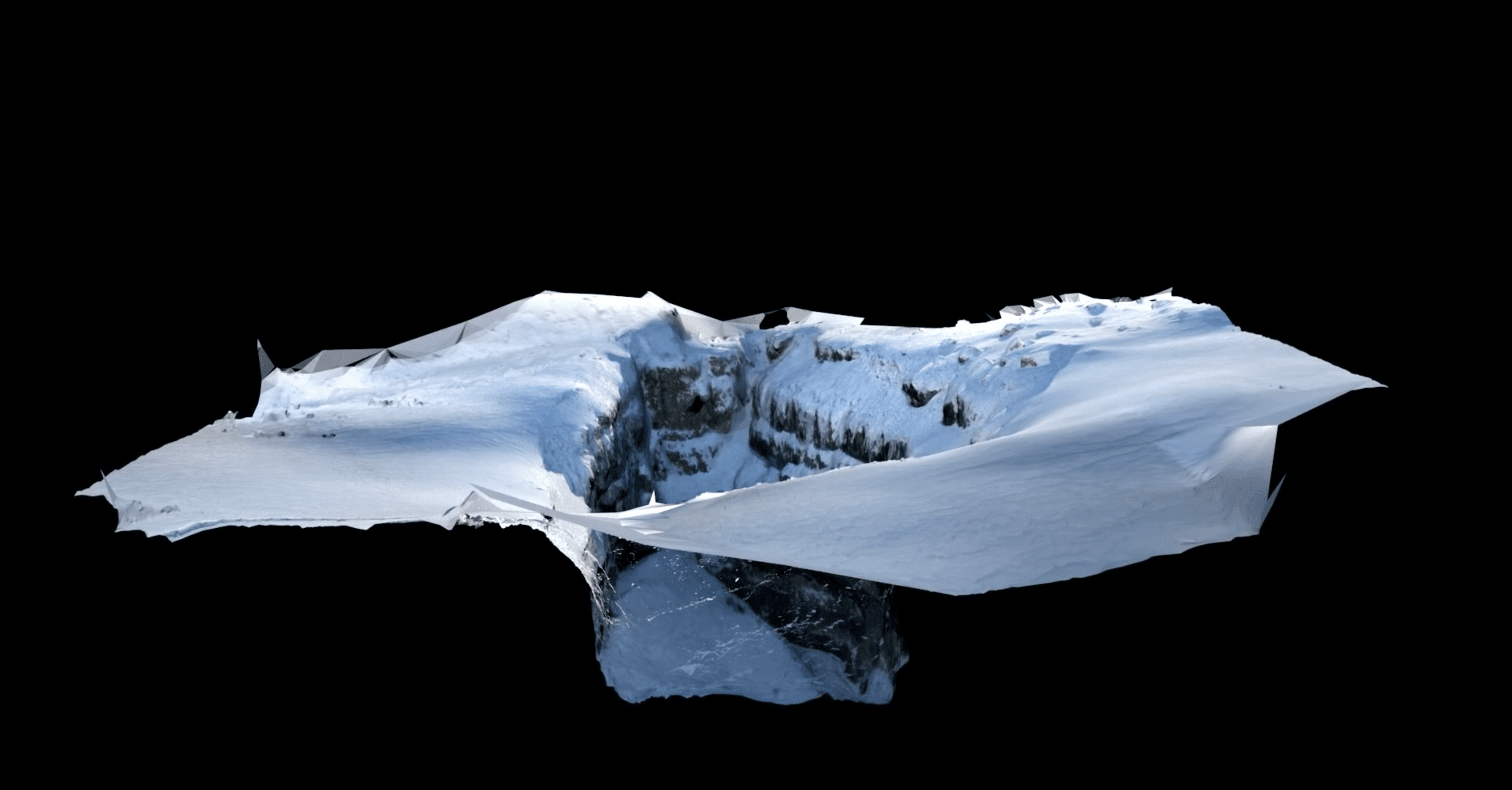
Working in difficult and frozen conditions 3,000 meters above sea level, with only a small time window due to changing weather and potentially melting surroundings, explorers, photographers and scientists used a laser scanner, an unmanned aerial system (UAS) vehicle and cameras to map out The Abyss of Cenote, one of the largest glacial caves in the Italian Dolomites.
