TRANSPORTATION The Illinois State Toll Highway Authority (Illinois Tollway) administers a 286-mile network of toll roads in northern Illinois. The heavily traveled system carries 1.4 million daily drivers and is constantly in need of maintenance and improvement. An...
Merrick Maps the Southeastern U.S. Coastline
MULTISENSOR MAPPING Merrick & Company provided LiDAR and hyperspectral imaging services and products to the U.S. Army Corps of Engineers (USACE), Joint Airborne Lidar Bathymetry Technical Center of eXpertise (JALBTCX), to map the southeastern U.S. coastline....
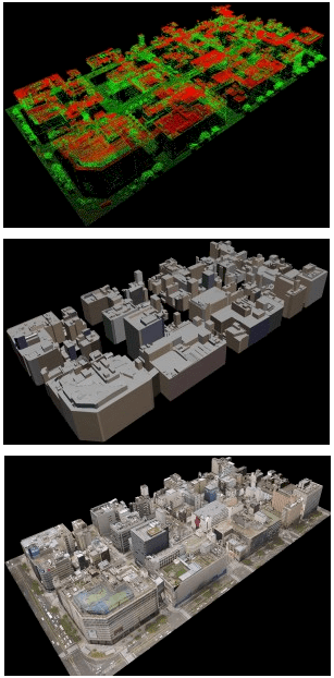
Use LiDAR, Oblique Images to Texture 3-D City Models
3 - D MODELING Terrasolid added new functionality to TerraScan, the company’s point cloud processing software. For two years the software has had the ability to automatically vectorize 3-D building models based on classified point clouds and building roof points....
LiDAR Boosts Brain Power for Self-Driving Cars
NAVIGATION It mounts on top of a vehicle, has 64 lasers that generate millions of data points per second, and is a potential game changer in the world of autonomous vehicle technology. The HDL-64E LiDAR sensor from Morgan Hill, Calif.-based Velodyne is designed for...
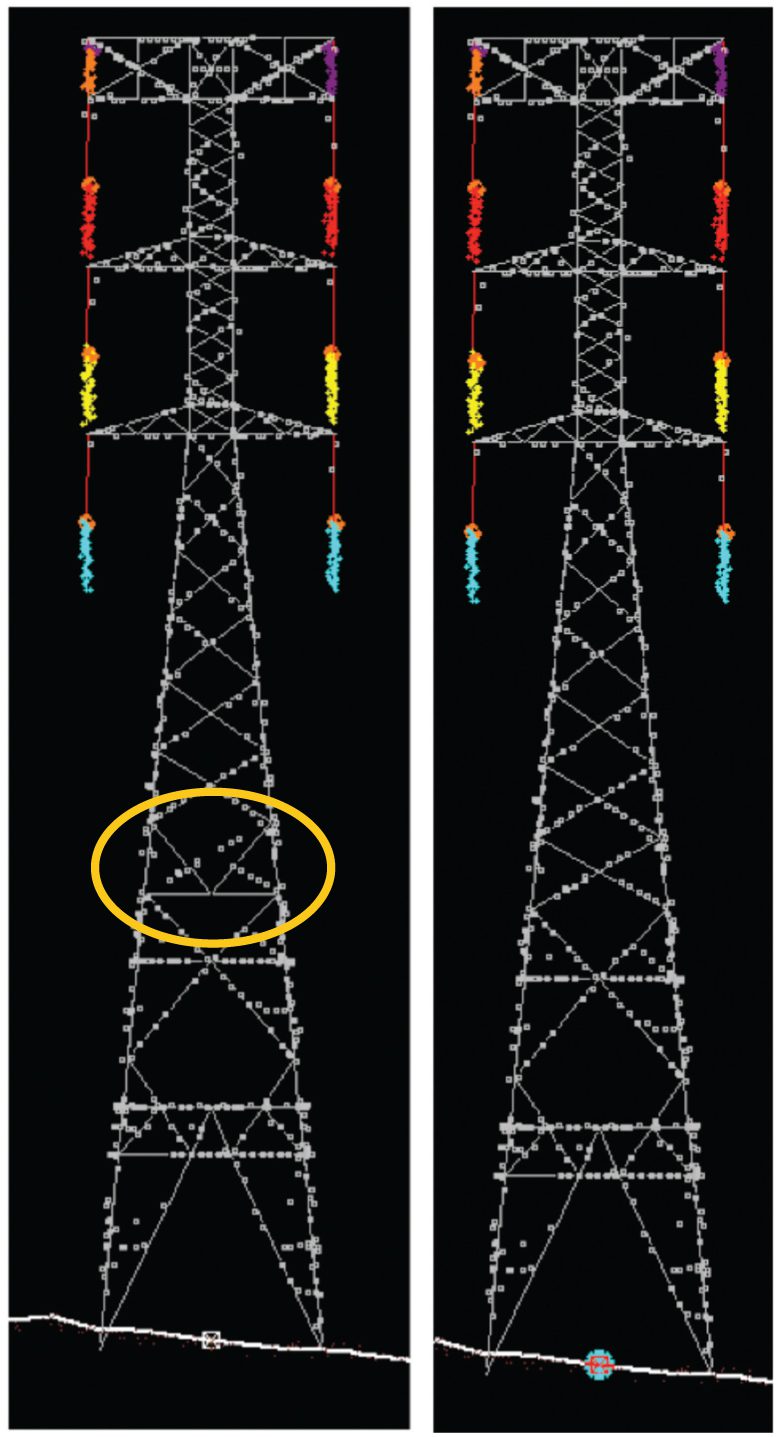
Consider an Integrated Approach for Upgrading Transmission Lines
UTILITIES MANAGEMENT W.I.R.E. Services, a division of Manitoba Hydro International Ltd. (MHI), recently completed an aerial LiDAR survey and engineering upgrade project for a large transmission line utility in Panama. The project included a LiDAR survey from which...
