TRANSPORTATION
The Illinois State Toll Highway Authority (Illinois Tollway) administers a 286-mile network of toll roads in northern Illinois. The heavily traveled system carries 1.4 million daily drivers and is constantly in need of maintenance and improvement. An ongoing challenge is to obtain precise terrain data for engineering design while reducing disruption of traffic and risks to surveyors on the ground. It's similarly challenging for design surveys to meet tight performance schedules. Last year, AeroMetric helped the Illinois Tollway meet these challenges.
The Approach
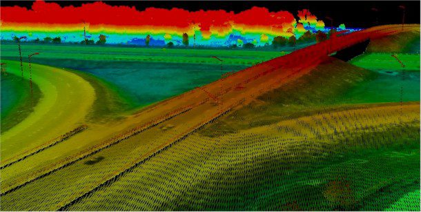
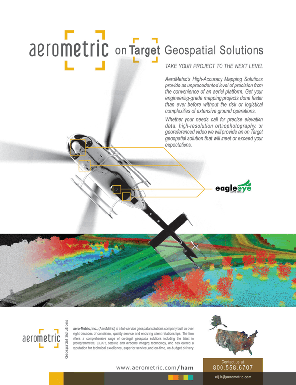
In 2011, a 36-mile segment of I-88 from State Route 251 to Orchard Road was designated to undergo milling and resurfacing. To design the project, the Illinois Tollway retained RS&H, an award-winning engineering firm headquartered in Naperville, Ill. RS&H turned to AeroMetric, a geospatial consultant that offered a creative and innovative approach to transportation corridor surveying by incorporating low-altitude LiDAR technology as part of its high-accuracy mapping solution.

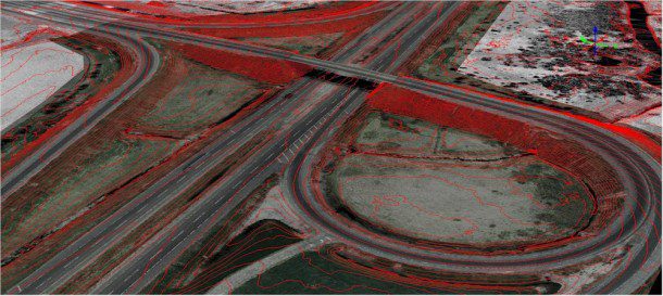
AeroMetric's I-88 aerial LiDAR survey met the project's high-accuracy mapping requirements and minimized roadway disruptions.
Tight vertical accuracy and highly detailed imagery were critical to the project's success. The Illinois Tollway hadn't previously used design mapping from helicopter-borne LiDAR. To provide an independent test of the data's accuracy, the Tollway retained two independent surveying firms to establish vertical control and test points by precise differential leveling.
Horizontal control was established by Global Positioning System (GPS) methods outside the traveled way. In addition to collecting the dense LiDAR point cloud using Tuck Mapping Solutions' state-of-the-art eagleeye helicopter-based mapping system, AeroMetric acquired color stereo aerial photography using one of its large-format camera systems in a fixed-wing aircraft. This enabled the team to produce high-density, high-accuracy LiDAR datasets, topographic maps, 3-D planimetric maps and 3-inch-resolution color digital orthophoto imagery for the entire corridor.
The Outcome
Conducting the survey from the air enabled the Illinois Tollway to avoid traffic disruptions and ensured the survey team's safety. In addition, AeroMetric's high-accuracy mapping approach allowed an accelerated schedule.
The original contract required the data to be delivered 90 days from receipt of the control survey data from the team surveyors, explained Jeff Stroub, AeroMetric's vice president. However, once we received the checkpoint control from the team surveyors, we were requested to expedite the final delivery. Because of the speed inherent in the helicopter LiDAR technology, we were able to deliver all datasets within 45 days, halving the delivery time and allowing the engineers to meet their fast-track preliminary design schedule.
The helicopter platform enabled the team to capture LiDAR datasets from a low altitude with great precision while substantially reducing the requirement for traditional field surveying.
The project was designed to achieve vertical accuracy of 0.10 feet, related Rob Merry, AeroMetric's geomatics manager. The final terrain data were tested using field-surveyed checkpoint control locations and achieved 0.05 feet, exceeding our expectations.
AeroMetric produced a high-accuracy aerial survey for the Illinois Tollway project more efficiently than we would have accomplished with a complete ground survey, said Preston Keefe, P.E., vice president of RS&H. Our schedule was accelerated, and AeroMetric's turnaround was excellent, delivering documentation with the precision we anticipated.
The I-88 project is one of several pilots that AeroMetric is conducting around the country. AeroMetric expects high-accuracy mapping to become an approach of choice of transportation
authorities nationwide for mapping busy, complex corridors.
We found that helicopter platform-based LiDAR was the best way to execute the high-accuracy mapping we required while minimizing roadway disruptions to our customers, related Brian Bottomley, P.E., senior project manager with the Illinois Tollway. We're very happy with the result of this project.
For more information, visit AeroMetric at www.aerometric.com/ham.


