Redlands, Calif., Nov. 11, 2013—Esri continues to expand its global presence with the opening of its Miami, Florida, office on November 1. This latest venture demonstrates Esri's commitment to supporting the domestic and international GIS user community. The Esri...
PCI Geomatics Delivers Historical Airphoto Processing System in Sabah, Malaysia
RICHMOND HILL, Ontario, Canada, Nov. 7, 2013—PCI Geomatics, a world leading developer of geo-imaging software and systems, today announces that it has successfully delivered to the Sabah Lands and Surveys Department (SLSD) a Historical Airphoto Processing (HAP)...

ESA Research Satellite Gives in to Gravity
On Nov. 11, 2013, the European Space Agency's GOCE satellite reentered Earth's atmosphere on a descending orbit pass across Siberia, the western Pacific Ocean, the eastern Indian Ocean and Antarctica.
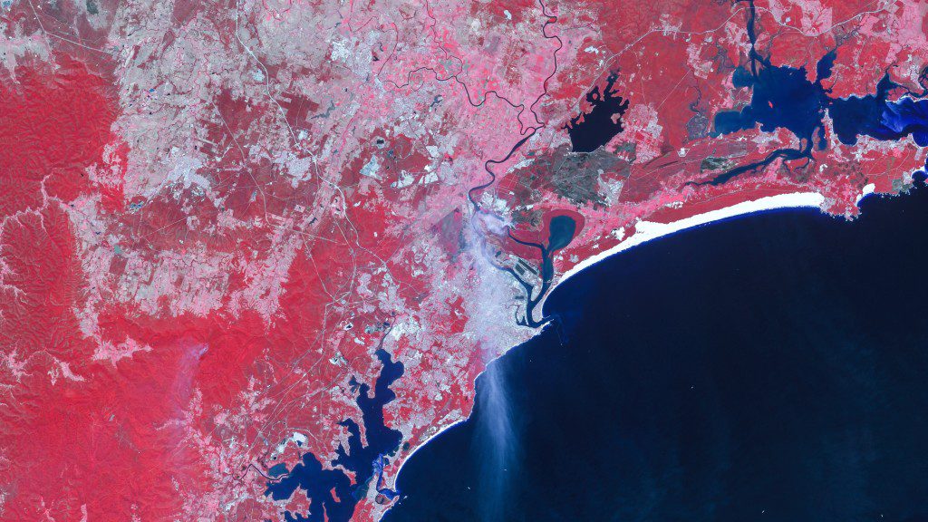
DMC Satellites Capture New Wildfire Season
With more intense wildfire conditions predicted by experts, satellite imagery from the DMC constellation monitors fire damage and can assist planning for wildfire management.

FAA Releases First Unmanned Aircraft Roadmap
On Nov. 7, 2013, the Federal Aviation Administration (FAA) released a roadmap highlighting the operational goals and safety issues we need to consider when planning for the future of our airspace.”
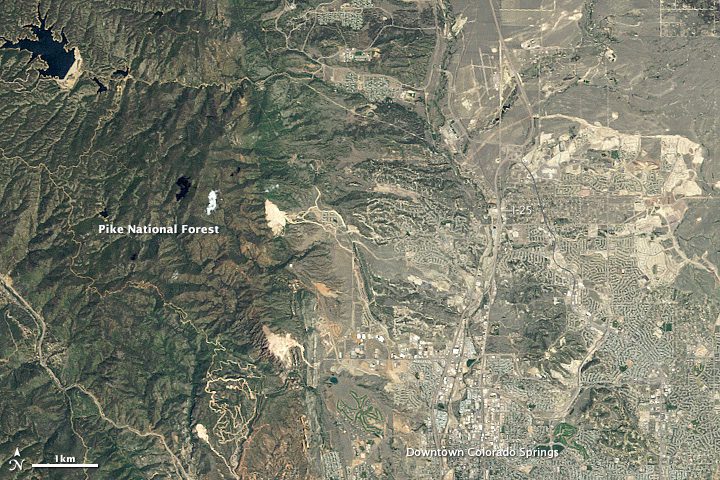
Why Have Colorado Wildfires Become So Destructive?
In recent decades, more Coloradans have moved into the wildland-urban interface, a wildfire-prone zone where wilderness and civilization meet.
East View Releases LandScan Global
Minneapolis, Nov. 3, 2013—The new LandScan Global Population Database has just been released and we would like to give you an opportunity to see it for yourself. We are now offering free data samples! Accurate and reliable population data is what distinguishes...
Exelis Delivers Critical GPS Satellite Simulation Software
CLIFTON, N.J., Nov. 4, 2013—Exelis (NYSE: XLS) successfully completed factory acceptance testing for the Global Positioning System (GPS) III navigation payload simulator software. Developed by Exelis, the software will simulate the behavior of GPS signals in...
LizardTech Software Products on Display at WALIS Forum 2013
SEATTLE, Nov. 4, 2013—LizardTech®, a provider of software solutions for managing and distributing geospatial content, will have a presence at this week’s WALIS Forum at the Crowne Plaza Perth located in Perth, Australia. Represented by the company’s Australian...
Trimble’s GeoExplorer GNSS Data Collection Solution Adds Remote Positioning Capability
SUNNYVALE, Calif., Nov. 5, 2013—Trimble (NASDAQ: TRMB) introduced today the next generation of its Trimble® GeoExplorer® data collection solution. The new Geo 7X includes an integrated laser rangefinder module, extended GNSS capabilities and improved hardware...
