April 24, 2014—To support the Open Geospatial Consortium (OGC) Compliance Program, the OGC is accepting proposals from organizations that are able to host the OGC Compliance Tools Infrastructure. Proposals should describe how the hosting organization would:...
OGC Seeks Comments on Charter for Big Data Domain Working Group
April 24, 2014—The Open Geospatial Consortium (OGC®) seeks comments on the charter for a new OGC Big Data Domain Working Group (DWG). The charter is available at http://external.opengeospatial.org/twiki_public/BigDataDwg/ . “Big Data†is an umbrella term...
Proteus Delivers Phase 1 of Abu Dhabi Land/Marine Mapping Ahead of Schedule
ABU DHABI, UAE, and BRISTOL, UNITED KINGDOM, April 28, 2014—Proteus, a provider of satellite-derived mapping and classification services, has delivered ahead of schedule the first phase of a fine-scale terrestrial and marine land use/land cover (LULC) and habitat...
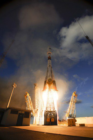
Vega Is Readied for Its Third Arianespace Mission, Carrying a Pioneering Earth Observation Spacecraft
April 22, 2014—Vega Flight VV03, Arianespace’s Vega mission with DZZ-HR, Kazakhstan’s first Earth observation satellite, is entering the final preparation phase for a nighttime liftoff next week from the Spaceport in French Guiana. This will be the light-lift...
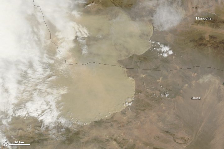
Satellites Capture China's Great Wall of Dust
A wall of dust was barreling across northern China on April 23, 2014. Images collected by NASA's Aqua and Terra satellites two hours apart show how fast the dust advanced.
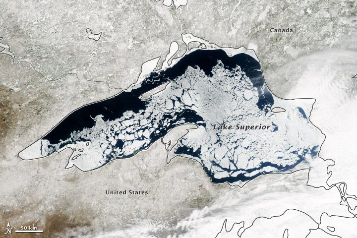
Satellite Shows Lake Superior Still Mostly Ice Covered
Though North America is a full month into astronomical spring, the Great Lakes have been slow to give up on winter. Lake Superior leads the pack, with more than 60 percent of its surface ice covered.
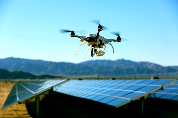
Firms Testing Inspection Drones
Drones from Skycatch and more established companies are monitoring power lines, inspecting oil and gas pipelines, checking wind turbines for defects and pinpointing malfunctioning solar panels.
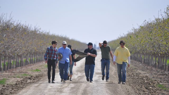
UAS Helps Save Water During Drought
A California grower is hoping a thermal camera mounted on an unmanned aircraft system (UAS) will pick up irrigation line leaks in his pistachio orchard so he can fix them faster.
Sentinel Returns First Images
The European Space Agency's Sentinel-1A satellite's first radar images of Earth give a tantalizing glimpse of the kind of operational imagery the new mission will offer Europe's environmental monitoring program.
Early Sentinel Maneuver Underscores Space Debris Problem
Before it could begin imaging Earth, an unprecedented collision avoidance maneuver during launch and early orbit phase was needed to clear Sentinel-1A from the path of a defunct NASA satellite.
