July 17, 2014—Members of the Open Geospatial Consortium (OGC®) have formed an OGC Geospatial User Feedback Standards Working Group (SWG). The purpose of this SWG will be to reach consensus on a standard way to encode users’ comments on the results those users...
Headwall Selects SBG Systems' Inertial Sensor for Full-Featured UAV-Based Remote Sensing Solution
Rueil-Malmaison, France, July 22, 2014—With the strong support of SBG Systems, Headwall offers a unique a fully integrated remote sensing solution, combining hyperspectral and LiDAR sensors on a small Unmanned Air Vehicle (UAV). Headwall has selected the Ekinox-N...
Woolpert to Provide Aerial Mapping for West Virginia
DAYTON, Ohio, July 21, 2014—Woolpert, a national geospatial, infrastructure management and design firm headquartered in Dayton, announced that it has been awarded a one-year contract with the West Virginia Department of Transportation, Division of Highways to...
40cm Satellite Imagery Now Available through East View Geospatial
MINNEAPOLIS, Minn., July 22, 2014—East View Geospatial, the leading provider of geospatial data and GIS production services, enthusiastically announces the availability of 40 cm Core Imagery products from DigitalGlobe. New government permissions allow DigitalGlobe...
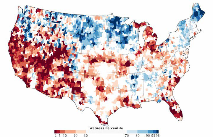
GRACE Satellite Paints Bleak Groundwater Picture
Drought and wildfires are battering several U.S. regional economies, as residents and agricultural businesses move toward water restrictions. Part of this story of water woes lies underground.
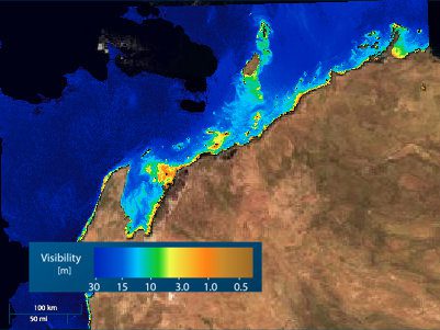
Monitoring Water Quality Down Under
Former Copernicus Masters competition winner EOMAP launched a new Web-based application that provides daily maps of Australia's coastal water quality.
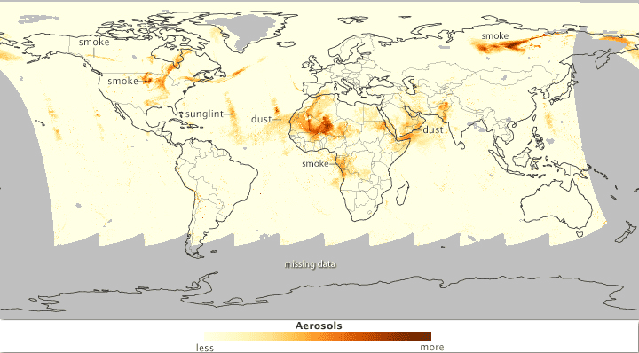
Satellites Track Aerosols to Smoky and Sandy Sources
Twenty years after developing instruments that could monitor Earth's ozone layer, scientists learned they could use the same observations to detect ultraviolet-absorbing aerosols in the air such as volcanic ash, dust and smoke.
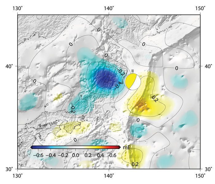
Lifetime of Gravity Measurements Heralds New Beginning
Although the European Space Agency's GOCE satellite is no more, its measurements acquired during four years in orbit have been drawn together to offer new opportunities for science.
Digital Data Services Presents Maperture Solutions for the Oil and Gas Industry
Lakewood, Colo., July 23, 2014—Digital Data Services, a leader in customer-focused geographic business solutions, announced Maperture®, a powerful web based map solution used to manage and view mapping data. Powered by Geocortex Essentials and Esri ArcGIS Server...
Epson Launches Next-Generation SureColor T-Series Large-Format Color Printers
SAN DIEGO, July 15, 2014—Epson America today introduced its next-generation family of large-format color printers – the Epson® SureColor® T3270, T5270, T7270, T5270D, and T7270D. Available in both single- and now dual-roll models, the SureColor T-Series features...
