WARSAW, Poland, Aug. 29, 2014—A team of research students and staff from Warsaw University of Technology have successfully demonstrated the first phase of flight test and integration of unmanned aircraft platforms with an autonomous mission control system. The...
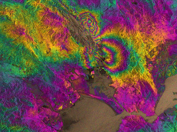
Radar Vision Maps Napa Valley Earthquake
Radar images from the European Space Agency's newly launched Sentinel-1A satellite have been used to map the rupture caused by the largest earthquake to shake northern California in 25 years.

Catching Film in Mid-Air: Revisiting Yesterday's Spy Satellites
Being a U.S. spy satellite in the 1960s wasn't easy”it meant dropping its photos in a special film bucket capsule from space, which the U.S. Air Force then had to catch in mid-air.
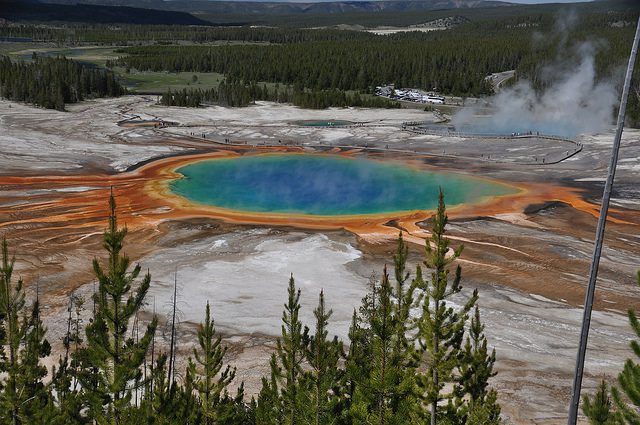
Yellowstone Digs in Its Heels Against Illegal Drones
Yellowstone National Park no longer takes a slap-on-the-wrist approach to people who violate its ban on camera drones. It could result in a $5,000 fine and/or six months in jail.

Recalling Hell with the Lid Off
During the first half of the 20th century, coal-burning power plants, factories and homes produced pollution that likely exceeded modern Beijing, one of the world's most polluted cities.
First Ever RQ-4 Global Hawk Hits 100th Flight on NASA Mission
SAN DIEGO, Aug. 25, 2014—The first completed Global Hawk has made history again with its 100th flight in support of NASA environmental research. The milestone occurred on a flight from Edwards Air Force Base in California more than 16 years after its first flight in...
KEYW Unveils Aeroptic Aerial Mapping System
HANOVER, Md., Aug. 21, 2014—The KEYW Holding Corporation’s (NASDAQ: KEYW) subsidiary, KEYW Corporation, will formally unveil the Aeroptic Mapping System August 22-25 at the 2014 National Guard Association (NGAUS) Conference & Exhibition in Chicago. With a...
Northrop Grumman Cryocooler on Board NASA’s OCO-2 Satellite
REDONDO BEACH, Calif., Aug. 20, 2014—A cool thing about space: cryogenic refrigerators from Northrop Grumman Corporation (NYSE: NOC) that chill satellite sensors to hundreds of degrees below zero Fahrenheit (degrees F) for maximum sensitivity. A new NASA satellite...
OGC Approves Best Practice for RESTful Encoding of OGC Sensor Planning Service for Earth Observation Satellite Tasking
Aug. 22, 2014—The Technical and Planning Committees have approved release of RESTful encoding of OGC® Sensor Planning Service for Earth Observation Satellite Tasking as an official OGC Best Practice. Organizations that manage and depend on Earth Observation...
ASPRS Establishes the First UAS Mapping Calibration Test Course
BETHESDA, Md., Aug. 22, 2014—The first mapping calibration test course for Unmanned Aircraft Systems (UAS) will be established by ASPRS at the Reno Stead airport, an FAAâ€designated UAS test site. The course will include ground-surveyed targets of varying height,...
