Hallowell, Maine, July 8, 2015 — Blue Marble Geographics (bluemarblegeo.com) is pleased to announce that the 2015 Blue Marble User Conference (BMUC) will take place in Arlington, VA on Tuesday October 6. This annual event provides industry experts, Blue Marble...
RIEGL to Attend, Exhibit, and Present at the Esri 3D Mapping Forum!
July 8, 2015 — RIEGL will be attending, exhibiting, and presenting at the Esri 3D Mapping Forum! The Esri 3D Mapping Forum will be held at the Omni San Diego in San Diego, California from July 18 through July 21, 2015. The Esri 3D Forum is an ideal place to...
Abstract Submissions Invited for 20th GIS/CAMA Technologies Conference
Des Plaines, IL, July 8, 2015 — URISA and the International Association of Assessing Officers (IAAO) are pleased to announce the milestone 20th anniversary GIS /CAMA Technologies Conference, February 22-25, 2016 in Savannah, Georgia. The long-running conference...
Drones Can Be Deadly For Wildland Firefighters
July 8, 2015 — Imagine if a hostile country sent an Unmanned Aircraft System or UAS, otherwise known as a drone, to disturb the efforts of firefighters during a catastrophic wildfire. The confusion that might ensue could cause loss of life and property as flames...
New GeoDigital Vegetation Management Calculator Estimates over $1 Billion in Savings for North American Utilities
July 8, 2015 — GeoDigital, a big spatial data and insight company, has partnered with The McDonnell Group, a leading integrated energy industry marketing firm, to launch an online calculator which provides an estimate of the potential financial benefit of moving...
UrtheCast Announces Closing of Offering of Subscription Receipts for Aggregate Gross Proceeds of $99,475,000
July 8, 2015 — UrtheCast Corp. (TSX:UR) ("UrtheCast" or the "Company") announced today that it has closed its previously announced prospectus offering (the "Offering") of 24,868,750 subscription receipts of the Company ("Subscription Receipts"), raising aggregate...
New Lockheed Martin Center Improves Satellite Sensing and Communication Technologies
DENVER, July 8, 2015 — A new development center will advance satellite sensing and communication technologies, broadly known as Radio Frequency (RF) payloads, at the Lockheed Martin (NYSE: LMT) facility in Denver. The RF Payload Center of Excellence will focus on...
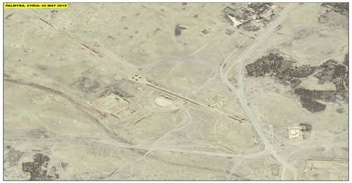
UNESCO and UNITAR-UNOSAT Protect Cultural Heritage with Geospatial Technologies
At the annual meeting of the World Heritage Committee in Bonn, Germany, UNESCO and UNITAR (the UN Institute for Training and Research) signed an agreement to protect cultural and natural heritage sites with the latest geospatial technologies. The strategic partnership will enable the organizations to work together during conflict situations and following natural disasters, sharing their respective expertise, and collaborating on prevention and capacity development.
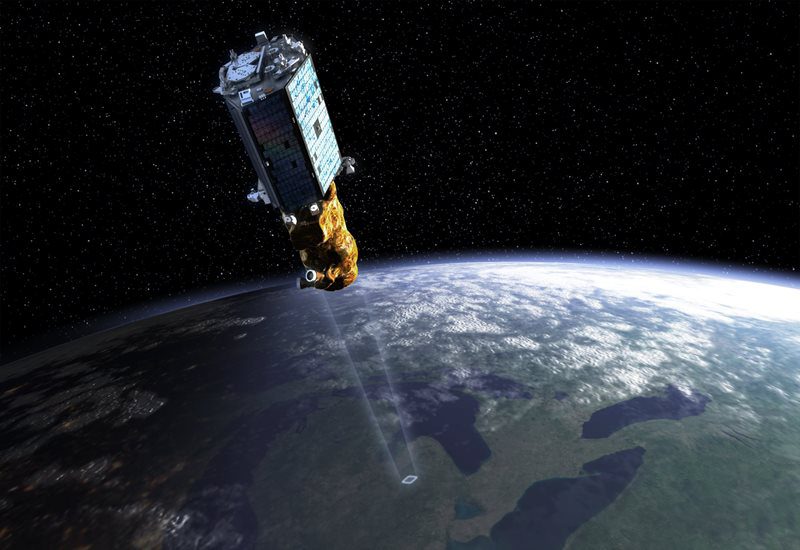
ISRO to Launch DMC3 Earth-Observation Constellation
The Indian Space Research Organisation (ISRO) is slated to launch its heaviest commercial load on July 10, 2015, with a payload of five satellites made up of the DMC3 constellation of optical Earth-observation satellites as well as two others aboard a PSLV-XL rocket from the Sriharikota spaceport in Andhra Pradesh.

Embry-Riddle Receives NASA Grant for High-Altitude Unmanned Aircraft
NASA awarded an engineering team at Embry-Riddle's Daytona Beach campus a $100,000 grant to develop a concept for an unmanned aircraft to be powered by renewable energy (wind or solar) and fly at 50,000-60,000 feet. The atmospheric satellite concept was chosen as one of 15 winning projects from hundreds of entries for a NASA Innovation Advanced Concepts program, Phase I award.
