WILMINGTON, NC, SEPTEMBER 2, 2015 – Geospatial mapping firm Independent Mapping Consultants, Inc. (IMC) recently announced its acquisition of the Wilmington, North Carolina based firm, Carolina Resource Mapping, Inc. (CRM). The CRM team offers experienced...
Blue Marble Announces Featured Speakers for Upcoming 2015 User Conference
Hallowell, Maine – September 2, 2015 - Blue Marble Geographics (bluemarblegeo.com) has an impressive list of featured speakers for the 2015 Blue Marble User Conference (BMUC) coming to Arlington, Virginia. The sixth Blue Marble User Conference, this is the first...
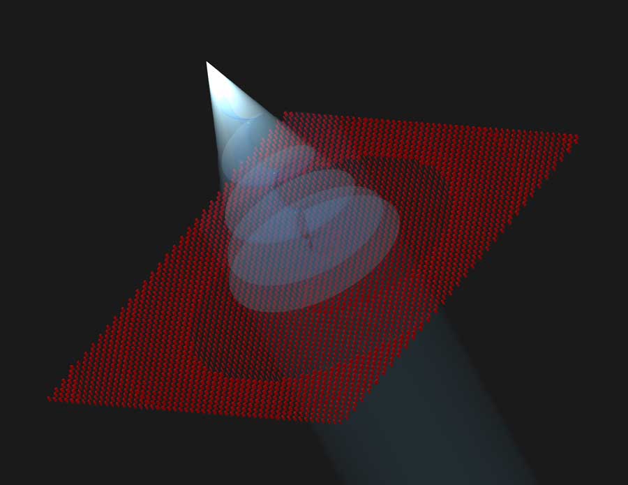
New, Ultrathin Optical Sensors Shape Light in Exotic Ways
Researchers have developed innovative flat, optical lenses as part of a collaboration between NASA's Jet Propulsion Laboratory and the California Institute of Technology. These optical components are capable of manipulating light in ways that are difficult or impossible to achieve with conventional optical devices.
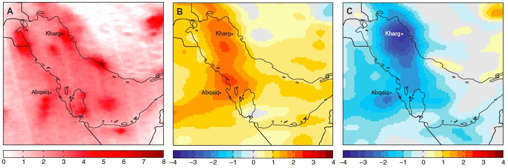
Satellite Spots Unexpected Result of Middle East Conflict
If there's any silver lining to the ongoing conflict in the Middle East, it may come in the form of fewer smog clouds. Political upheaval, economic recession and armed conflict over the last five years drove down air-pollution levels, especially smog, across the Middle East, according to an open-access report published recently in Science Advances.

Crowdsourcing to Spot Illegal Fishing Vessels at Cocos Island Marine Protected Area
Turtle Island Restoration Network (SeaTurtles.org) partnered with DigitalGlobe's crowdsourcing platform (Tomnod.com) to create the first crowdsourced digital patrol of the Cocos Island Marine Protected Area to defend one of the Pacific Ocean's most-vibrant marine-life habitats.
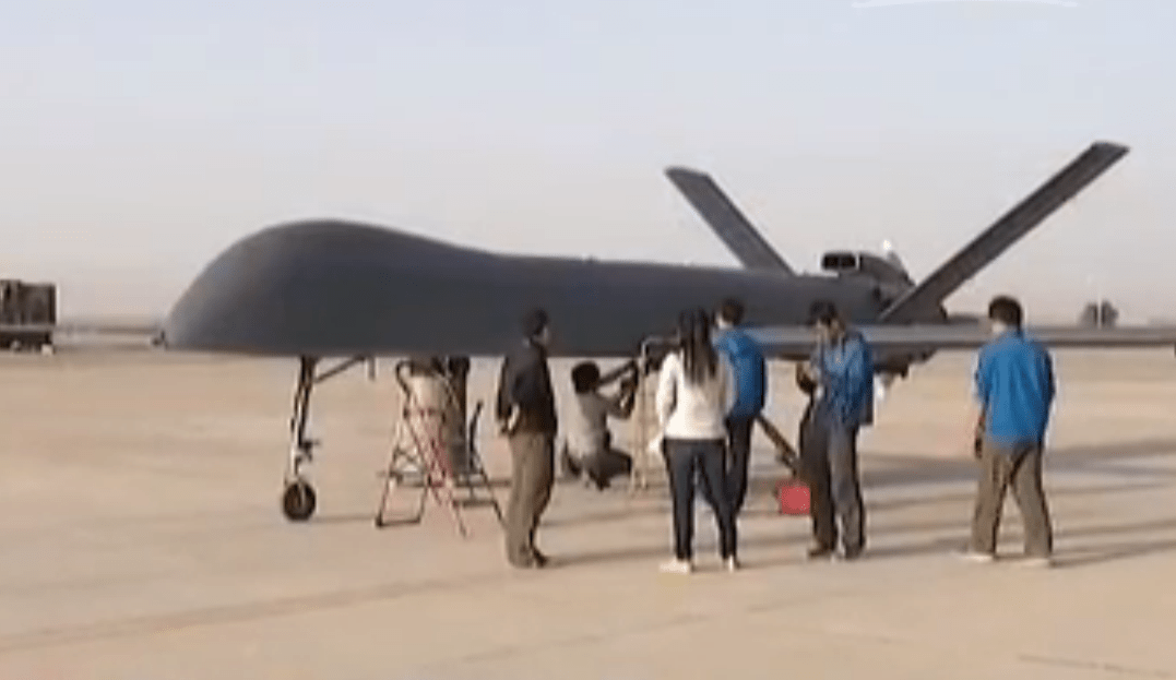
China's Largest Drone Makes Maiden Flight
China's largest, self-developed unmanned aerial vehicle (UAV) made its maiden flight in Gansu province on Aug. 31, 2015. The drone’s first flight lasted about 20 minutes, although it can reportedly stay in the air for more than 30 hours.
The Data Farmers' Almanac
A NASA Big Data system, developed and maintained by Raytheon, is helping scientists forecast the potential impact climate change may have on human health, safety and security issues worldwide.
GITA Sponsors GoGeomatics Back to School Socials
St. Paul, Minnesota, September 1, 2015 – The Geospatial Information and Technology Association (GITA) is proud to sponsor the 2nd Annual GoGeomatics Back to School Socials this September. Offered at university cities across Canada, these free events aim to encourage...
Trimble Enhances its Connected Farm Solution with Bundled Packages
SUNNYVALE, Calif., September 1, 2015 —Trimble (NASDAQ: TRMB) announced today that its Connected Farm™ solution will be available in Free or Standard subscription bundles to suit growers with varying farm management requirements. The Connected Farm entry level...
UNF Engineering Professor Awarded NSF Grant for Coastal Research/Education
September 1, 2015 — Dr. Bill Dally, an associate professor in the School of Engineering at the University of North Florida, was awarded a grant for more than $500,000 by the National Science Foundation to develop an amphibious remotely operated vehicle (ROV) for...
