The global aerial imaging market is poised to attain high gains through 2032 owing to the growing occurrences of natural calamities such as storm surges, floods, wildfires and tropical cyclones.

The global aerial imaging market is poised to attain high gains through 2032 owing to the growing occurrences of natural calamities such as storm surges, floods, wildfires and tropical cyclones.
EOS SAT is a constellation consisting of seven small optical satellites created by EOS Data Analytics (EOSDA), a global provider of AI-powered satellite imagery analytics, to support the implementation of sustainable agriculture methods and environmental monitoring of forestlands by providing high-quality data for analysis.
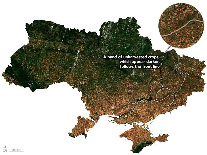
The NASA Harvest team calculated that farmers harvested 26.6 million tons of wheat in 2022, several million tons higher than expected in leading forecasts.
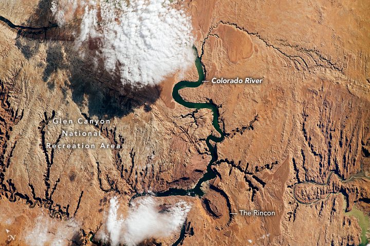
The river drains a sizable portion of the Rocky Mountain Range and provides water resources to more than 40 million people across seven U.S. states and northern Mexico.
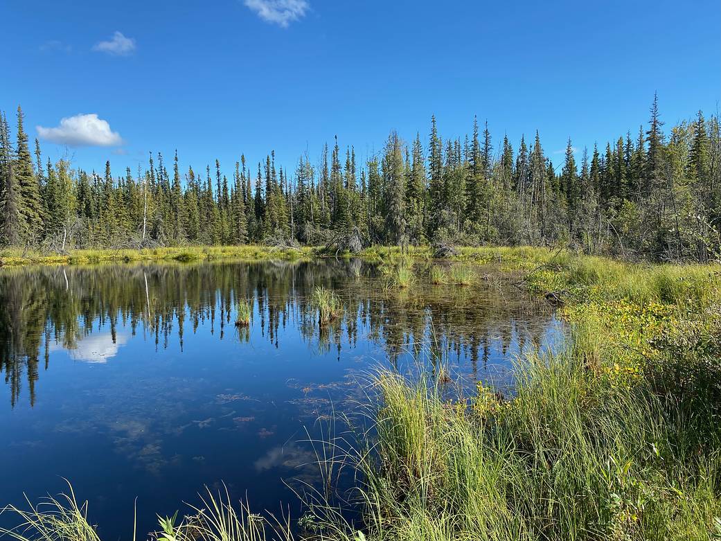
Since 2015, scientists participating in NASA's Arctic Boreal Vulnerability Experiment (ABoVE) have been studying the impacts of climate change on Earth's far northern regions and how those changes are intertwined.
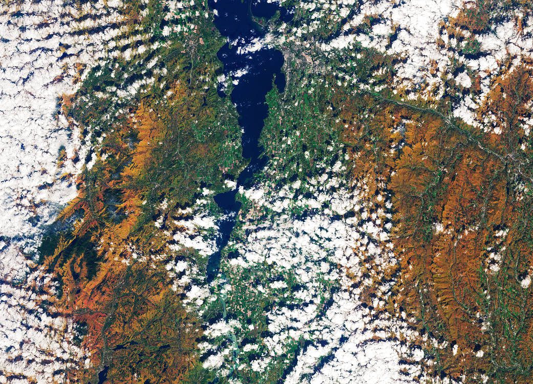
The Operational Land Imager-2 on Landsat 9 acquired this vibrant image of deciduous trees and conifers in the Adirondack Mountains in northeast New York on Oct. 8, 2022.
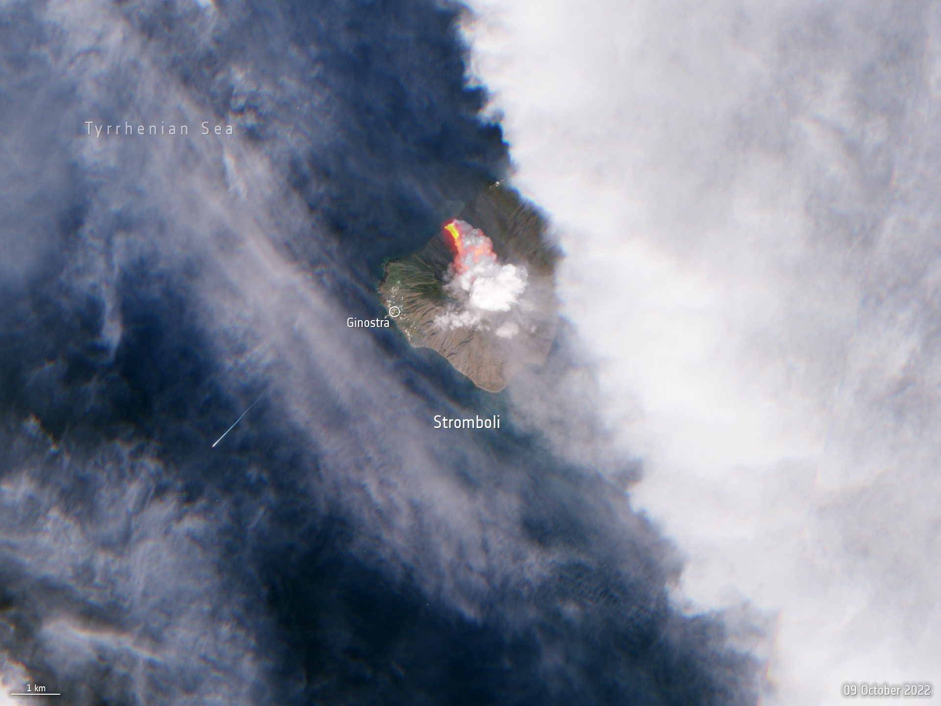
A volcano on the Italian island of Stromboli erupted early on Oct. 9, 2022, releasing huge plumes of smoke and a lava flow pouring into the sea.
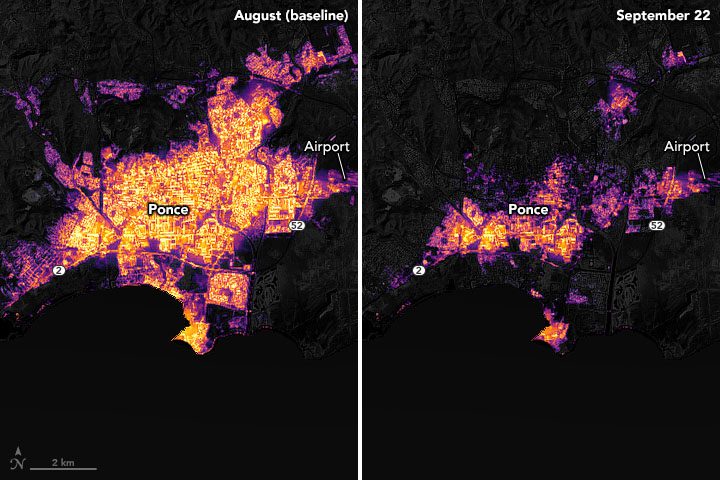
After being struck by fierce winds, torrential rainfall, and widespread flooding from Hurricane Fiona, citizens of Puerto Rico were enduring significant power outages in mid-September 2022.
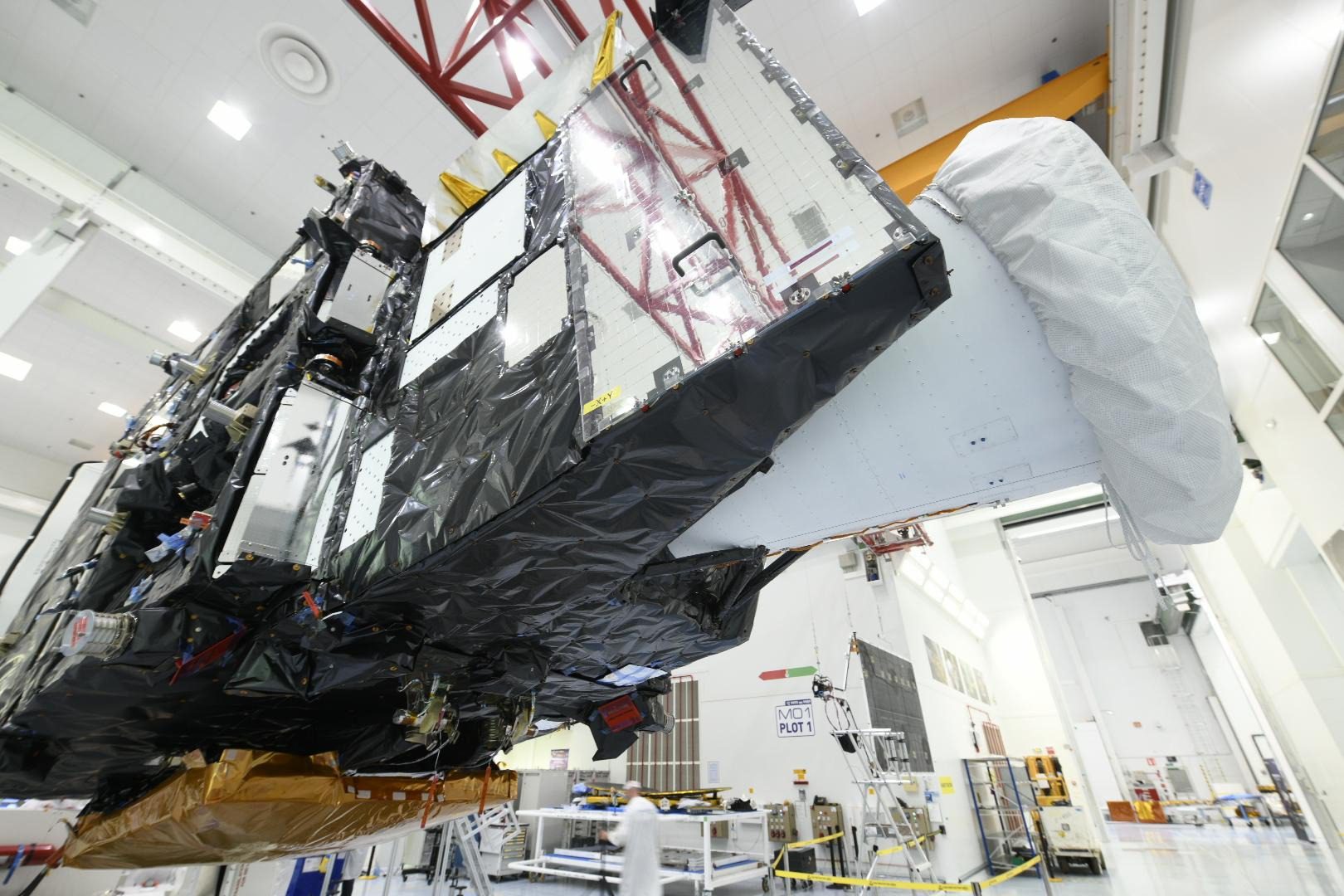
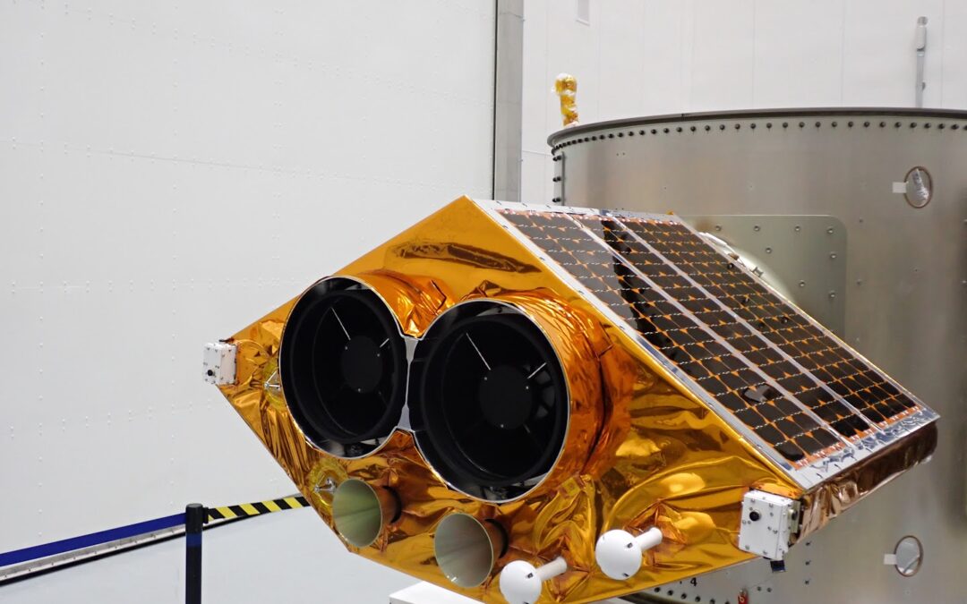
Before leaving the south of France at the end of September 2022, this remarkable new weather satellite took center stage at Thales Alenia Space's facilities in Cannes.
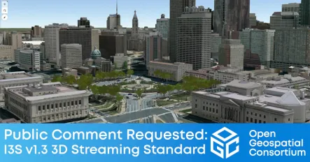
The Open Geospatial Consortium (OGC) seeks public comment on version 1.3 of the OGC Indexed 3D Scene Layer (I3S) and Scene Layer Package Format Community Standard.
