Coastal waters and nearshore groundwater supplies along more than a fifth of coastlines in the contiguous United States are vulnerable to contamination from previously hidden underground transfers of water between the oceans and land.
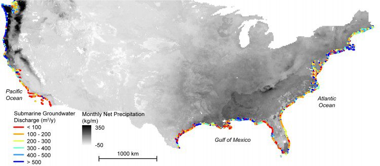
Coastal waters and nearshore groundwater supplies along more than a fifth of coastlines in the contiguous United States are vulnerable to contamination from previously hidden underground transfers of water between the oceans and land.
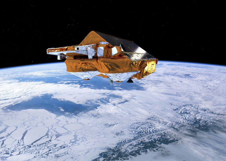
Scientists from the Norwegian University of Life Sciences report that the European Space Agency's CryoSat satellite and its radar altimeter can map coastal sea levels much closer than previous satellite-based methods.
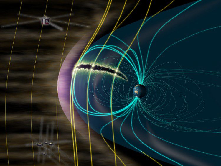
An international team led by Hiroshi Hasegawa and Naritoshi Kitamura (ISAS/JAXA) analyzed data taken by the U.S.-Japan collaborative GEOTAIL mission and NASA's MMS satellites, finding that the interaction between the magnetic fields of Earth and the Sun, or more precisely the phenomenon known as magnetic reconnection, can feed aurora explosions.
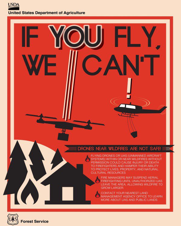
To address the growing problem of unmanned aircraft systems (UASs) impeding wildland firefighting efforts, the U.S. Department of the Interior and industry partners activated a prototype warning system that provides real-time alerts and geofencing alarms to prevent drone pilots from interfering with firefighting operations.
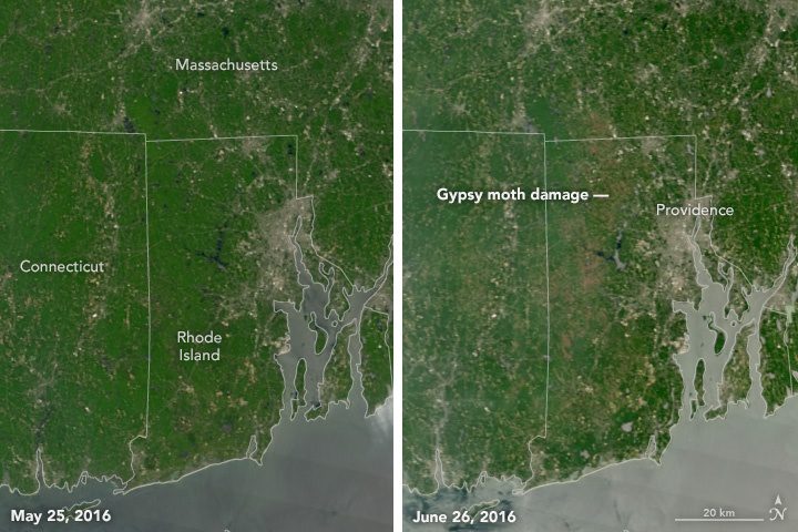
Although the headline conjures images of Mothra from the old Godzilla movies, the destructive insects in this care are the European gypsy moth caterpillar, which is experiencing a population boom and chewing through large swaths of hardwood forest in New England and the Mid-Atlantic.
The ArcGIS Imagery Book is a new multimedia compilation published by Esri to help readers understand how imagery and remote sensing power modern GIS technology.
According to a Euroconsult report, Prospects for the Small Satellite Market, more than 3,600 SmallSats are expected to be launched over the next 10 years. The total market value of these satellites is anticipated to be $22 billion (manufacture and launch), a 76-percent increase over that of 2006-2015.
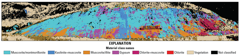
Although Alaska contains vast mineral deposits, its size and remoteness have prohibited study and extraction of these resources. To remedy this, the U.S. Geological Survey (USGS) began the Alaska Hyperspectral Project to assess the applicability of hyperspectral surveying to rapidly acquire data about the distributions of surficial materials, including different types of bedrock and ground cover.
Until July 18, 2016, the European Commission is taking applications from individuals and teams from startups, SMEs, industrial companies, research institutes and universities for its Copernicus Accelerator, which hopes to foster development of commercial space applications and products.
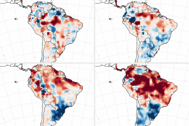
In South America's Amazon basin, El Niño conditions in 2015 and early 2016 reduced rainfall during the wet season, leaving the region drier at the start of the 2016 dry season than any year since 2002.
