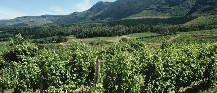
Noveltis, a French company, has been using SimActive's Correlator3D software to help with precision viticulture. Based on multispectral drone imagery, mapping products are generated to determine vine health and detect missing plants.
Noveltis, a French company, has been using SimActive's Correlator3D software to help with precision viticulture. Based on multispectral drone imagery, mapping products are generated to determine vine health and detect missing plants.
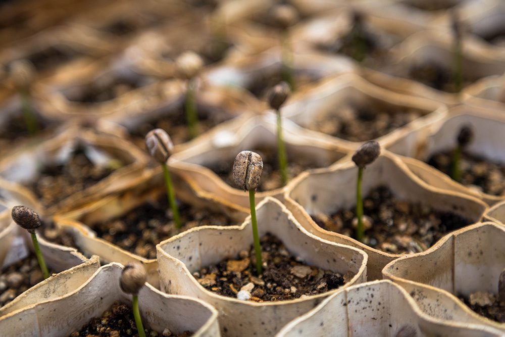
Earth-i teamed with WeatherSafe to support coffee farmers of Burundi through Earth-i's ACCORD program, which combines high-resolution satellite imagery with crop analysis to provide stakeholders with critical insights on key coffee farming decisions to improve crop quality, thereby supporting sustainable growth for coffee farmers large and small.
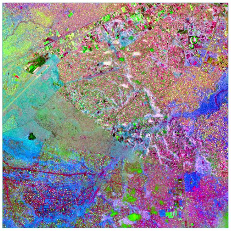
East View Geospatial is teaming with Planet and the World Bank to identify unplanned urbanization in specific developing areas using satellite imagery. Starting in mid-2017, East View Geospatial will begin calculating and detecting change to the Floor Space Index...
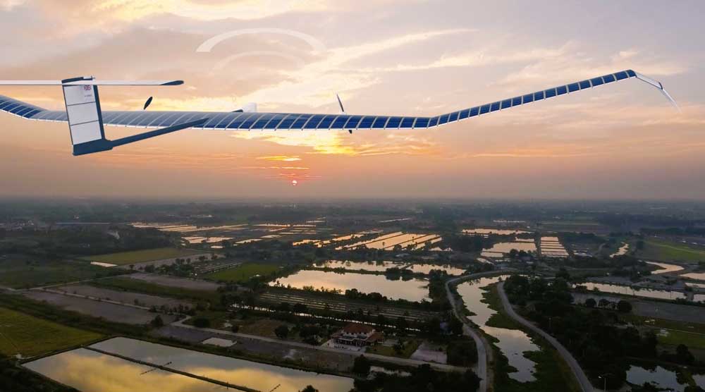
Airbus recently launched its U.S. base and operations of a new commercial drone startup: Airbus Aerial. With bases in the United States and Europe, Airbus Aerial's initial business will focus on developing new imagery services that leverage software and aerospace technology to offer actionable data and analysis of information provided by drones, satellites, high-altitude aircraft and other sources.
More than two decades of observations by five radar satellites show the acceleration of ice loss of 30 glaciers in Western Palmer Land in the southwest Antarctic Peninsula.
The Geological Remote Sensing Group (GRSG) expanded its membership as Planet”owners and operators of the world's largest commercially operated fleet of satellites”became the group's latest corporate member.
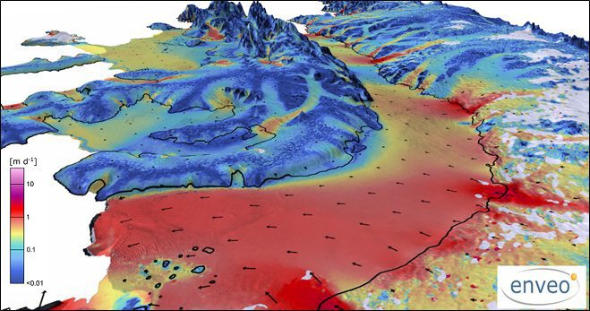
With approximately 90 percent of world trade carried by ships, ensuring a vessel follows the fastest route has obvious economic benefits. By merging measurements from different satellites, the European Space Agency (ESA) is providing key information on ocean currents to make shipping more efficient and help reduce carbon dioxide emissions.
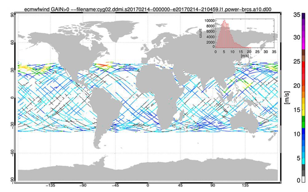
NASA's Cyclone Global Navigation Satellite System (CYGNSS), a constellation of eight microsatellites that will take detailed measurement of wind speeds inside hurricanes, successfully completed the development and on-orbit commissioning phases of its mission and moved into the science operations phase.
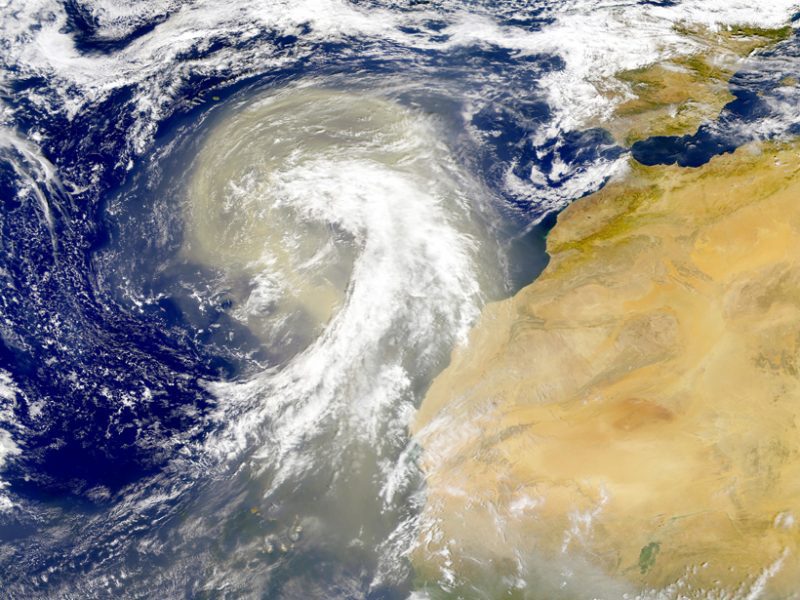
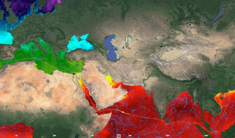
Earth's atmosphere is dusted with tiny particles known as aerosols, which include windblown ash, sea salt, pollution, and other natural and human-produced materials. Aerosols can absorb or scatter sunlight, affecting how much light reflects back into space or stays trapped in the atmosphere.
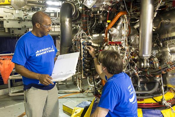
An RS-25 rocket engine with a new flight-model engine controller and flight configuration software was successfully tested for the first time at NASA's Stennis Space Center on March 23, 2017.
