With the Bangladesh government proposing a vulnerable low-lying island as a relocation site for thousands, Sentinel-1 satellite data have shown how unsuitable this site would be.
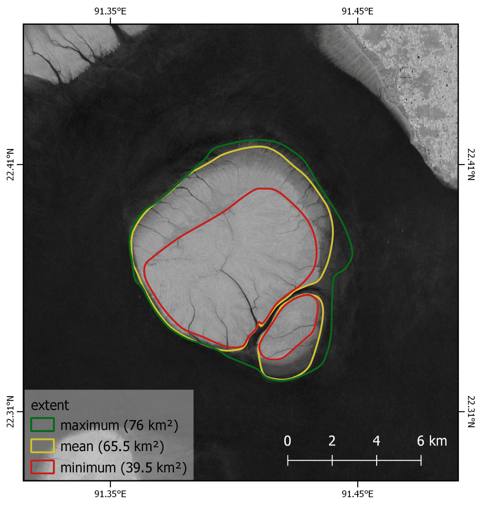
With the Bangladesh government proposing a vulnerable low-lying island as a relocation site for thousands, Sentinel-1 satellite data have shown how unsuitable this site would be.
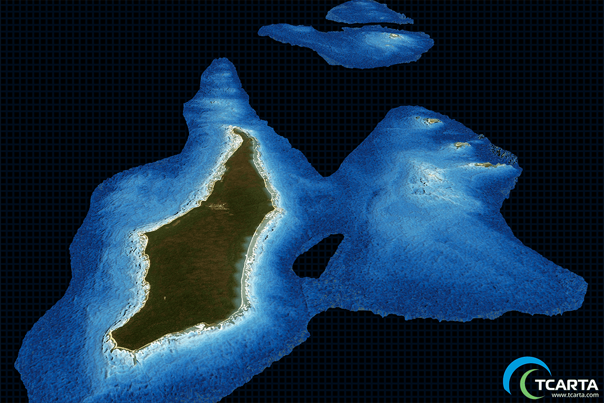
TCarta delivered satellite-derived bathymetry (SDB) to Total SA, one of the world's largest oil and gas producers, which will use the water-depth data for preparing seismic survey works off the coast of Myanmar.
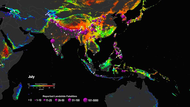
The Landslide Hazard Assessment for Situational Awareness (LHASA) model melds information regarding slope, lithology, deforested areas, and proximity to fault zones and roads to derive a map of landslide susceptibility.
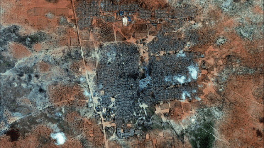
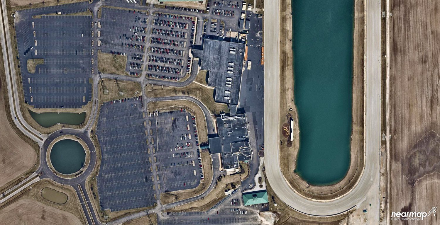
Satellite photos and advanced software provide population estimates for refugee camps. The data helps aid organizations use resources efficiently.
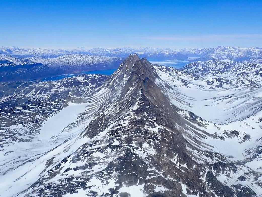
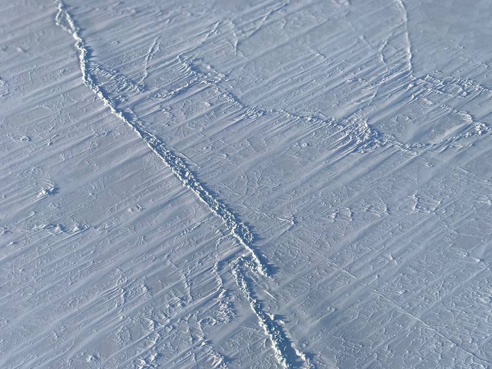
NASA's Operation IceBridge successfully collected data over several glaciers, research sites and some parallel coastal grid lines on April 26, 2018, as part of its spring 2018 campaign.
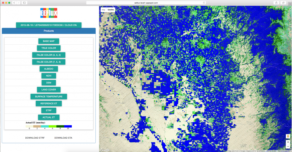
The most significant draw on the water supply is crop irrigation, accounting by some measures for nearly two-thirds of U.S. surface-freshwater withdrawals.
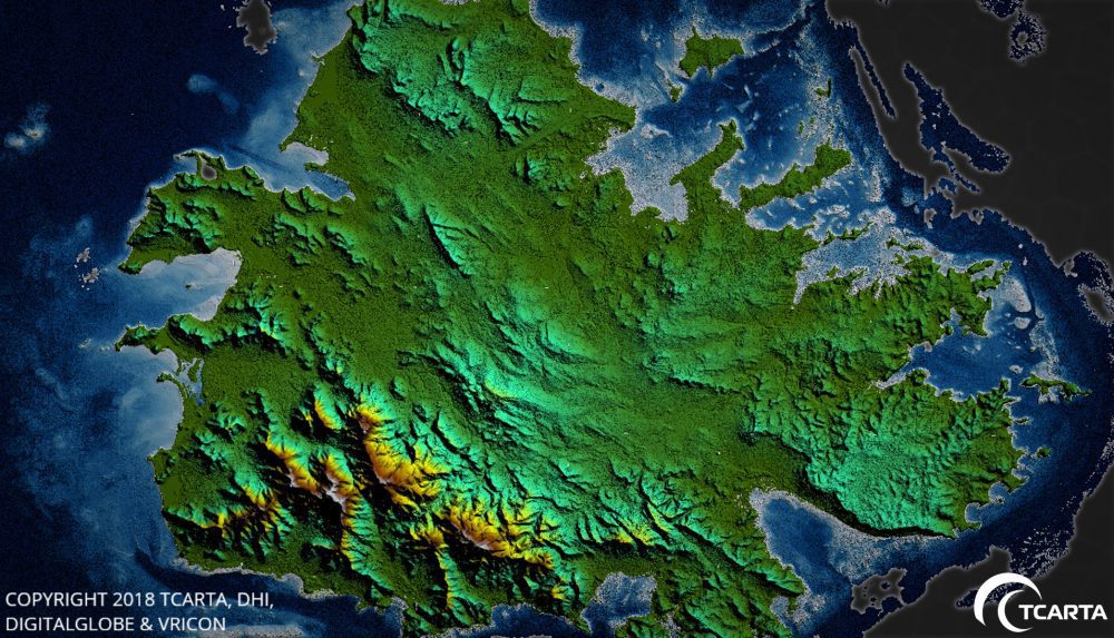
TCarta delivered pre- and post-disaster surface models for the Caribbean islands of Antigua and Barbuda for use in Hurricane Irma recovery efforts.

NSR's newly released High Altitude Platforms (HAPs), 2nd Edition report forecasts $1.7 billion in cumulative HAPs revenues over the next decade for airships, balloons and pseudo-satellite platforms.
A quantum leap in computing capacity has allowed us to model and analyze the real world – all from our desktop and mobile devices. In days past, maps were purely for visualization and direction. Today, they have graduated to full-blown analytics platforms empowering...
Sea ice in the Arctic grew to its annual maximum extent on March 17, 2018, and joined 2015, 2016 and 2017 as the four lowest maximum extents on record, according to scientists at the NASA-supported National Snow and Ice Data Center (NSIDC) and NASA.
