The European Space Agency's GOCE gravity satellite already has delivered the most accurate gravity map of Earth. Now its orbit is being lowered to obtain even better results.
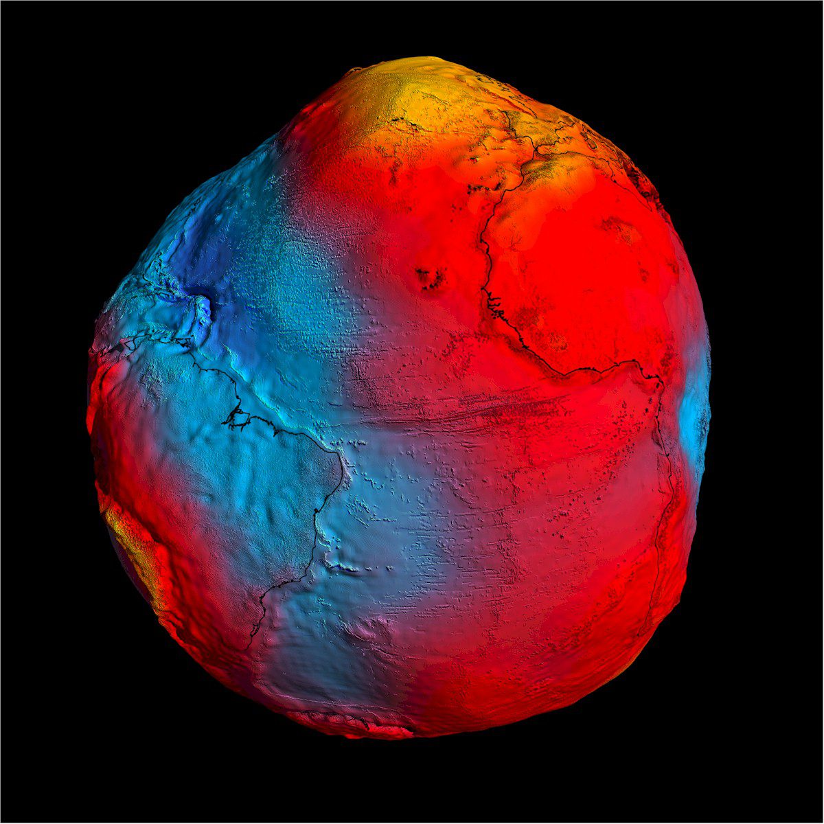
The European Space Agency's GOCE gravity satellite already has delivered the most accurate gravity map of Earth. Now its orbit is being lowered to obtain even better results.
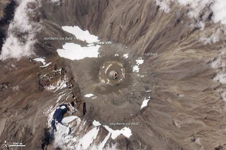
Cold, dry air at the top of Mount Kilimanjaro has sustained large ice fields for more than 10,000 years, but trends beginning more than a century ago suggest its peaks soon may be ice-free.
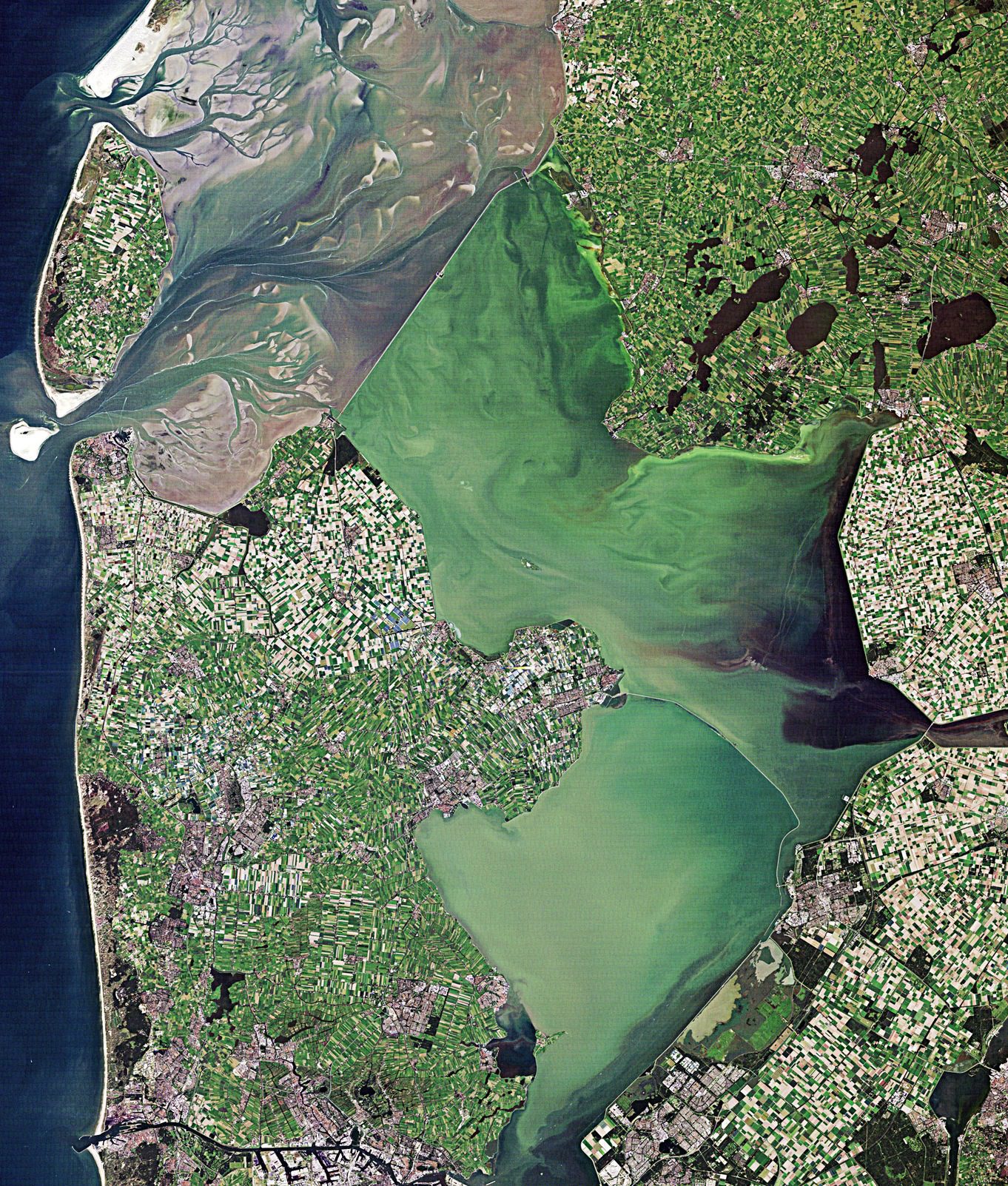
In the Netherlands, local authorities are looking to satellite observations as a promising option for dike monitoring and to protect against dike failures.
The European Space Agency's Soil Moisture and Ocean Salinity mission again showed its versatility by capturing unique measurements of the largest Atlantic Hurricane on record.
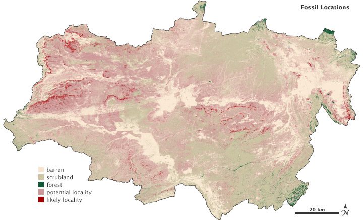
Colleagues at Western Michigan University are using data from the Landsat 7 satellite's Enhanced Thematic Mapper Plus instrument to find fossils.

Aerial mapping firm Bluesky has compiled the first countrywide 3-D map of English and Welsh trees, complete with detailed modeling of tree heights and canopy cover.
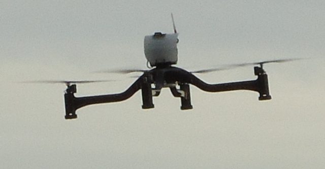
An Aermatica small unmanned aircraft system is helping Italian utility company ENEL remotely monitor its power plants to prove to the Italian government it can be done safely and effectively.
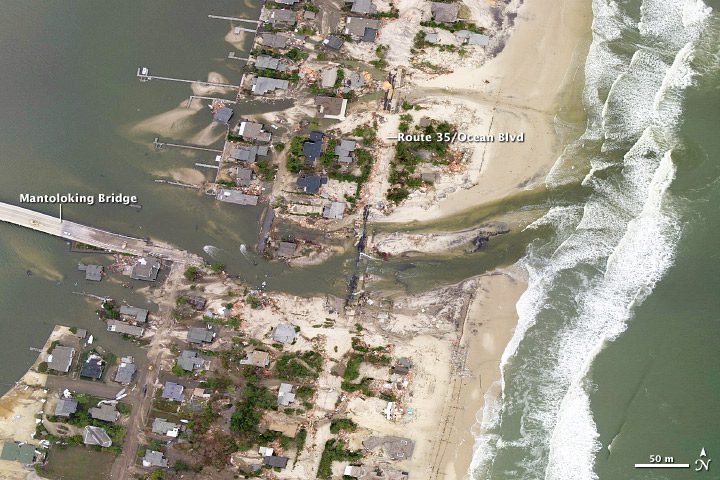
Before-and-after aerial images of the New Jersey coastline just north of where Hurricane Sandy made landfall clearly illustrate why meteorologists are calling the hurricane Superstorm Sandy.

A one-man Dutch business won the top prize in the European Earth-monitoring competition. The winning project, Cerberus, exploits social media to advance Earth observation applications.
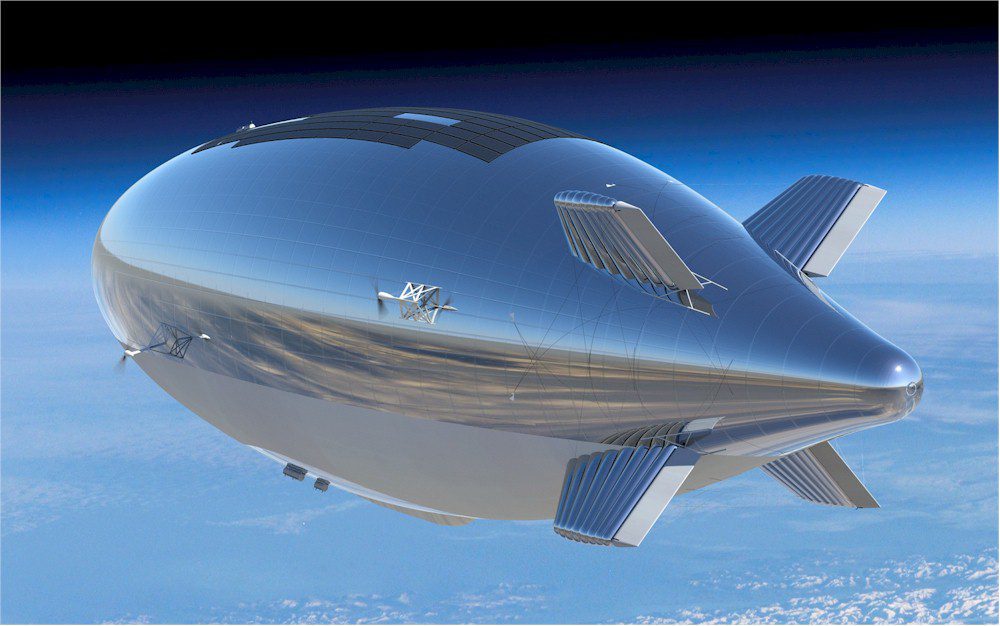
A Government Accountability Office report cites technical challenges and rapid acquisitions of some lighter-than-air Earth observation platforms as problematic.
